The Medieval Castle and Mighty River of Yamuki-yama (Mt. Yamuki)
やむきやま

八向山
YAMUKI-YAMA
Tiny peak that was home to a medieval castle along the banks of the mighty Mogami River.
Jump to My Guide to Hiking Yamuki-yama
In Brief: Yamuki-yama is Known for:
- Location of the medieval Yamuki Castle on the banks of the Mogami River
- Grand views over the Mogami River and to Gassan, Murayama Ha-yama, The Kamuro Alps, and Chokai-san.
- Location of Yamuki Shrine prayed to by millions over the years, including Minamoto no Yoshitsune
- Location Matsuo Basho boarded the Mogami River on his way to the Dewa Sanzan
Yamuki-yama in the Pecking Order
Mountains in Japan have been revered for millennia, but often it is the taller peaks that garner all the attention. It’s not hard to see why, I mean, the taller peaks stick out like a sore thumb. In the case of Yamagata Prefecture, this honour belongs to the likes of Chokai-san, Gassan, Ide-san, and Zao-san. However, some of the low-lying peaks truly deserve a lot more attention than they get. Take the once medieval castle on the precarious cliff-face along the Mogami River that is Yamuki-yama, for example.

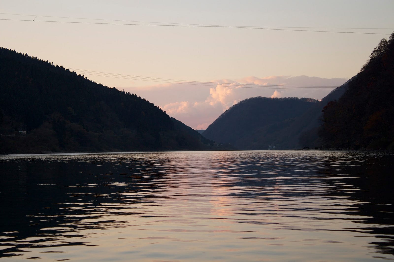
At a humble 206m (675. ft.) above sea level, Yamuki-yama is not breaking any records. However, this tiny peak was in one of the most strategic locations for a mountain in the entire history of Yamagata Prefecture, the banks of the Mogami River in the Motoaikai area of Shinjo City, right where the river takes a sharp turn. Yamuki-yama’s height and location meant it was in the perfect location to oversee action from miles around, and for a river as pivotal in the development of Yamagata Prefecture, Yamuki-yama certainly was advantageous to anyone able to lay claim to it.
The History of Yamuki-yama and the Mogami River

There are two main parts of Yamuki-yama to explore, the summit to the north, and the Yamuki castle remains on the banks of the Mogami River to the south. Built during medieval Japan (commonly referred to as the period of time between the Kamakura and Azuchi periods of 1185 to 1600), the Yamuki Castle provided the Mogami Clan expansive views over The Mogami River, a very important feature of the landscape during periods of war.
Trade on the Mogami River

This period of time was known as the Sengoku period when Japan was in a constant state of civil war. However from the 1600s onwards, Japan came under the rule of the Shogun and saw times of relative peace. During this time, trade along the Mogami River really picked up, and Yamuki-yama was a critical landmark along the trade routes.
Known as Dewa Province at the time, this was when Yamagata Prefecture truly made its mark on the world. The development of Yamagata Prefecture is directly correlated with the early development of Edo, the city these days known as Tokyo.
How Yamagata helped Tokyo develop into an international city
You see, farmers from all over Yamagata Prefecture would send rice and safflower down the Mogami River until it reached Sakata City on the Sea of Japan coast. This rice and safflower was then traded all throughout Honshu on the Kitamae-bune North Sea Route ships. The Shogun at the time even owned land in Yamagata Prefecture and relied on the Kitamaebune ships to provide food for a burgeoning Edo.
Here’s a very in-depth, and very interesting history of the Kitamae-bune ships.
Famous Visitors to Yamuki-yama

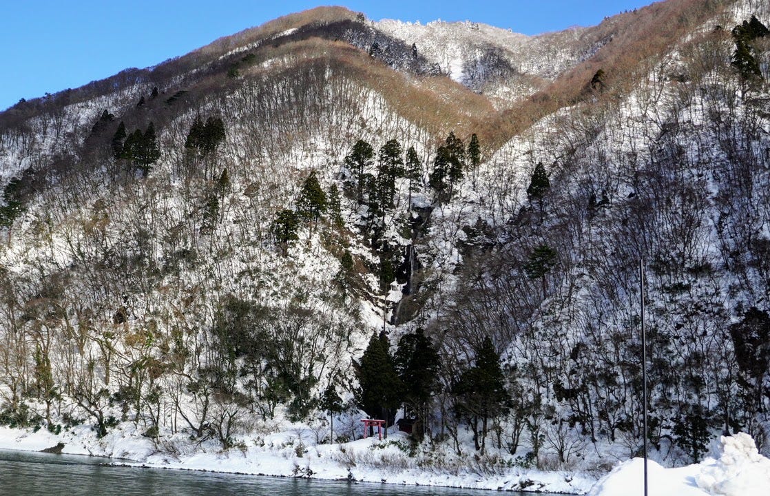
I mentioned that the cliff face was steep right? What if I told you there was a shrine located on it? Part-way up the cliff face you can make out a small red shrine, the Yamuki Shrine. The name Yamuki is from the Kami called Yamuki, and was named as such by a junior fifth rank from the government who visited in 874 during the early stages of the Heian period.
Yamuki shrine was primarily prayed to for a safe journey by people sailing on the Mogami river. One very famous person to do so was Minamoto no Yoshitsune, who stopped at this shrine specifically to pray while on his way to Hiraizumi of Oshu according to The Chronicles of Yoshitsune.
Learn all about this story with my article on Kamewari-yama.
Right across the river from Yamuki-yama was where Matsuo Basho boarded a river boat while compiling The Narrow Road to the Deep North. It is therefore very likely that he too prayed to the Yamuki Shrine.
Yamuki-yama These Days

Unfortunately, these days Yamuki-yama is being slowly swallowed up by the very river that has provided so much sustenance over the centuries. The distinctive cliff face of Yamuki-yama is becoming larger by the day, and all that remains of the castle are areas where buildings obviously lay. This means that when you visit Yamuki-yama, you’re going to have to use your imagination a bit to get a sense for what it was like for the Daimyo throughout the years.
The Yamuki Castle isn’t that much of a hike (details below), and you can easily make out an area split into about three different heights, which were apparently the donjon, i.e. the main part of the castle, the second bailey, and the third bailey. Each bailey was said to have two defensive layers of walls called Yagenbori, with huge empty spaces between them. There was also a Noroshidai, a stand used for smoke signals.
When you get closer to the river bank, the sheer steepness of the cliff face really hits you. It. Is. Steep. Let me tell you. You do NOT want to fall down there. This also means that the views are second to none. I had never seen the Mogami winding its way up the landscape towards Oishida Town like that before. It had also never occurred to me that the river took such a sharp turn either. More than one hairpin for a fast-moving river like the Mogami would definitely mean that any mountain in its way will erode.
My Guide to Hiking Yamuki-yama: Getting There

Good luck getting to Yamuki-yama with anything besides a car. Heading along Route 47 from Shinjo to Tozawa Village, take a right directly in front of the Uchigawa bridge. Follow the river down a little bit and the trailhead is at the Hachiman Jinja (shrine). There is enough parking here for six cars, but be warned that it can get extremely slippery. Either make sure you have a 4WD, or park in the dry spots.
Hiking the Trail up Yamuki-yama

After paying your respects at the Hachiman Jinja (in the video I mistakenly called it Yawata Jinja), follow the river to the west from the shrine and head north at the remains of the old water pump. Cross a small stream, and you’ll see signs for the trail, which begins properly here. Follow the trail for about ten minutes, and you will come across a lookout on the left hand side. Another five minutes up the mountain and you’ll reach a split in the road to either the remains of the Yamuki Castle, or the summit itself. Head north for the summit, and south for the remains of the castle.
The trail is covered in bush, and the ridge drops off sharply to the west. The remains of the Yamuki Castle are past the empty moats that were the second and third baileys. You can get a view over the Mogami river from the remains of the Yamuki Castle, but it is a sharp drop so be very careful. Also, you can get a good view of the steep cliffs of Yamuki-yama and its spectacular mountain valley from the base of the Motoaikai Bridge on the opposite bank of the river.
Our hike up Yamuki-yama

This seemingly easy mountain taught us a good lesson. Always check and double check you are on the right path. For the first 90 minutes, again we went the wrong way, heading up the Yamuki Kodo (八向古道 ancient path up Yamuki-yama) instead of the more modern way.
What was supposed to be about 90 minutes one way turned into a 5 hour adventure.
It was a good adventure though, wasn’t that bad in retrospect. The first path we took was definitely the wrong way, we had to clamber on bush after bush and reed after reed only to realise that the path wasn’t really a path. So we turned back, and I’m really glad we did.
Getting on Track

When we got to the entrance to the first path, we noticed that there was a gravel road that continues along the river, and then we saw a sign pointing into the mountain. If we hadn’t noticed that, I’m not sure what we would have done.
This sign pointed to seemingly nowhere, but we could make out some switchbacks in the snow that turned out to be the correct path. From then on, the path was much more obvious. A mixture of narrow gaps with snow in the middle, and then walking along sharp ridges.
Before long we reached the junction that takes you to the remains of the Yamuki castle to the left, and the summit to the right. We wanted to hit up the summit first, and kept following the path up carefully searching for the next pink marker in the trees along the way.
The trick summit of Yamuki-yama

There were a few areas completely inundated with snow, but we just headed in what was the right direction according to this app. After reaching what felt like the summit, we realised we still had a little further to go, and climbed up and down a few smaller peaks until we found the summit marker. 206m above sea level, with not much around it besides a beech forest.
However, we did get to see Chokai-san through the trees, as well as Gassan and Murayama Ha-yama, and then out to the Kamuro alps. On the way back I visited the remains of the Yamuki castle, which were just some flat areas of dirt, but there was a really good view over the Mogami river and the surrounding towns. All up it was very good exercise, and was a good warm up for when we hit up the Kamuro alps later, hopefully this year!
Nearby locations worth checking out
Mogami River
The 229km Mogami River running the length of Yamagata Prefecture is the 7th longest river in Japan, and the longest contiguous river in one prefecture, taking 3 to 5 days for the water to flow from the source to the ocean. Along with the Fuji river in Yamanashi and Shizuoka Prefectures, and the Kuma River in Kumamoto, the Mogami is one of the big three fastest-flowing rivers in Japan.
The Mogami River was featured prominently in Matsuo Basho’s The Narrow Road to the Deep North. Matsuo Basho and his trusty partner Kawai Sore stayed three days in Oishida, and once they had good weather, they travelled to the Dewa Sanzan, boarding the Mogami River in the area right in front of Yamuki-yama.
This river voyage inspired the following haiku by Matsuo Basho:
Gathering the rains
Of summer, how swift she is
Mogami River
- Matsuo Basho
River Cruise on the Mogami
Need some inspiration? Why not do what Matsuo Basho did and take a cruise down the Mogami? River boat cruises along the Mogami are offered by multiple companies including during the cold winter months when you can sit under a heated Kotatsu and sip Amazake, a sweetened sake lees drink (the extract from making sake that is non-alcoholic).
Shiraito Falls
Located on the opposite bank of Mogami River at the terminus of the river cruise, the Shiraito Falls is well worth a stop if you get the chance. The Shiraito Falls is one of the top 100 Falls of Japan, and it’s not hard to see why when you see the real thing.
The Abandoned Ski Field of Tsuchiyu-yama and The Forest of Illusions: Genso no Mori in Tozawa Village
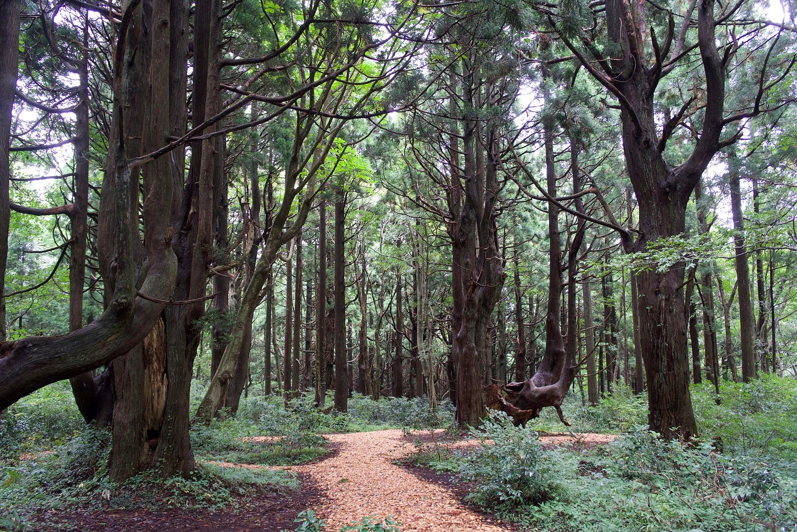
From the Shiraito Falls, Genso no Mori, the forest of illusions, is only a short drive. Or if you’re climbing Tsuchiyu, this isn’t much of a detour at all. Genso no Mori is a naturally occurring cedar forest that is covered in trees that have morphed due to the snowfall in the region. Just be warned that Genso no Mori forest can be a bit tough to get to. You have to take a sharp turn into the mountains from Route 47 along the Mogami River, and then drive up a gravel road for a while, but once you’re there it really is like being in another world.
Yonetaihei-zan

Located just to the north of Yamuki-yama, Yonetaihei-zan is oddly the exact same height, and is known for its marsh, the Yone Marsh. I visited Yonetaihei-zan in winter so didn’t get to explore the marsh, but it wouldn’t be too far of a detour at all. Yonetaihei-zan is a 30min climb to the summit too, so it would be easy to do both of these mountains in the same day (weather and season permitting).
Kosugi-no-Osugi: The Totoro Trees
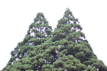
With places like Ginzan Onsen and Genso-no-Mori, the forest of illusions, Yamagata Prefecture is covered in places similar to those depicted in Ghibli films, or in this case, two trees that resemble the famous character Totoro. The Totoro Trees aren’t too far from Yamuki-yama, about 20 minutes by car.
Yozo-san and the Yozo marsh
One other famous marsh near Yamuki-yama is the Yozo marsh found on Yozo-san on the borders of Sakata City and Sakegawa Village.
The Kamuro Alps
On the other side of Shinjo City, The Kamuro Alps are five or so peaks to the east of Yamuki-yama. The Kamuro Alps are Kamuro-san, Komata-yama, Hiuchi-dake, Hachimori-yama, and Mokuzo-san. Kamewari-yama also lies to the south.
Shinjo City
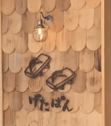
Speaking of Shinjo City, there are a lot of great places to explore here. Shinjo City is famous for its three-day festival in August, featuring huge floats and large dances that are free to watch. It is also home to one of my absolute favourite bakeries, Geta Pan (Facebook), that I intentionally go to sometimes even though it is an hour drive away.
Taizo-san: The Epitome of Autumn Leaves in north Japan
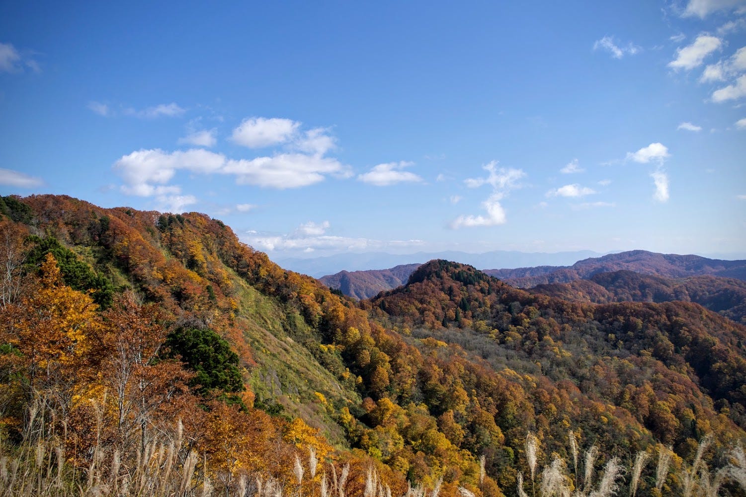
Taizo-san is one of the historic routes linking The Shonai and Mogami Regions of Yamagata Prefecture, and is by far one of the best spots in Tohoku, North Japan, to take in the autumn leaves.
References
Yamagatayama Page (Japanese)
Yamuki Castle and the Basho River Boats (Japanese):八向(やむき)楯と芭蕉乗船の地
八向楯は、新田川が最上川に注ぎ込む河口にあり、最上川の雄大な流れに白い絶壁が映え絶景です。 俳聖芭蕉と曾良が舟に乗って最上川を下ったのがこの辺りで、「芭蕉乗船の地」として芭蕉と曽良の陶像が立っています。…www.city.shinjo.yamagata.jp
Yamuki Shrine (Japanese): https://yamagatakanko.com/attractions/detail_1425.html
YAMUKI-YAMA
八向山 | やむきやま
Mt. Yamuki, Yamukiyama
Yamuki-yama (八向山やむきやま) is a 206m (675. ft.) peak in the Mogami region of Yamagata prefecture. Yamuki-yama best climbed from April to October. Yamuki-yama is a level 1 in terms of physical demand, which means it is easy to hike, has a A technical grade, which means it requires little expertise, and you want to allow at least 2 hours for a climb.
Mountain Range
Yamuki-yama
Region
Mogami
Elevation
206m (675. ft.)
Technical Demand
A (requires little expertise)
Physical Demand
1 (easy to hike)
Trails
1) Yamuki-yama Trail
Best time to climb
April to October
Day trip possible?
Yes
Minimum Time Required
2 hours return
PDF Maps by TheHokkaidoCartographer and JapanWilds.org. See all here.


YAMABUSHI NEWSLETTER
KIWI YAMABUSHI

TIM BUNTING - KIWI YAMABUSHI