North Japan’s Abandoned Ski Field and Phantom Forest
つちゆやま

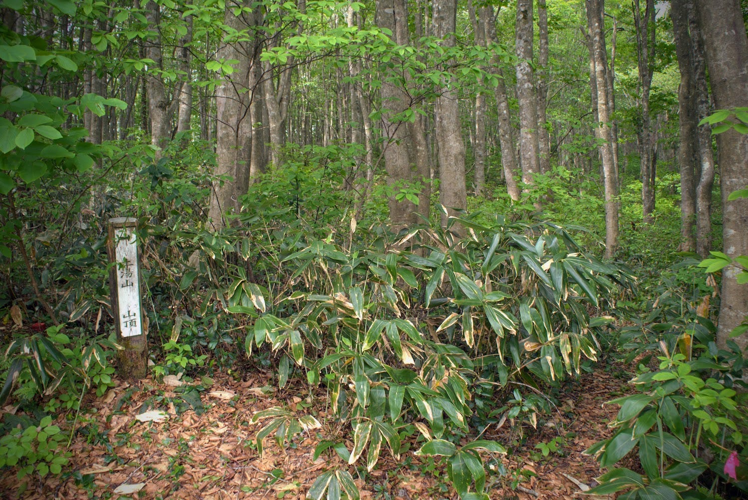
土湯山
TSUCHIYU-YAMA
Short and quick hike with views of Chokai-zan and near the Mogami River, Shiraito Falls, and Genso no mori, the Forest of Illusions.
Skip to My Guide to Hiking Tsuchiyu-yama.
I have a special affinity for the Mogami River. The first taste of the cherry-loving Yamagata prefecture for most of my English teacher friends was from a few thousand metres high in the sky. For me, it was a two-hour drive through the prefecture, following the Mogami River along the way. That drive along the river was the first of many. But it took me 11 years to realise that there was an abandoned ski field along the way.
Tsuchiyu-yama is a smallish mountain on the banks of the Mogami River near the border of Tozawa-mura and Shonai-machi. The peak boasts Genso-no-Mori, The Forest of Illusions, or The Phantom Forest, and an abandoned ski field, the former Mogami-gawa Ski field.
The Mist of Mogami
The best time to be out along the Mogami River has got to be the early morning. This is when the clouds are well and truly out to play. This was the case when I went to climb Tsuchiyu-yama, and it was the case when I went to climb Kamewari-yama a week later too.
Looking up from the base of the mountain, all I could see was a summit shrouded in cloud, the famous Mogami mist. But my first port of call wasn’t Tsuchiyu-yama that day. No, I was aiming for an even more mysterious destination, the fabled Genso-no-Mori, AKA The Phantom Forest or The Forest of Illusions.
Genso No Mori (The Forest of Illusions)
Genso-no-Mori is an ancient cedar forest full of mangled trees. The trees formed this way due to the heavy snowfall in the region that have well and truly stood the test of time. As an extremely mysterious location Genso-no-Mori is worthy of being a destination in and of itself. However, much like Tsuchiyu-yama, Genso-no-Mori is a bit tough to get to, and depending on the time of year, is also covered in bugs.
Getting to Genso-no-Mori and Tsuchiyu-yama
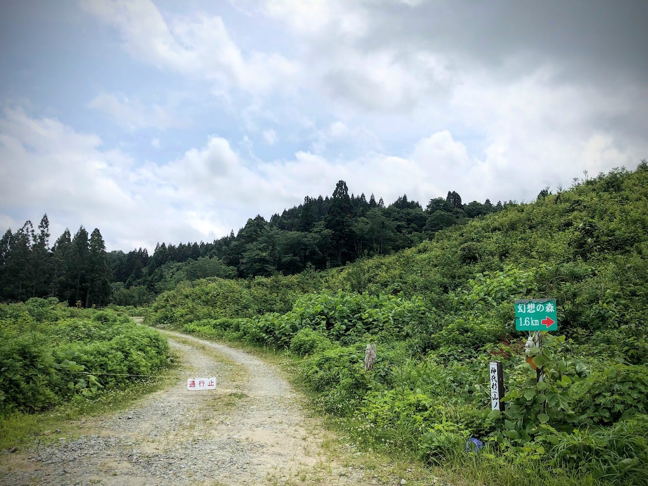
To get to Genso-no-Mori and Tsuchiyu-yama, it’s easiest to find your bearings at the Shiraito Falls Michi no Eki Roadside Station (also known as the River Station) car park. From there, you can either walk to both Genso-no-mori and the Tsuchiyu-yama trailhead, or just drive there by heading east along Route 47. On the right there is a part where the railway crosses above a narrow road that heads into the mountains with a sign for Genso no Mori 幻想の森. Take this road.
The road is gravel, and is quite long and winded so take care. Part-way up the road splits off to the left. This is the trailhead to Tsuchiyu-yama. Keep following the trail and you will eventually get to Genso-no-Mori. Then all you need to do is backtrack to the trailhead. This is also the best place to park your car. There is enough space there for maybe one or two cars, but be careful not to block the path.
Hiking Tsuchiyu-yama
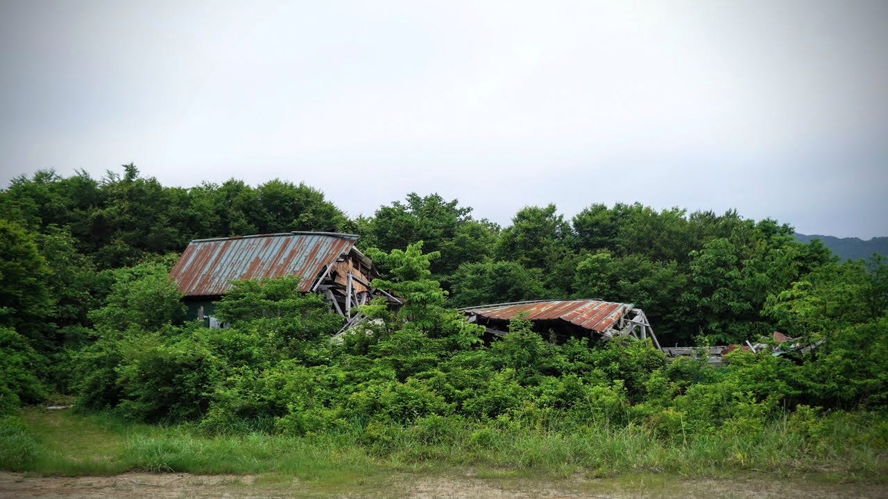
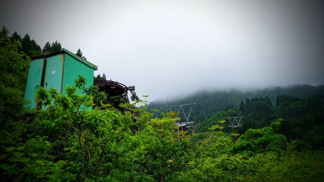
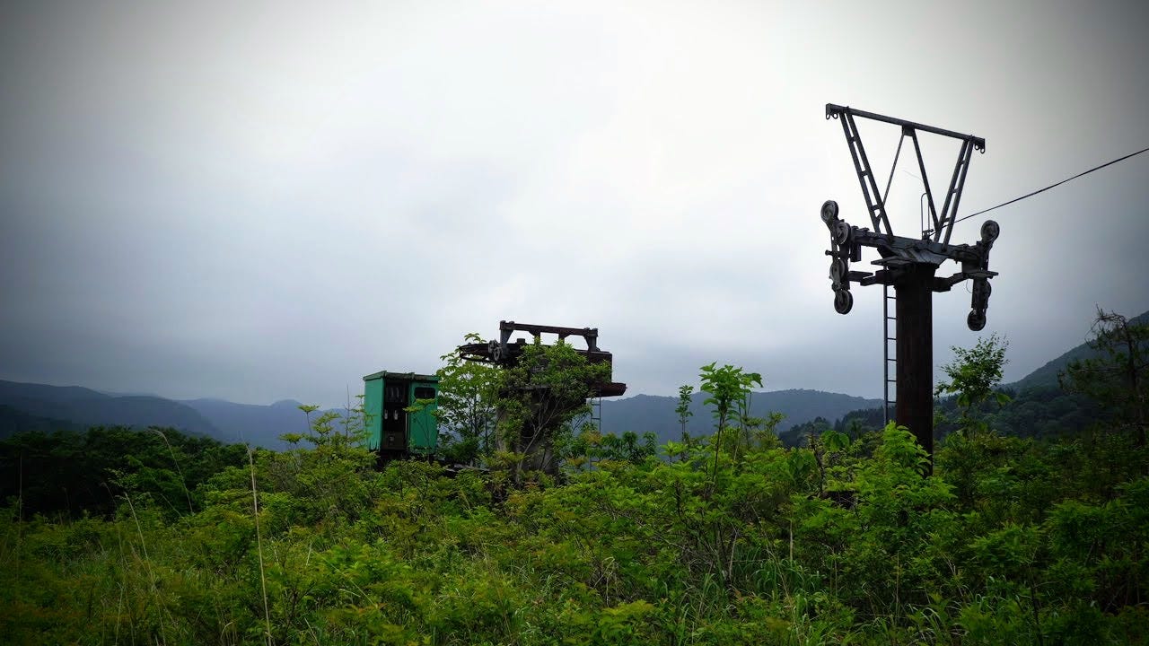
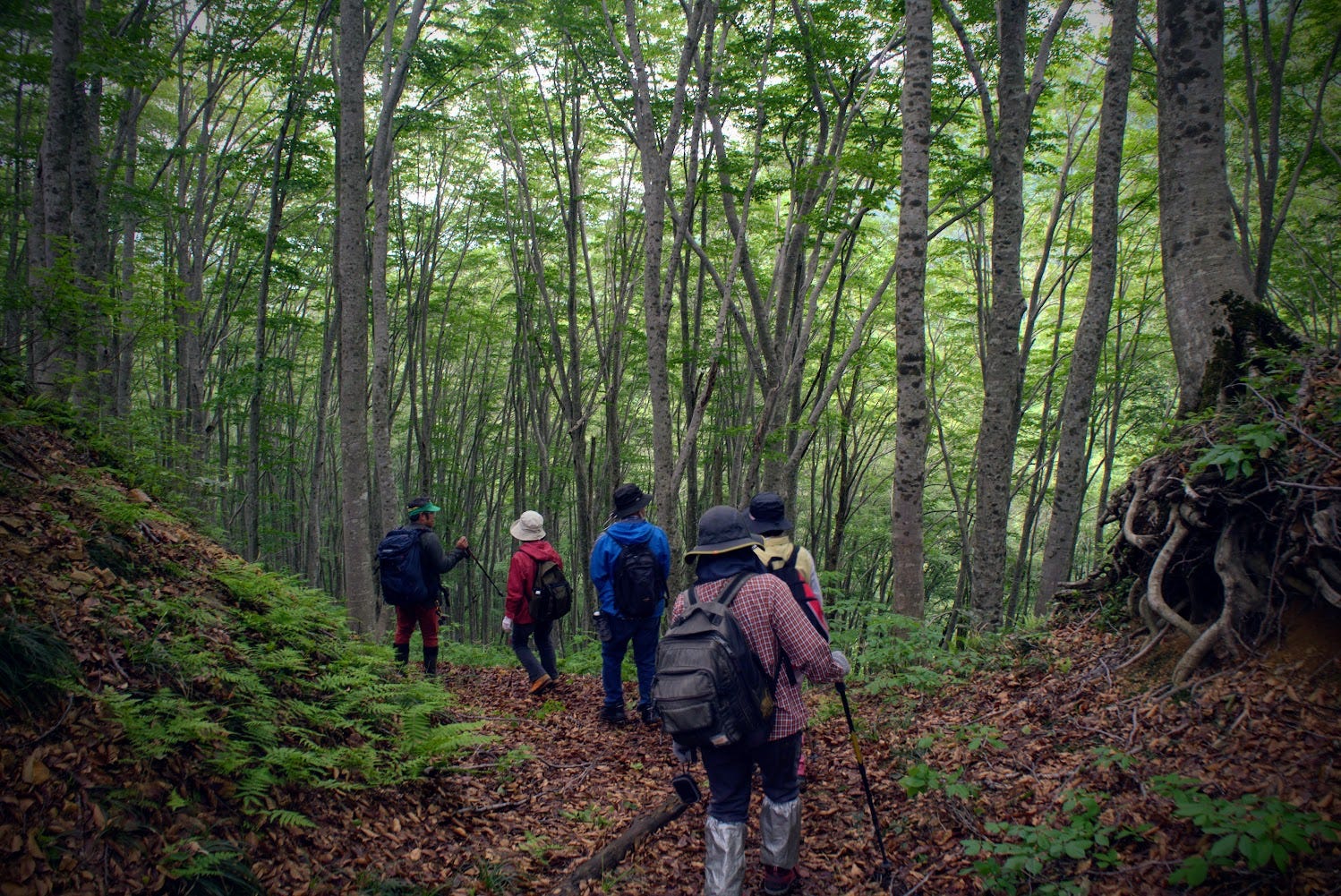
Tsuchiyu-yama only has one trail. From the trailhead, you just need to keep following the trail all the way up, it’s pretty obvious. The trail will first take you through a few forests and past some waterfalls. Then, you will come out at the dilapidated ski lift and collapsed buildings. Follow the main ski field to the top of the lift, and keep going up. The trail gets narrower towards the summit, and you will come out at a place with three giant antennae. Then, there is a beech forest path with pink tags to follow until you reach the real summit. There isn’t a lookout from the summit, but the beech forest is fun to explore.
The Charms of Tsuchiyu-yama
There are some very good views of the surrounding mountains along the trail, and if you’re lucky Chokai-zan. However, it’s a bit of a slog to get up there, and you can get similar views elsewhere. Plus, the trail is gravel the whole way up. If like me you opt for yamabushi shoes, or just shoes with a thin sole, your feet are going to hurt. I’m used to it from walking barefoot a lot as a kid, but if you’re not used to it, it would probably be quite uncomfortable. Best to bring proper shoes.
Once you’re at the summit, it’s just a matter of backtracking to your car. If the mists of Mogami isn't too much, you should have some really good views most of the way down. Otherwise, in all honesty, there isn’t that much to see on the mountain that you can’t see elsewhere.
Tsuchiyu-yama (Mt. Tsuchiyu) is located along the border of Shonai Town and Tozawa Village. The former. ski field is the final destination along the Tohoku nature path (Tohoku Shizen Hodo) called the Mogami Gorge and History Path (Mogami Kyo to Rekishi no Michi).
Tsuchiyu-yama is known for:
- Genso-no-mori AKA The Forest of Illusions, The Phantom Forest
- Mogami-gawa Ski Field, Abandoned Ski Field they are trying to reforest
Locations near Tsuchiyu-yama worth checking out
Mogami River
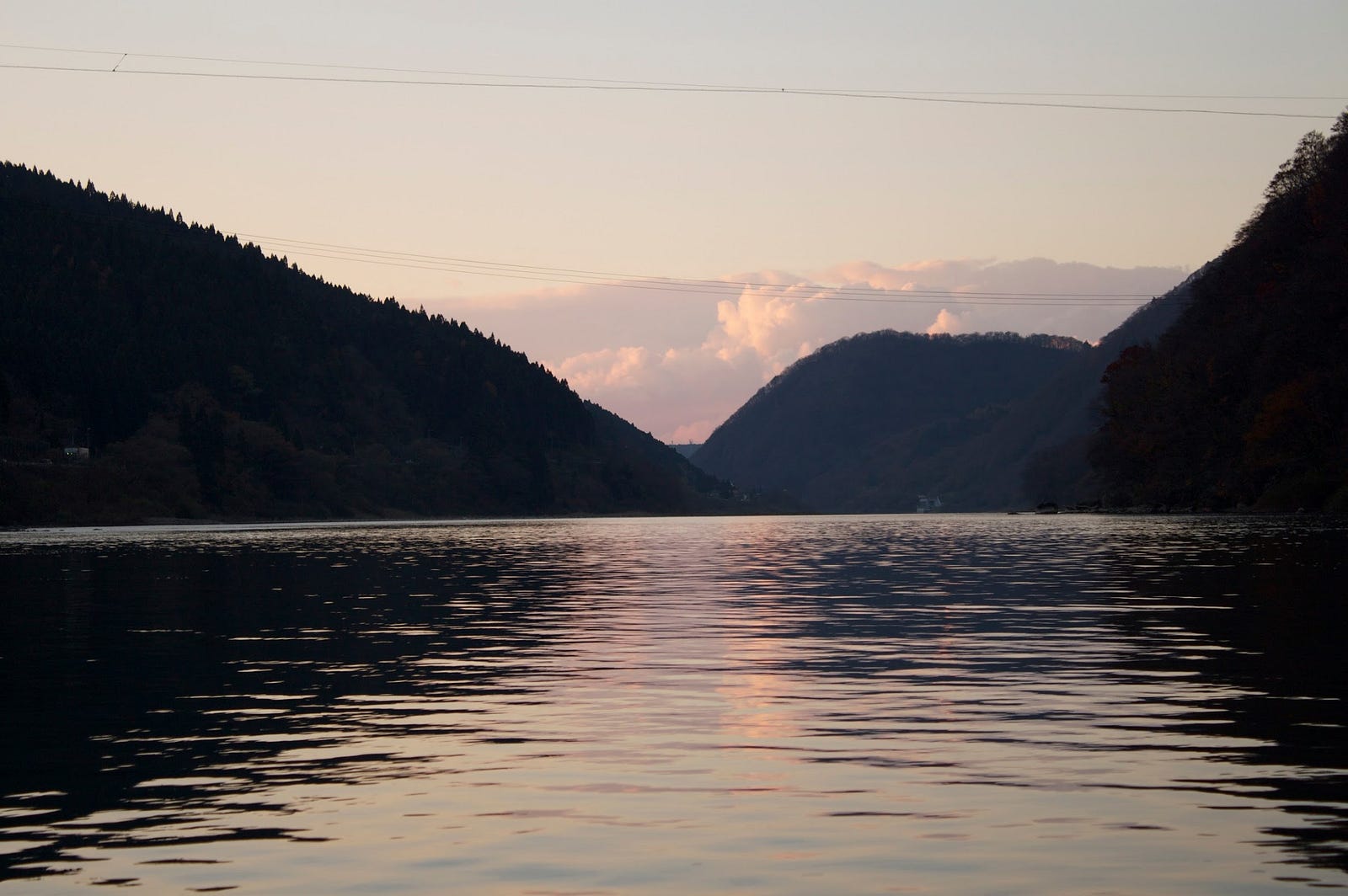
The 229km Mogami River running the length of Yamagata Prefecture is the 7th longest river in Japan, and the longest contiguous river in one prefecture, taking 3 to 5 days for the water to flow from the source to the ocean. Along with the Fuji river in Yamanashi and Shizuoka Prefectures, and the Kuma River in Kumamoto, the Mogami is one of the big three fastest-flowing rivers in Japan.
The Mogami River was featured prominently in Matsuo Basho’s The Narrow Road to the Deep North. Matsuo Basho and his trusty partner Kawai Sore stayed three days in Oishida, and once they had good weather, they travelled to the Dewa Sanzan, boarding the Mogami River in the area right in front of Yamuki-yama.
This river voyage inspired the following haiku by Matsuo Basho:
Gathering the rains
Of summer, how swift she runs
Mogami River
Matsuo Basho
River Cruise on the Mogami
Need some inspiration? Why not do what Matsuo Basho did and take a cruise down the Mogami? River boat cruises along the Mogami are offered by multiple companies. You can even try a cruise during the cold winter months when you can sit under a heated Kotatsu and sip Amazake, a sweetened sake lees drink (the extract from making sake that is non-alcoholic).
Shiraito Falls
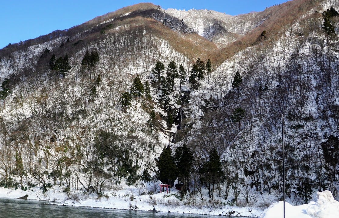
Located on the opposite bank of Mogami River at the terminus of the river cruise, the Shiraito Falls is well worth a stop if you get the chance. The Shiraito Falls is one of the top 100 Falls of Japan, and it’s not hard to see why when you see the real thing.
Haguro-san and the Dewa Sanzan
Yamuki-yama

Yamuki-yama is a low lying peak on the banks with a huge history as a strategic location for the medieval Yamuki castle for The Mogami Clan, and for the burgeoning trade along the Mogami River that helped lead Edo, modern-day Tokyo, to its status as a global city.
Yozo-san
Located between Sakata City and Sakegawa-mura, Yozo-san is an epic hike along an ancient mountain pass of primeval beech forests, unstoppable views, mysterious swamps, massive gorges complete with breathtaking waterfalls and snow bridges, all with a legendary history.
Yonetaihei-zan

I visited Yonetaihei-zan in winter so didn’t get to explore the marsh, but it wouldn’t be too far of a detour at all. Yonetaihei-zan is a 30min climb to the summit too, so it would be easy to do both of these mountains in the same day (weather and season permitting).
Kamewari-yama
Kamewari-yama (Mt. Kamewari亀割山かめわりやま) is a 594m (1948 ft.) peak in the Mogami region of Yamagata prefecture best climbed from June to October. Moreover, Kamewari-yama is a level 1 in terms of physical demand, which means it is easy to hike, has a A technical grade, which means it requires little expertise, and you want to allow at least 3 hours for a climb.
Hijiori Onsen and Jizomori-yama
The quaint town of Hijiori Onsen is named after a monk who healed his broken elbow in the hot spring water found there. Tucked away in the hills behind Gassan, Hijiori Onsen is famous for recording the greatest snowfall of any region in Japan, and there is even an annual competition to see who can dig through the snow to the ground the fastest. Hijiori onsen is also home to the famous Jizomori-yama, a peak with a shrine tucked into an indent in the mountain and a cave for ascetic training.
References
Yamap (Japanese app with my explanation in English)
Yamagatayama official website (Japanese): https://yamagatayama.com/hyakumeizan/no-047/
Information about the Mogami River (Japanese):
幻想の世界に息づく最上川峡の自然と歴史文化
戸沢村を流れる最上川中流部は最上峡と呼ばれ、両岸には樹齢1千年を超す天然木の「山の内杉」が群生し、左岸の土湯山の一角は「幻想の森」と呼ばれています。最上峡は、「義経記」や「奥の細道」に記述があるなど、古くから多くの文学者・詩人の描写の対象と…www.yamagata-takara.com
TSUCHIYU-YAMA
土湯山 | つちゆやま
Mt. Tsuchiyu, Tsuchiyuyama
Tsuchiyu-yama (土湯山つちゆやま) is a 577m (1893 ft.) peak in the Shonai and Mogami regions of Yamagata prefecture. Tsuchiyu-yama is open year-round from what I can tell, but you will need snowshoes in the winter. Tsuchiyu-yama is a level 1 in terms of physical demand, which means it is easy to hike, has a D technical grade, which means it requires a relative amount of expertise, and you want to allow at least 1.5 hours one-way for a hike.
Mountain Range
Tsuchiyu-yama
Region
Shonai, Mogami
Elevation
577m (1893 ft.)
Technical Demand
D (requires moderate expertise)
Physical Demand
1 (easiest to climb, although I disagree, it gets quite steep!)
Trails
Tsuchiyu-yama Trail (3 hours return)
Best time to climb
People have snowshoed it in February, so I assume year-round. I would recommend hiking in spring or autumn.
Day trip possible?
Yes
Minimum Time Required
1.5 hours one-way
PDF Maps by TheHokkaidoCartographer and JapanWilds.org. See all here.


YAMABUSHI NEWSLETTER
KIWI YAMABUSHI

TIM BUNTING - KIWI YAMABUSHI