The Swamp Monster of Yozo
よぞうさん

与蔵山
YOZO-SAN
Ancient trail of primeval beech forests, legendary swamp monsters, waterfalls, snow bridges, and more.
Yozo-san is known for:
- Yozo-numa, pond with a legendary history
- Aomorigaeru pond, pond with frog’s eggs in trees and salamander eggs beneath the surface
- Views of the Sea of Japan and Chokai-zan
- The Maboroshi-no-Takigun, a group of ‘phantom’ waterfalls along the Oashizawa river
Each year in June, Sakegawa Village holds a hiking event from Yozo-san’s Hanesawa Trailhead all the way down to the Oashizawa Trailhead. This event proves very popular, often selling out in a matter of days. 2022 was the 28th time this event was held, and I was lucky enough to take part. My timing was impeccable, in fact. I would have been one of the last people to enquire as bookings closed the day I sent my email.
Best known for the Sakegawa River and the salmon it provides, as well as the Totoro trees (see below), Sakegawa Village is a very remote part of a very remote part of Japan, northern Yamagata Prefecture. You may recognise the name from my Yonetaihei-zan article, but Sakegawa for me is a quintessential rural Japanese village. Nothing but rice fields, mountains, and tiny farming hamlets.
So, you may be wondering, why is an event such as this so popular as to sell out so fast? To be honest, I had the same question. But having climbed Yozo-san, I now know why.
Yozo-San’s ancient past
Yozo-san is a peak along the Yozo-toge, an ancient mountain pass originally established over 1200 years ago. You see, during the Nara period (710–794), the Yozo-toge was established as an auxiliary mountain pass to connect Taga Castle in the current-day Tagajo, Miyagi Prefecture on the Pacific coast, and Kinowanosaku, a castle in current-day Sakata City on the Shonai coast of The Sea of Japan.
That this mountain was pivotal in connecting two very strategic locations in the distant past is enough to get me excited. Besides that, however, Yozo-san is simply bursting at the seams with amazing places to explore and legendary tales to tell, such as how the name Yozo came about in the first place.
The legend of Yozo: Yozo-san’s namesake
Long, long ago, a young child named Yozo was grilling things in a charcoal hut located along Yozo-san’s mountain pass. Well, one autumn day, Yozo was carrying firewood for the fire. Tired from all the work, Yozo opted for a drink from a nearby bamboo flume when they spotted two small fish swimming past. Yozo caught the fish, quickly fried them in the charcoal, and enjoyed them as part of their lunch.
Suddenly, Yozo felt an insatiable thirst. Even drinking water unstoppably from the flume wasn’t enough to quench his thirst. Yozo quickly ran down to a nearby mountain stream and began drinking the water to no avail.
Day turns to night
Soon day turned into night, and Yozo’s worried mother gathered some of the townspeople to head up the mountain pass in search of her son. However, the group found the area around the coal hut had flooded and become a giant pond. Unable to find her son, Yozo’s mother started calling out ‘Yozo yai, Yozo yai’.
Until then the light of the moon had been shining brightly on the calm pond, but at that moment the water in the pond began stirring and stirring, before turning into a giant whirlpool.
Yozo strikes back
All of a sudden, a giant white snake came out of the whirlpool, opened its bright red mouth, and replied ‘I’m here’. Yozo had been so thirsty they dammed the valley to form a pond, and turned into a giant snake when drinking the water!
From that moment on, no matter how many times they called out Yozo, no one ever saw the snake again.
Unsurprisingly, the mother cried all the way back to the village. From these events Yozo-numa and Yozo-toge were named. Ever since then, some have claimed to see a white snake swimming in the pond. So, keep a look out when you’re there!
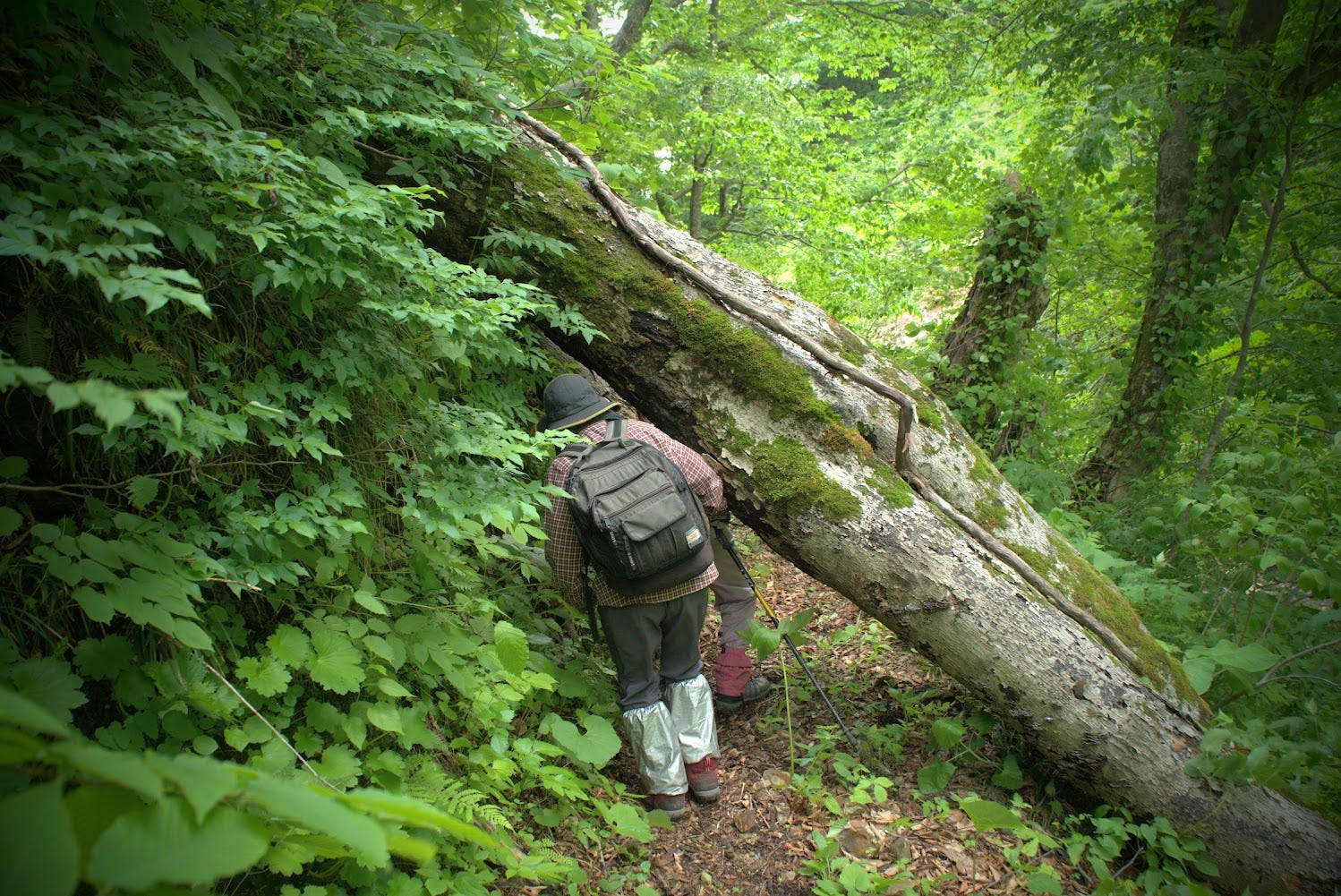
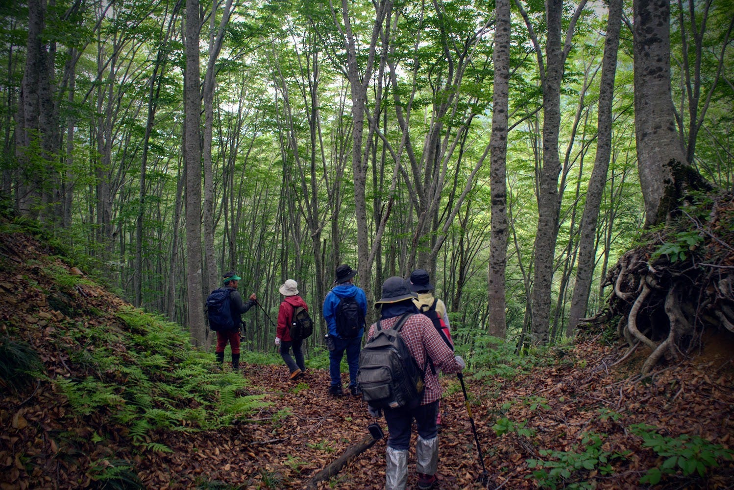
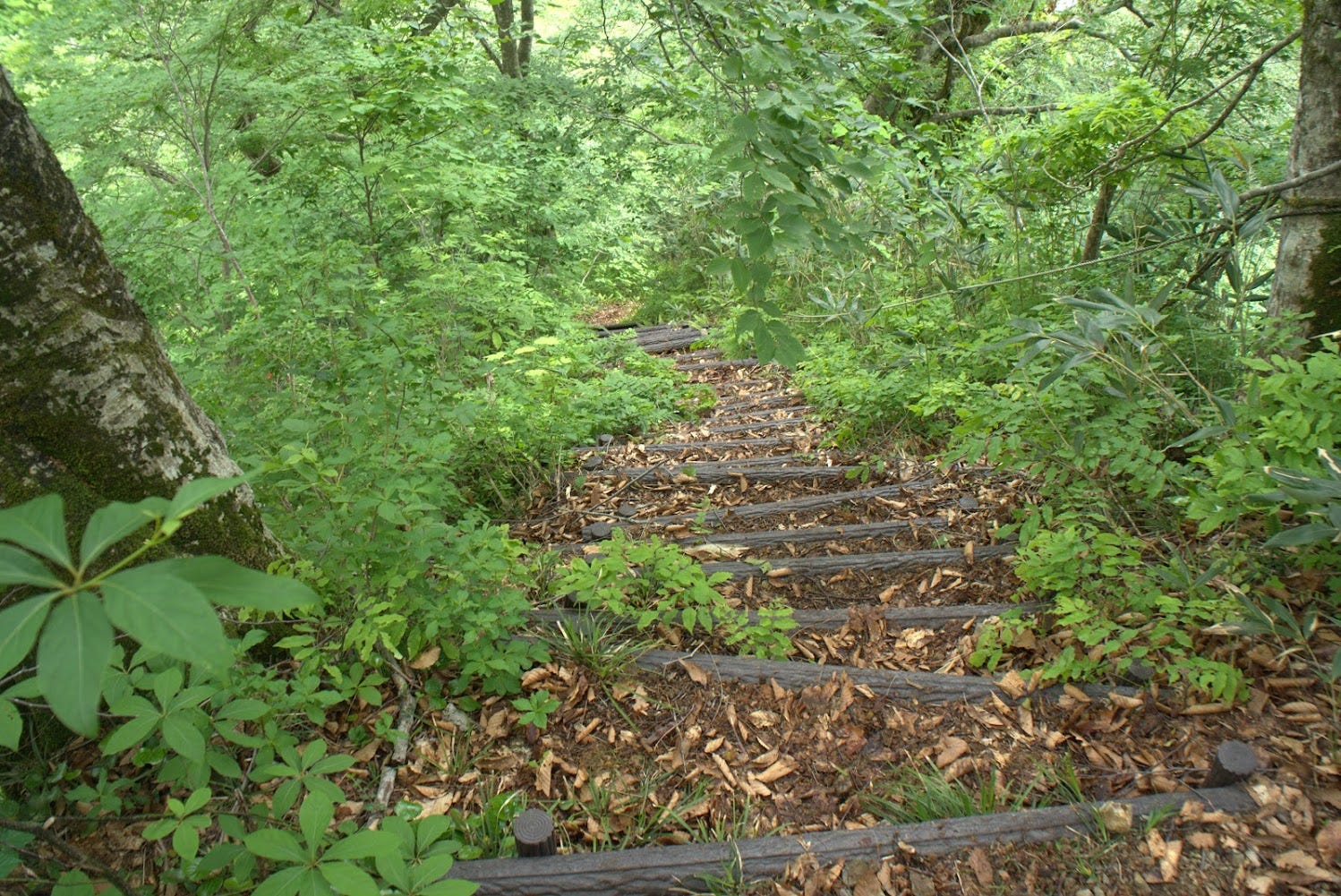
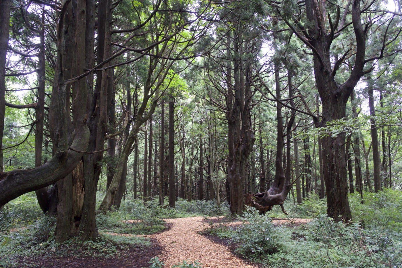
The primeval forests of Yozo-san
The Hanesawa Trailhead starts off in front of a deep beech forest similar to that of the nearby Taizo-san. The outer edge has much younger trees, as the wood was used after WWII for reconstruction before replanting. However, you will soon find yourself in a primeval forest with huge beech trees providing an amazing canopy and cover from the sun.
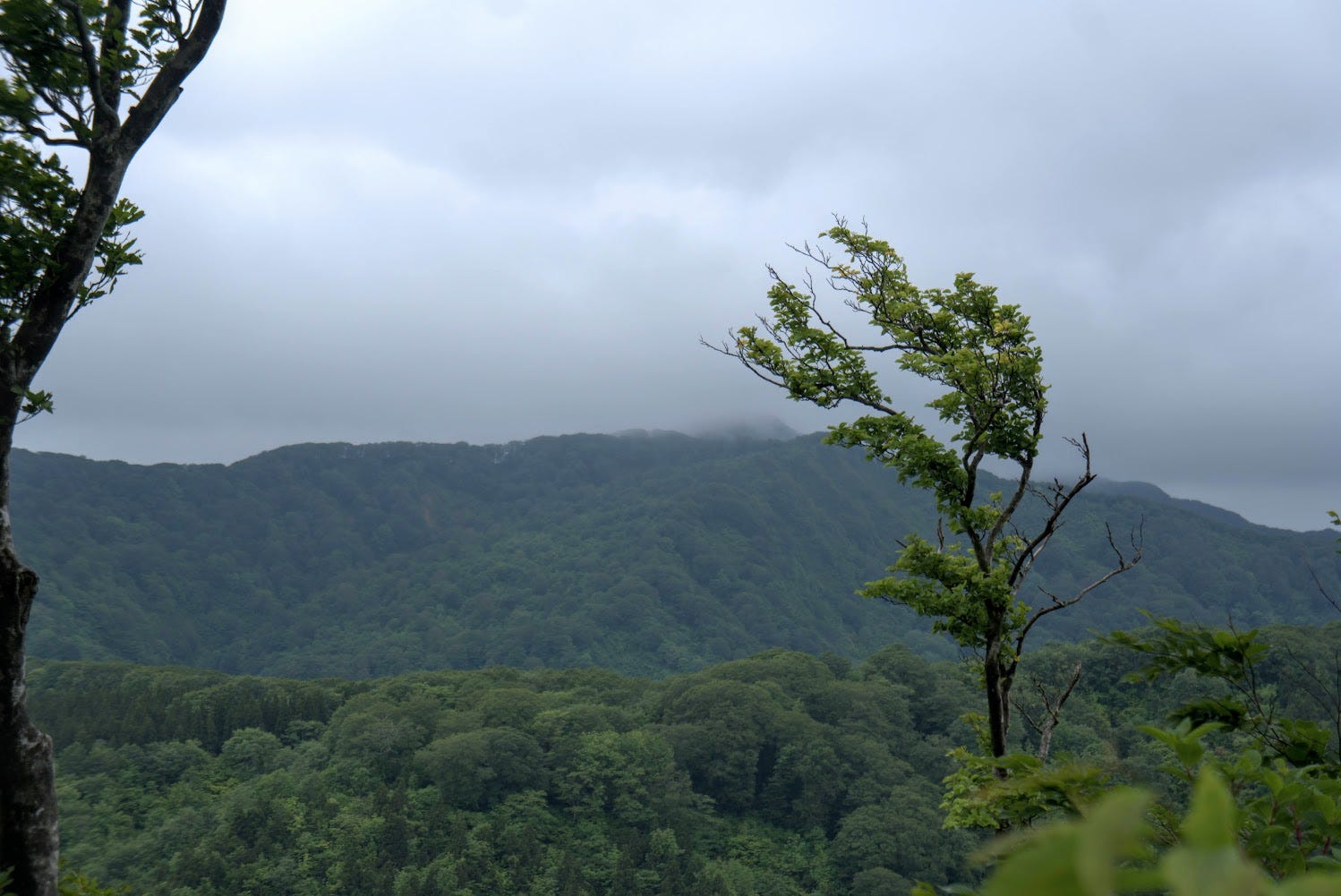
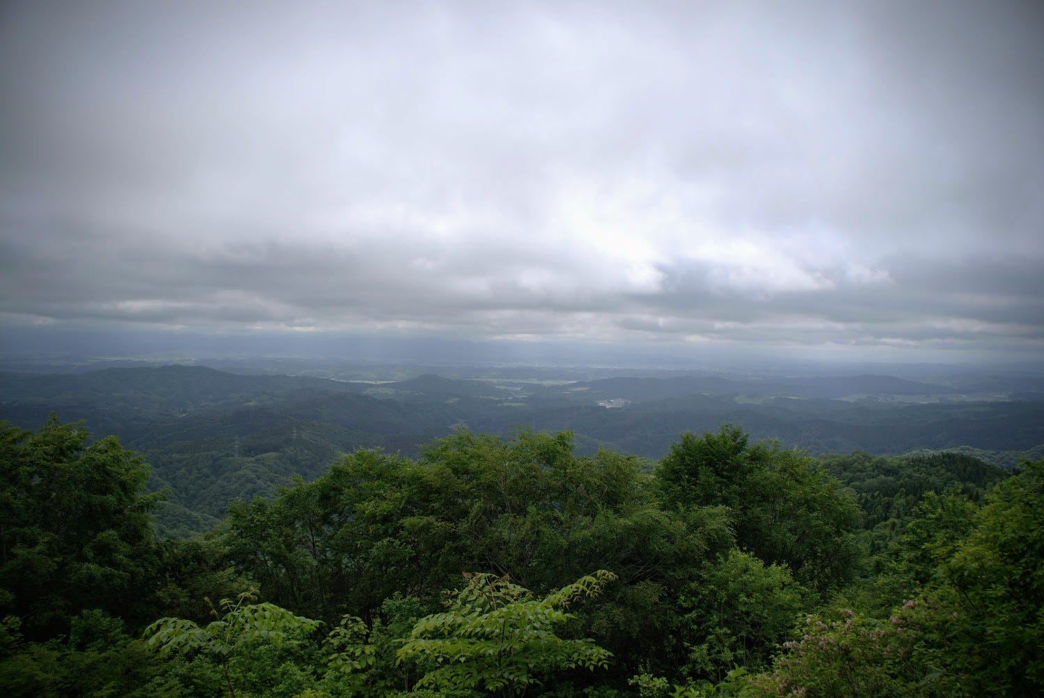
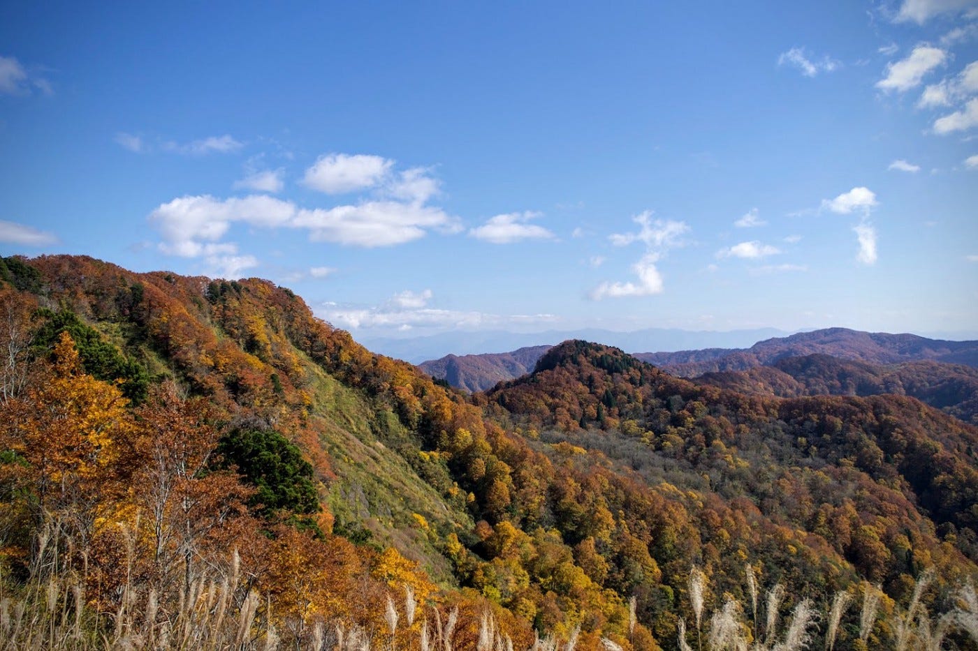
There are a number of streams to cross as you walk through this forest, and before long there is a turnoff that takes you to the summit of Yozo-san. From here, the rest of the hike is basically all a really long downhill. After a token photo, keep following the path back to the main trail. Soon you will come across a fork in the road at Tsutsuji-ga-oka, the ‘hill of azaleas’. There is a lookout to the left here from where you can see the surrounding mountains with the Shonai Region and The Sea of Japan in the distance.
Giant Beech Trees and Legendary Snakes
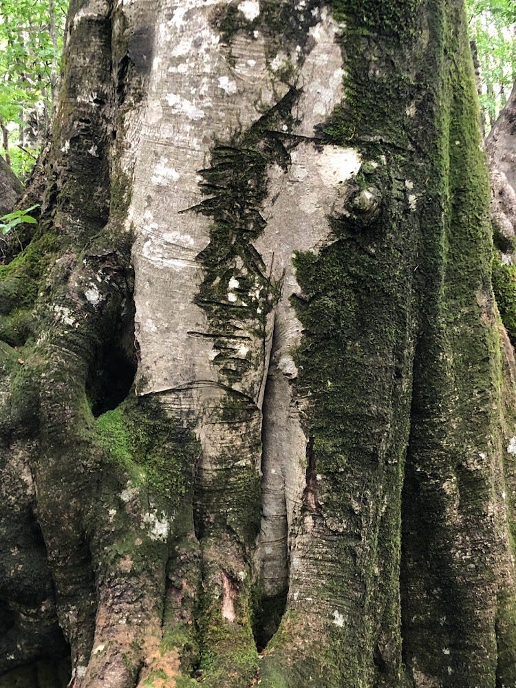
Keep following the trail amongst the giant beech trees and soon you will come across Buna-no-Kyoboku, AKA the giant beech tree. As the thickest tree around, Buna-no-Kyoboku has been a landmark along the trail for centuries, and even has ‘Hanesawa this way’ and ‘Yozo this way’ carved into it.
There is a lookout on the right as you go down the mountain through the beech forest from where on the right day Chokai-zan can be seen poking its head up through the clouds. Then there is a junction which takes you either to the Yozo-numa, or the Maboroshi-no-takigun, The Phantom Falls.
Yozo-Numa
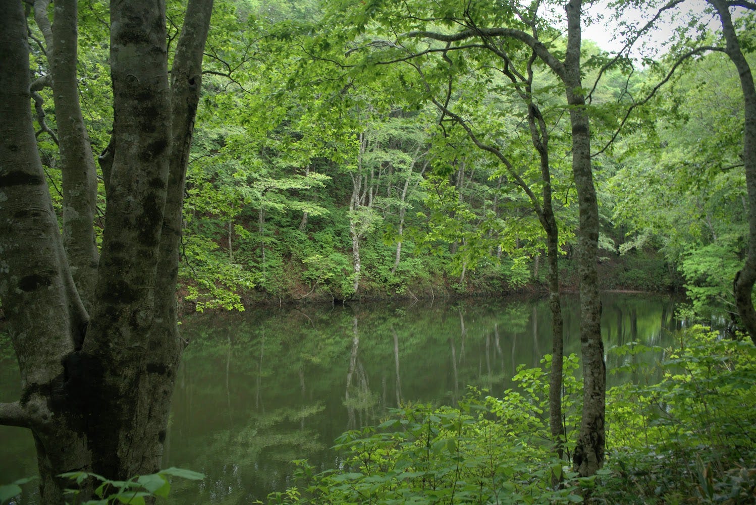
From the junction, Yozo-numa is very close, about 5 minutes on foot. Yozo-numa is a mysterious pond in the middle of a lush forest. Legend has it that Yozo-numa is where giant snake named Yozo comes from, who then started living in the village at the base of the Yozo gorge. When we were taking a photo at Yozo-numa, they asked us to say ‘Daigya’ instead of cheese, as this is the local dialect for ‘giant snake’.
Yozo-numa is a great little spot to grab a bite to eat before getting back on to the trails. The trail to Sakata from the Yozo-numa pond is currently overgrown, but in the past it was possible to take this path to the city in the Shonai region. Each year in June, Sakegawa village hosts a very popular trekking tour of Yozo-san.
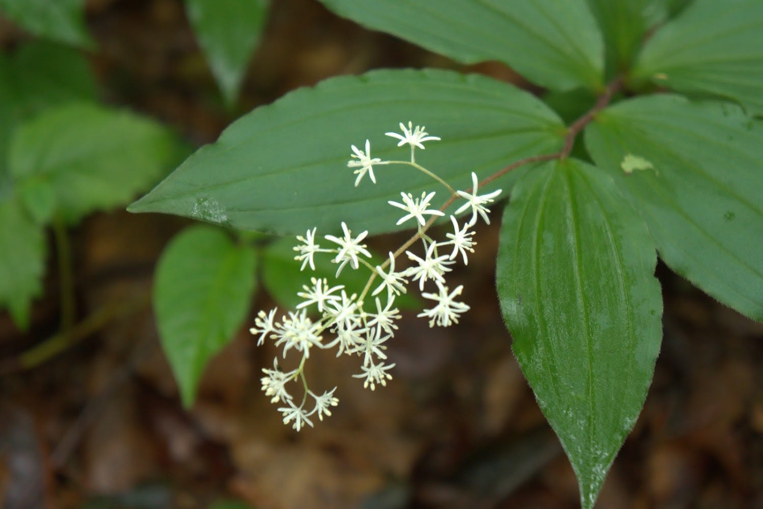
Moriaogaeru ‘Forest Green Tree Frog’ Swamp
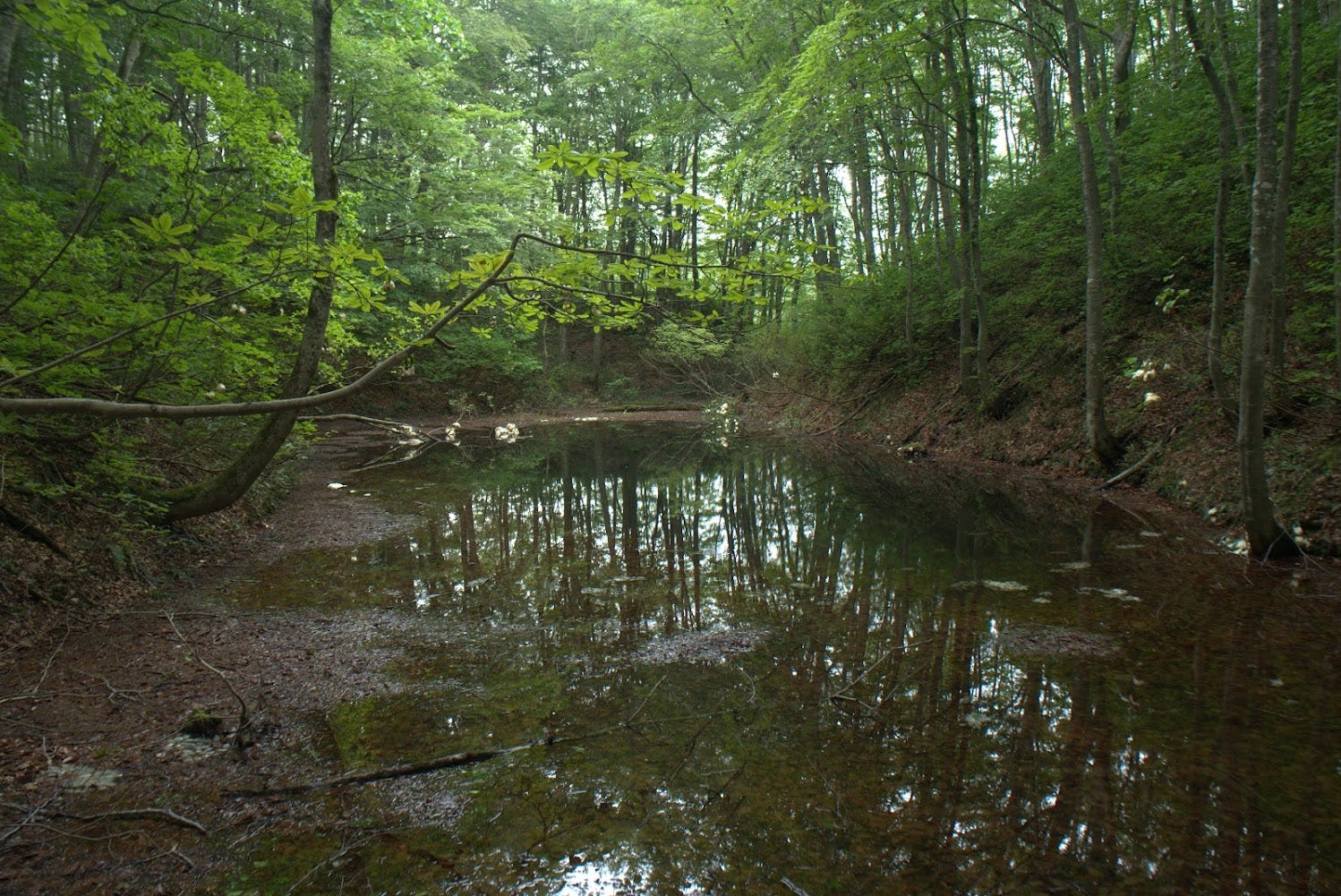
Heading from Yozo-numa, take a left at the junction towards the Maboroshi-no-takigun. About 20 minutes hike later, you will come across one of the most bizarre places I have ever seen, the Moriao-Gaeru-no-numa, ‘swamp of forest green tree frogs’.
Surrounded 360° by forest is a medium-sized swamp with something peculiar indeed. Look up and hanging from the tree branches you will see big bunches of white. These are Moriaogaeru, forest green tree frog eggs, as the frogs jump all the way up into the trees to lay them. Then, if you look in the water you will see something similar, large bunches of white eggs. These are Japanese black salamander eggs.
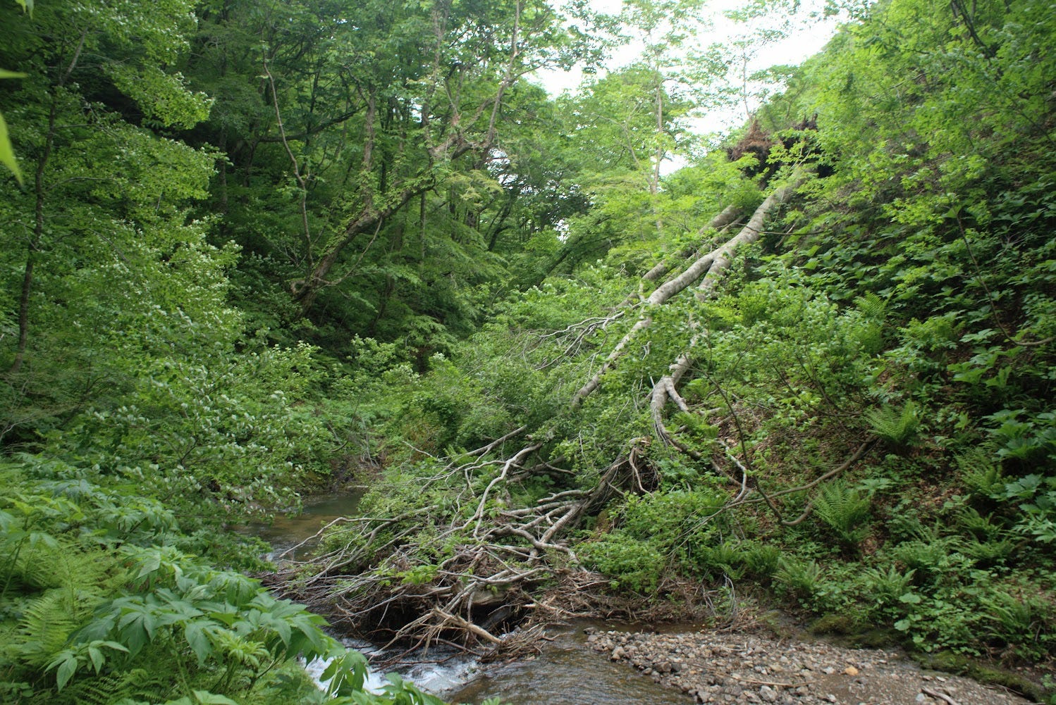
The Phantom Falls of Yozo-san ‘Maboroshi-no-Takigun’
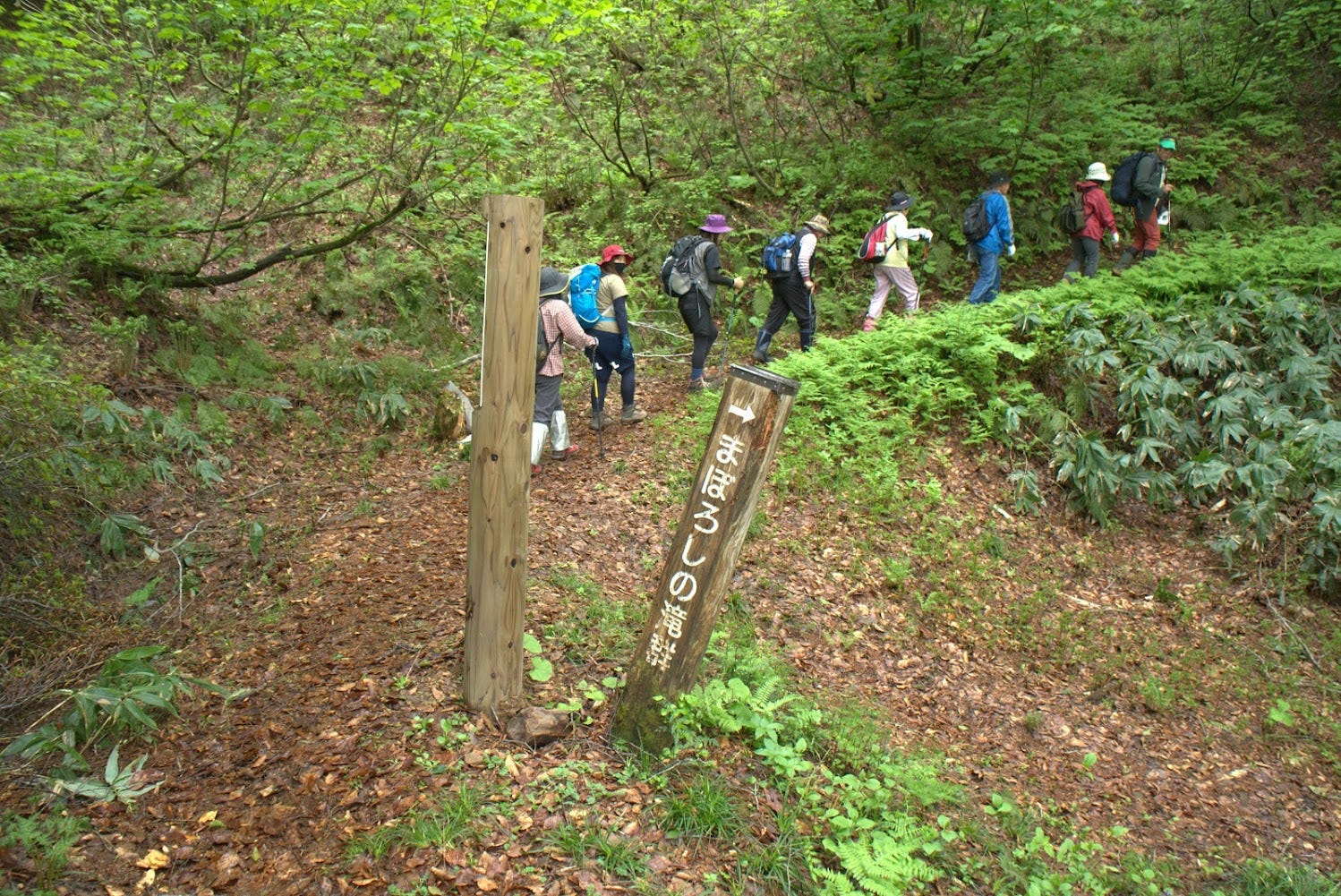
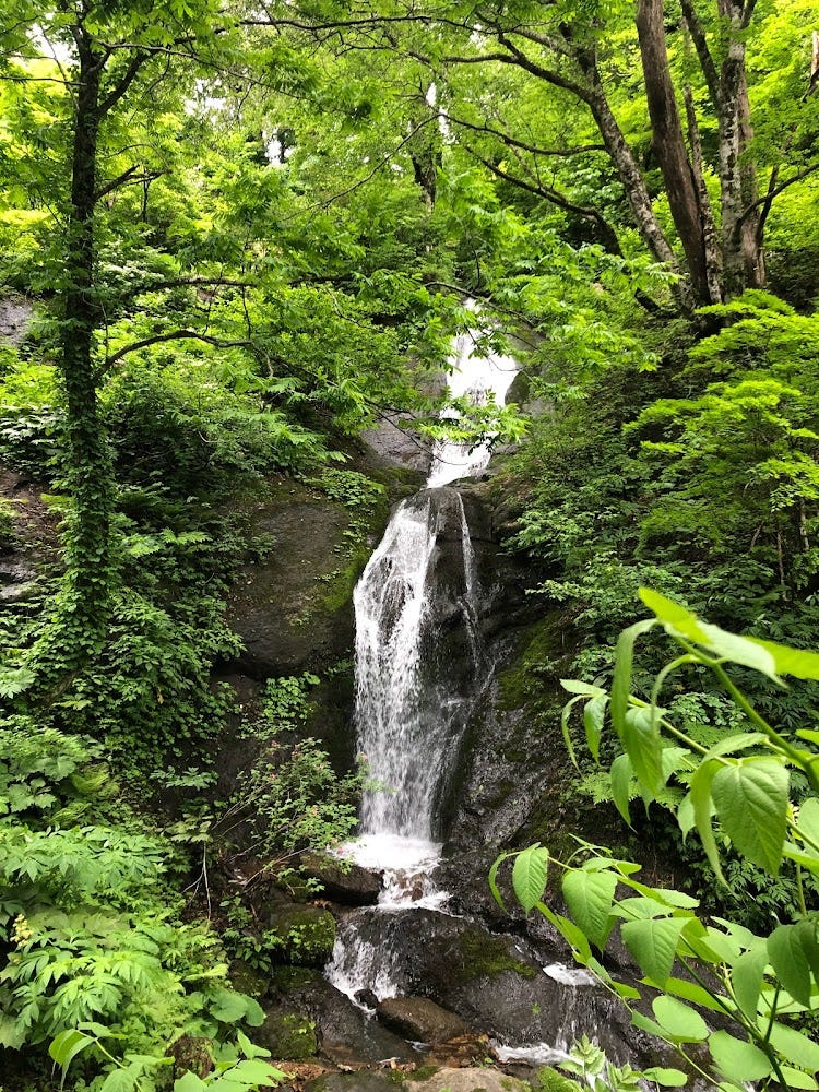
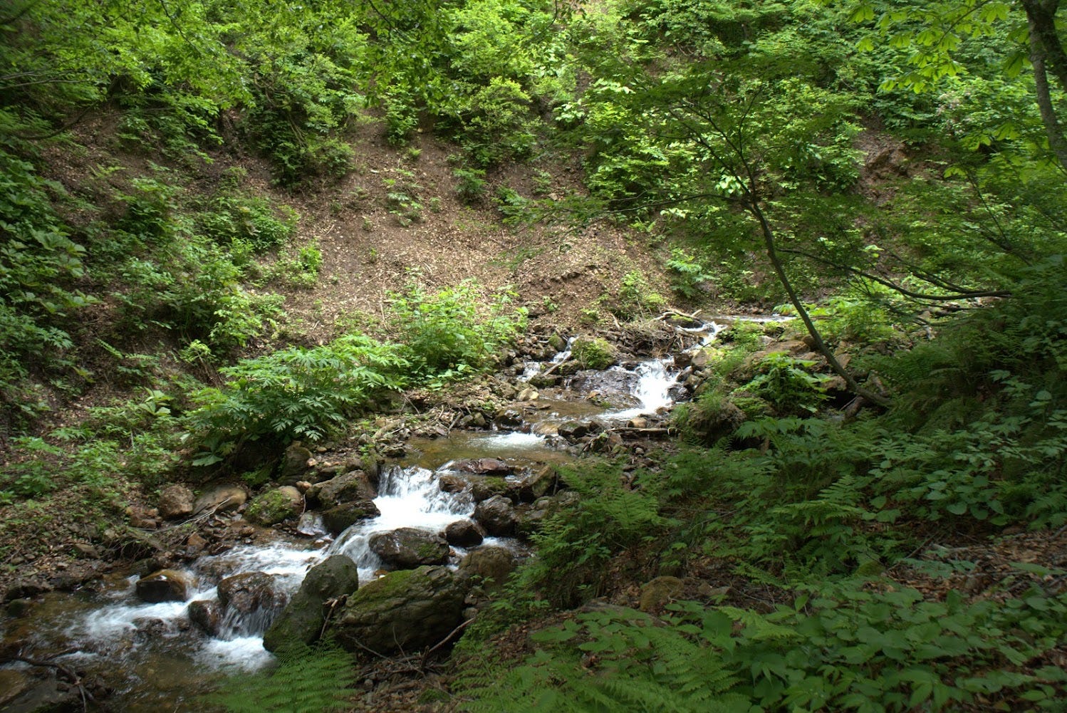
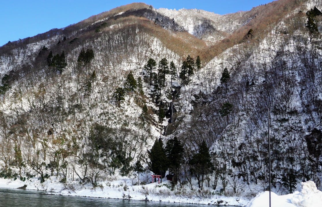
Follow the trail further down, and you will come across Maboroshi-no-Takigun ‘The Phantom Falls’. These four waterfalls were so named as when someone found them over 50 years ago, no-one had ever come across them, so no believed they existed. On closer inspection though, the waterfalls were indeed deemed real.
The first waterfall you come across is Otaki (big falls). Otaki was also known as Fudomyo’o-no-taki after Fudomyo’o, as it was used by Shugenja for waterfall meditation in the past.
White monkey falls
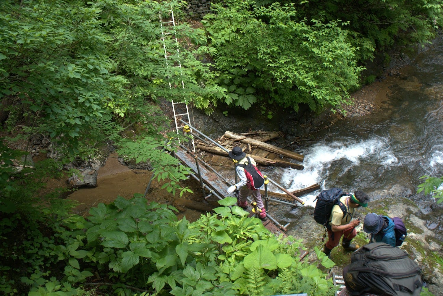
A little further down the trail and there is a turnoff for Hakuen-no-taki (white monkey falls) and Fufu-no-taki (couple’s falls). Keep going and you will come across a temporary bridge over one that has quite clearly collapsed, and then the 120m-high Yuzawa-no-taki on the opposite bank of the river. Each of these waterfalls are awe-inspiring and well worth checking out.
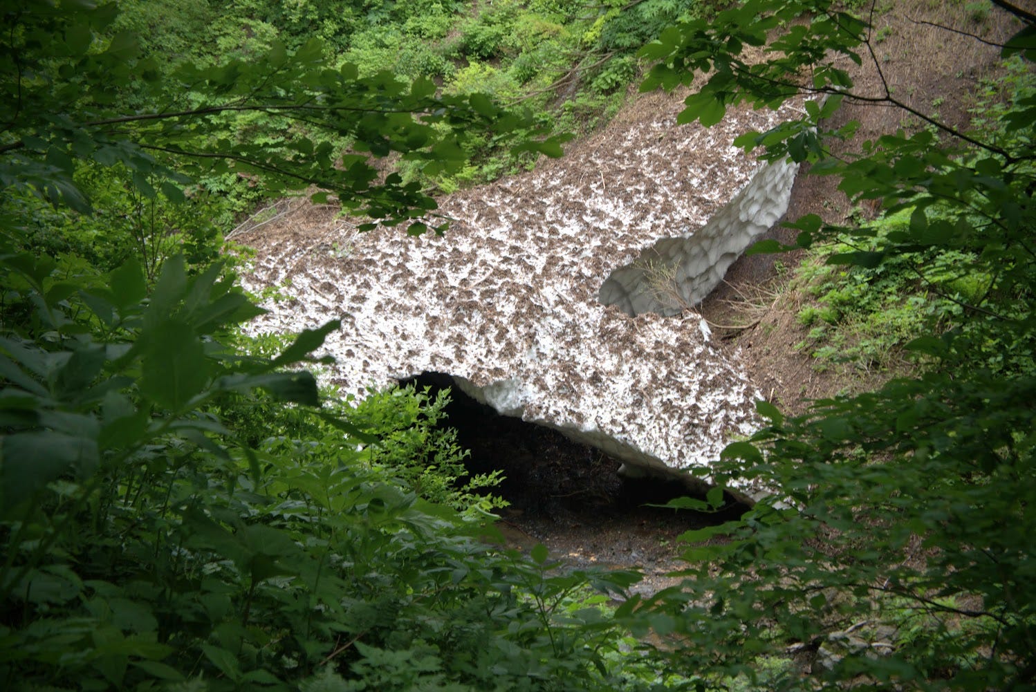
From the phantom falls, follow the river down about 30 minutes and you will reach the Oashizawa Trailhead. If you’re there early enough in the year, take a look out for snow bridges that form over the river, but do not try to climb under them!
The Five Katsura Brothers
Near the Oashizawa Trailhead lie the five Katsura brothers of Kagoyama (five Katsura Cercidiphyllum japonicum), and the Fujikyuurosawa-no-sennen katsura, a 1000-year-old Katsura tree with a circumference of over 20m.
Hanesawa Trailhead (2 hours 50 minutes return)
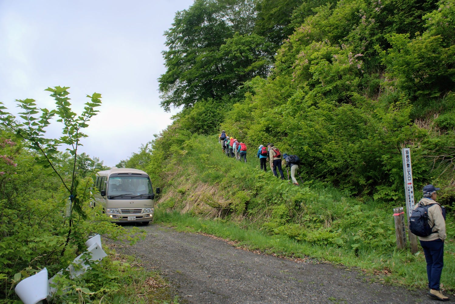
From Hanesawa Onsen, head west along the forest road where you will come across a sign reading ‘与蔵峠越え羽根沢口’ the Hanesawa Trailhead to Yozo-san, which takes you to Yozo-san and Yozo-numa. There is enough space here for ten cars to park.
There are lookouts at the Hanesawa Trailhead from where the Shinjo Basin and Murayama regions of Yamagata Prefecture can be seen. Especially famous is the thick fog that shrouds the Shinjo Basin in the early morning hours in mid-autumn, known as the ‘Yozo Plateau Sunrise Sea of Clouds’.
The path has very few large inclines, and takes you amongst a beech forest where you walk on the carpet of fallen leaves. There is an intersection leading to the summit after about 30 minutes, which is a part that rises slightly, and there is a marker designating the summit, but no lookout.
For Yozo-numa, without taking the turnoff to the summit, head straight along the mountain ridge. Along the way there are a number of junctions, and you want to go to the right at all of them. Head 0.9km in the direction of the Yozo-numa and there is a lookout from where on good days you can see out to Chokai-zan and the Kamuro Alps to the east. A short walk from the lookout and you’ll meet with the Oashizawa trail and arrive at the Yozo-numa.
Oashizawa Trail (4 hours 20 minutes return)
The Oashizawa trailhead is located at the end of the forest road that starts from the Oashizawa hamlet. At the trailhead there is enough space for 10 cars and a toilet just in case. Following the trail along the northern bank of the Oashizawa river, you will eventually come across Maboroshi no Takigun the phantom falls.
There are four famous waterfalls here; Yuzawa-no-taki, O-taki AKA Fudomyo-o-no-taki, Hakuen-no-taki white monkey falls, and Fufu-no-taki the couple’s falls. From the falls of illusion to the Yozo Swamp, the trail rises sharply through a beech forest, but evens out around the Moriaogaeru swamp. Eventually the path meets the Hanesawa trail, and after about 5 minutes the Yozo-numa swamp.
Nearby locations worth checking out
The ‘Beauty’ Hot Spring of Hanesawa Onsen
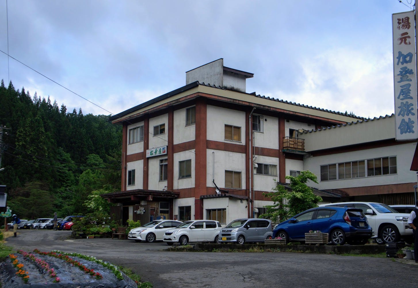
Hanesawa Onsen is located in the south west of Sakegawa Village. The hot spring was discovered by accident in 1919 when they were searching for oil. Yamagata Prefecture is famous for having an Onsen (hot spring) facility in each of its 35 municipalities. Among these, Hanesawa Onsen is rare in that it derives from a geyser, and this means it has a slightly alkaline ph value of 8.4 which is great for your skin.
The quality of the hot water has lead to Hanesawa Onsen becoming Nihon Sandai Bijin no Yu, or in the ‘top three onsen for beautiful people’ in Japan. The concentration is up there with that of Yunokawa Onsen in Shimane Prefecture, and the quality of the spring water is great for your skin, leaving it silky smooth.
In Hanesawa Onsen there are three Onsen Ryokan (traditional inns) locals have enjoyed since long, long ago. There is also a public bathing facility in the town.
Japanese Link for Hanesawa Onsen
The Totoro Trees
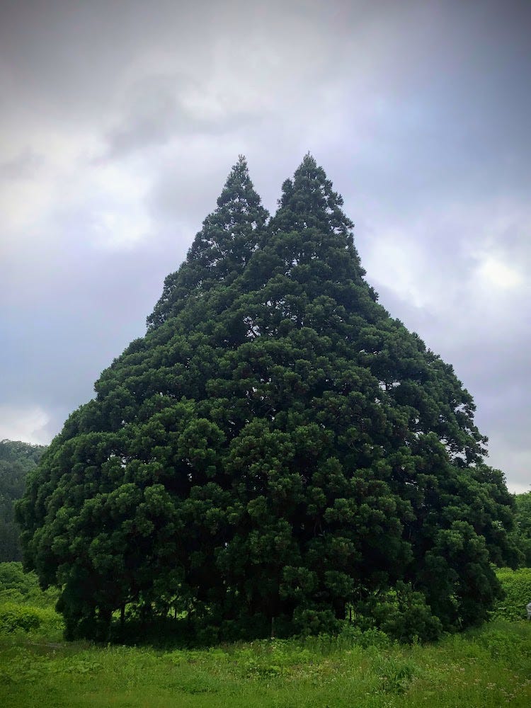
With places like Ginzan Onsen and Genso-no-Mori, the forest of illusions, Yamagata Prefecture is full of places similar to those depicted in Ghibli films, or in this case, two trees that resemble the famous character Totoro.
Shinjo City

Sakegawa Village is located adjacent to Shinjo City, and is a short 15 minute drive to the station. Shinjo City is famous for its three-day festival in August, featuring huge floats and large dances that are free to watch. It is also home to one of my absolute favourite bakeries, Geta Pan (Facebook), that I intentionally go to sometimes even though it is an hour drive away.
River Cruise on the Mogami
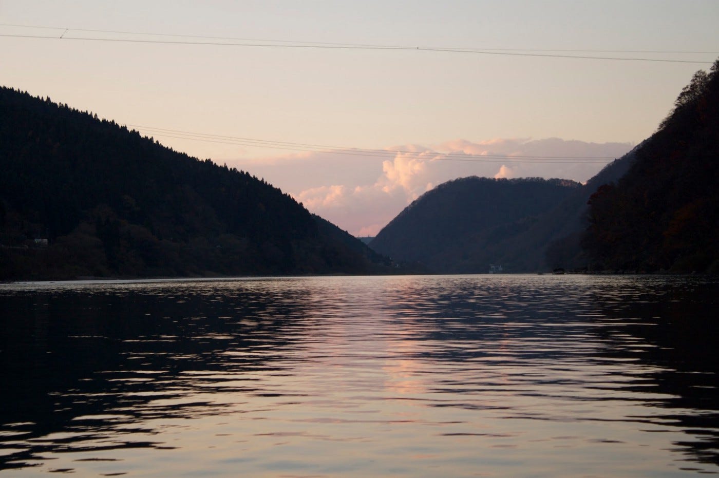
The nearby Mogami River that runs the length of Yamagata is the longest contiguous river in one prefecture and featured prominently in Matsuo Basho’s The Narrow Road to the Deep North. Matsuo Basho and his trusty partner Kawai Sore stayed three days in Oishida, and once they had good weather, they travelled to the Dewa Sanzan. This river voyage inspired the following haiku:
Gathering the rains
Of summer, how swift she flows
Mogami River
Matsuo Basho
Many companies offer cruises along the Mogami River, including during the cold winter months when you can sit under a heated Kotatsu and sip Amazake, a sweetened sake lees drink (the extract from making sake that is non-alcoholic).
Genso no Mori: The Forest of Illusions near Tsuchiyu-yama in Tozawa Village
Genso no Mori, the phantom forest or forest of illusions, is a naturally occurring cedar forest covered in cedars that have morphed due to the snowfall in the region. Be warned the forest is a bit tough to get to. You have to take a sharp turn into the mountains from Route 47 along the Mogami River, and then drive up a gravel road for a while, but once you’re there it really is like being in another world.
Taizo-san: The Epitome of Autumn Leaves in north Japan
Taizo-san is one of the historic routes linking The Shonai and Mogami Regions of Yamagata Prefecture, and is by far one of the best spots in Tohoku, North Japan, to take in the autumn leaves.
Yonetaihei-zan

Located just to the east of Yozo-san, Yonetaihei-zan is known for its marsh, the Yone Marsh. I visited Yonetaihei-zan in winter so didn’t get to explore the marsh, but it wouldn’t be too far of a detour at all. Yonetaihei-zan is a 30min climb to the summit too, so it would be easy to do both of these mountains in the same day (weather and season permitting).
After climbing Yozo-san, I learned that one of the guides is from Yone, and organised to interview him sometime in the future.
Yamuki-yama

Yamuki-yama is a low lying peak on the banks with a huge history as a strategic location for the medieval Yamuki castle for The Mogami Clan, and for the burgeoning trade along the Mogami River that helped lead Edo, modern-day Tokyo, to its status as a global city.
References
Yozo Toge Wikipedia (Japanese)
Sakegawa Village page on Yozo-numa and Yozo-Toge and The Maboroshi no Taki (phantom falls) (Japanese)
YOZO-SAN
与蔵山 | よぞうさん
Mt. Yozo, Yozo-Toge, Hanesawa-yama, Mt. Hanesawa
Yozo-san (Yozotoge, Hanesawayama) (与蔵山(与蔵峠、羽根沢山)よぞうさん, よぞうとうげ, はねさわやま) is a 703m (2306 ft.) peak in the Shonai and Mogami regions of Yamagata prefecture. Yozo-san (Yozotoge, Hanesawayama) is best climbed from June to November. Yozo-san (Yozo-toge, Hanesawa-yama) is a level 2 in terms of physical demand, which means it is relatively easy to hike, has a A technical grade, which means it requires little expertise, and you want to allow at least 3 hours for a climb.
Mountain Range
Yozo-san
Region
Shonai, Mogami
Elevation
703m (2306 ft.)
Technical Demand
A (requires little expertise)
Physical Demand
2 (a little demanding)
Trails
Two. 1) Ohashizawa Trail (4 hours 20 minutes return), 2) Hanesawa Trailhead (2 hours 50 minutes return)
Best time to climb
June to November
Day trip possible?
Yes
Minimum Time Required
3 hours
PDF Maps by TheHokkaidoCartographer and JapanWilds.org. See all here.
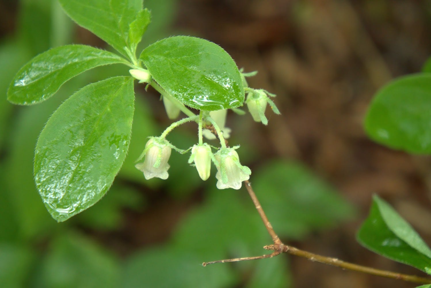
100 Mountains of Yamagata, Ancient paths and trails, Autumn Leaves, Birds of prey, Forest Bathing, Full Day Hikes, Half-day hikes, Hard to reach, Historical Hikes, Lakes and ponds, Mogami Region, Mogami River, Mountain Flowers, Mountains below 1000m, Myths and Legends, Onsen Hot Springs, Sakata City, Sakegawa Town, Shonai Region, Short hikes, Water Springs, Waterfalls, Wetlands


YAMABUSHI NEWSLETTER
KIWI YAMABUSHI

TIM BUNTING - KIWI YAMABUSHI