Close Encounters of the Tengu Kind
むらやま てんぐやま

村山 天狗山
(MURAYAMA) TENGU-YAMA
(Murayama) Tengu-yama is a 403-m high peak in Nishikawa town that is home to a Tengu, a yokai or supernatural being.
I knew the risks.
I knew the reputation.
Mountains and other sacred areas in Japan are known for being the abode of the kami, buddha, and many other creatures.
Including the bad kind.
Like the Tengu.
Judging by name alone, it’s obvious Tengu-yama is the sort of mountain you need some form of protection on.
Tengu.
Yama.
The mountain of the Tengu. One of Japanese folklore’s most fearsome characters.
For the uninitiated, Tengu are Buddhist monks or Yamabushi that were so self-conceited they fell straight from the Buddha realm, into the magical realm.
In short, Tengu are opponents of Buddhism, trying their darnedest to distract devoted followers of the religion. The disruptive demons are also harbingers of war known to possess or even kidnap people, leaving them in a state of madness only to be found some years later dazed and confused.
Inhabiting mountains all over Japan, much like us yamabushi, there are two main types of Tengu: Karasu Tengu, and Hanadaka Tengu.
Simply ‘Raven Tengu’ in English, Karasu Tengu are known for their birdlike traits. However, Karasu Tengu are:
“men, but not men; bird, but not bird; dog, but not dog; they possess the hands of a human, the head of a canine, a pair of wings, and are capable of both flight and walking.”
Yokai Attack.

In saying that, perhaps the Tengu this yamabushi needs to be most weary of is the Hanadaka Tengu, the ‘long nose’ Tengu.
- Enormous nose (much like this yamabushi, thanks Dad)
- Large feathered wings (these lats aren’t just for show)
- Bright red skin (you try climbing Haguro in the height of summer)
- Barefoot, or wearing single-toothed Geta (come to think of it, our yamabushi shoes, jikatabi, are pretty much barefoot runners…)
It’s unknown which type of Tengu inhabits Tengu-yama, or how many Tengu there are at that.
Frankly, I’d rather not find out.

I didn’t need locals to tell me the creature on this mountain has caused all manner of mischief and mayhem over the centuries.
That much I knew.
That much I prepared for.
Naturally, whenever yamabushi enter sacred sites such as Tengu-yama, we always wear some form of protector, such as a Shime necklace. When I knew I was going to be climbing this peak, I came prepared.
Or so I thought.
I packed my Shime especially for this trip. Only, the hike seemed much shorter than what I was used to. At the last minute, I decided to switch to a lighter bag.
My first mistake.
Of course I forgot to put my shime in the new bag. This was the first clue something was up. This was the first clue the Tengu already had my number. Off to a good start.
So, like the truly brave yamabushi I am, I set off knowing fully well what I was potentially in store for.
And then it happened.
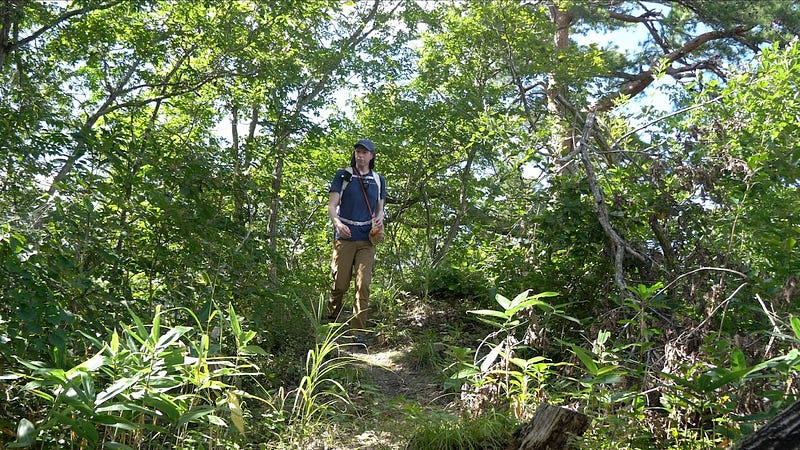
I like to film a lot of my hikes up the mountains of Yamagata. The mountains here are always much more beautiful, and much more intriguing than I could ever imagine.
Tengu-yama was no different.
This tiny mountain on the edge of Nishikawa Town is known not only for the mythical creature that inhabits its slopes, but also the ease at which you can get panoramic views at the summit. When I did eventually make it there, after hiking for all of about 30 minutes, I was greeted with a tiny shrine, a random bell, and some of the best views of Gassan, Murayama Hayama, Nishikawa, and Sagae this side of the Mogami.
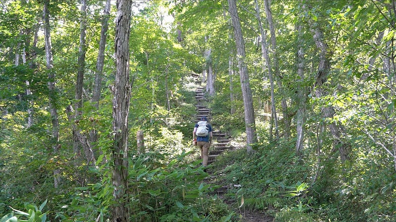
Then on the way back, I found the perfect place to film; a long set of stairs along the dense forest of Tengu-yama with an interesting curved section fans of solo hike videos would be sure to enjoy.
So I did what I always do.
I set the camera up, and set off.
Usually, it’s about 20 or so seconds walking in one direction, turning around, and about the same time walking back to pick up the camera until I find the next spot to film.
That much I’m used to.
However, this was Tengu-yama, and these weren’t any ordinary stairs. These stairs were steep. They were built for Tengu after all.
After about two or so minutes of labouring up the steep slope, I eventually reached the top, the part still visible on the camera.
Or so I thought.
As I turned around, I looked for my camera to make sure I had gotten the shot.
That was when I realised,
My camera had disappeared.
I hastily made my way down the stairs, and began a frantic search for my camera. I went to the spot where it should have been, to no avail.
Until, I noticed some of the grass had been disturbed. Turns out my camera had first fallen over, and then slid down the mountain.
I carefully picked up the camera, and checked the footage for traces of supernatural beings.
And then I saw it.
Right at the end of the video. Bright red face, enormous nose, and what could have been a wing reaching out for the camera right before the footage cut off…
Getting to Tengu-yama in Nishikawa
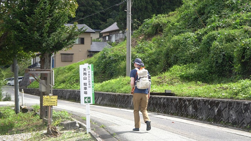
Tengu-yama is located on the outskirts of Nishikawa town. Nishikawa is tiny, and you would even be able to walk to Tengu-yama from the Nishikawa IC. Take note, however, it would probably take you the same amount of time to walk there as it would to hike the mountain.
Hiking Tengu-yama in Nishikawa
At 403m (1322 ft.) of elevation, Tengu-yama is not a big mountain by any stretch of the term. All up, it took me about 45 minutes to get from the carpark at the base to the summit, including time for filming, and searching for my camera.
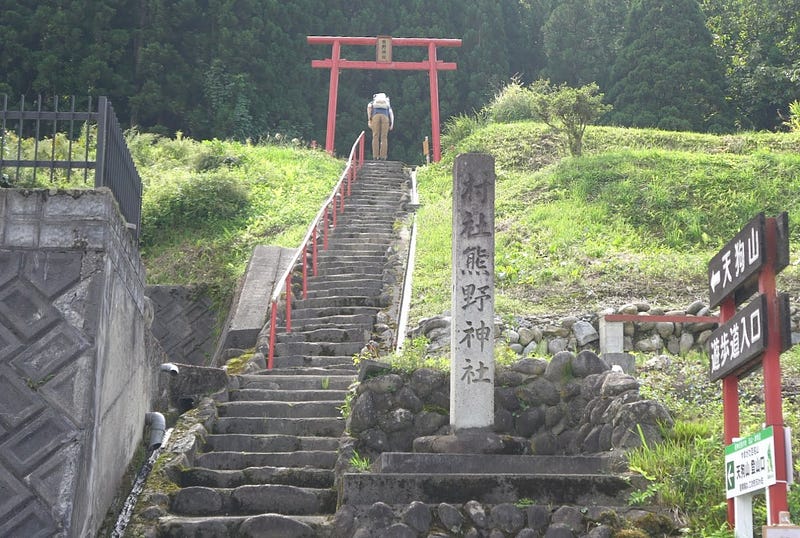
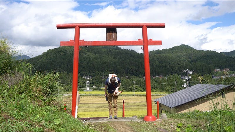
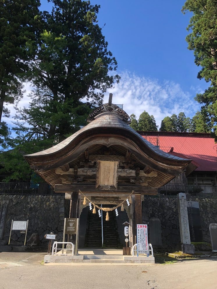
Starting off at the carpark, you’ll see a stairway a few metres down the road, and some stark red torii gates at the top. These torii are the entrance to Kumano Jinja, Kumano shrine, located right where the trail into the mountain starts.
The Pines of Tengu-yama
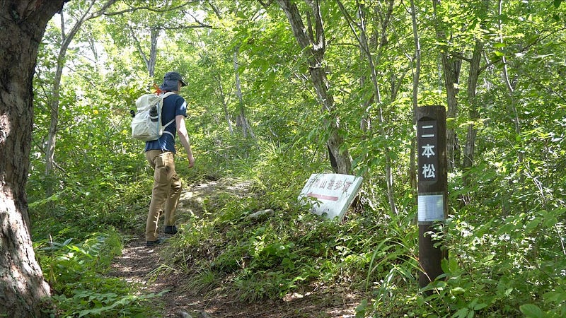
Follow the forest trail up a few hundred meters and you’ll come across the first bend. Here you’ll find the Karakasa Matsu, a pine tree said to resemble a paper parasol.
Then, simply follow the trail up a few more hundred metres and you’ll see the Nihon Matsu, a pair of pine trees. Not long after you’ll come across the Fufu Matsu, the ‘married couple’ of pine trees.
A little further along and you’ll come to the Yasumiba, a fork in the road that is a traditional rest stop. Here there are a few seats, and the former trail up Tengu-yama. This trail isn’t as well kept as the main trail, but is a good alternative if you’re keen for that kind of thing.
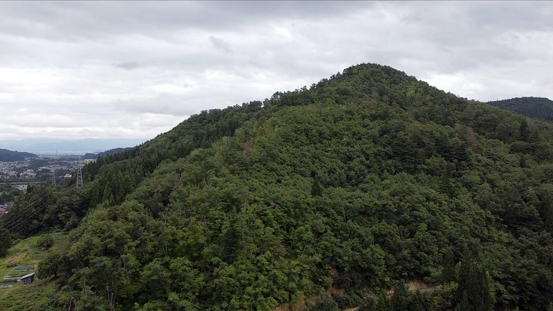
The Summit of Tengu-yama
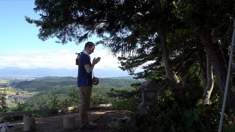
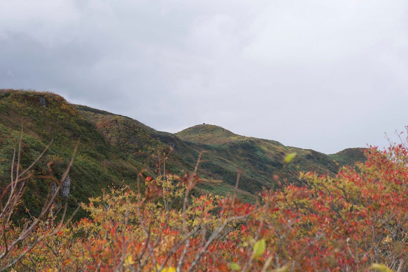
Then it’s not long until you reach the summit of Tengu-yama. There you’ll find a small Hokora shrine, and a panoramic view of Gassan, Murayama Ha-yama, Nishikawa, and Sagae city and inland Yamagata prefecture in the distance.
There is also supposedly a bunch of rocks here that I assume were the Tengu rock, but it was a bit too overgrown to really tell.
Then it’s just a matter of turning back, and potentially taking the former trail down as it loops up with the stairway from before.
Nearby Locations Worth Checking Out
Dewaya Ryokan in Nishikawa
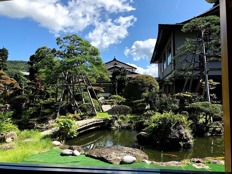
Famous for its unique take on Dewa Sanzan mountain vegetable cuisine, Dewaya Ryokan in Nishikawa is a must-stay Ryokan in Nishikawa Town.
Tsutaya Ryokan in Shizu Onsen
Run by a fellow yamabushi, the affable Shida-san, Tsutaya is a Ryokan in Shizu Onsen right at the entrance to the Gassan Ski Lift. Tsutaya is my go-to Ryokan. The meals are second to none, combining locally sourced mountain vegetables with some of Shida-san’s unique recipes, and the drink selection is also up there. Then of course is the hot springs. Tsutaya has both private and semi-public (for paying guests) hot springs with unbeatable views out onto Yudono-san and Ubaga-take. (They are also buidling a sauna!). Needless to say, you should probably just go stay there.
Yukihira Coffee in Nakayama Town

Just south of central Sagae City, Yukihira Coffee is a tiny coffee stand in Nakayama Town. Offering both blends and single origin coffee, Yukihira Coffee is one of the best cafes in the prefecture. They also have a selection of sweets (try the Canelé!). Plus, a broad range of coffee-making paraphernalia that is sure to please any coffee-lover.
Murayama Ha-yama
Murayama Ha-yama is a former Dewa Sanzan peak in inland Yamagata Prefecture with an extensive Shugendo and Mountain Worship history. Access to Murayama Ha-yama is possible from nearby Sagae City.
Daizumori-yama
Daizumori-yama is a mountain in Oe Town on the edge of the Asahi Renpo (Mountain Range) famous for its flora and fauna and the 360 degree view from its massive lookout.
Dewa Sanzan: Haguro-san, Gassan, and Yudono-san

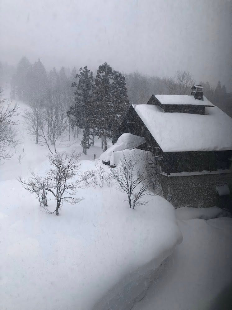
Gassan and Yudono-san are both accessible from Nishikawa; Gassan from the Gassan Ski Lift in Shizu Onsen, and Yudono-san can be directly accessed from the Gassan Road. Unfortunately, Haguro-san is on the completely opposite side of Gassan from where Tengu-yama lies, but is definitely worth a visit if you have the time.
Iwanesawa Trailhead up Gassan
Resources:
Yokai Attack by Hiroko Yoda and Matt Alt.
(MURAYAMA) TENGU-YAMA
村山 天狗山 | むらやま てんぐやま
Mt. Tenguyama (Murayama), Mt. Tengu-yama
(Murayama) Tengu-yama ((村山)天狗山(むらやま)てんぐやま) is a 403m (1322 ft.) peak in the Murayama region of Yamagata prefecture. (Murayama) Tengu-yama is best climbed from July to October. (Murayama) Tengu-yama is a level 1 in terms of physical demand, which means it is easy to hike, has an A technical grade, which means it requires little expertise, and you want to allow at least 1.5 hours for a climb.
Mountain Range
(Murayama) Tengu-yama
Region
Murayama
Elevation
403m (1322 ft.)
Technical Demand
A (requires little expertise)
Physical Demand
1 (easy to hike)
Trails
Tengu-yama Trail (40 minutes one-way)
Best time to climb
July to October
Day trip possible?
Yes
Minimum Time Required
1.5 hours return
PDF Maps by TheHokkaidoCartographer and JapanWilds.org. See all here.


YAMABUSHI NEWSLETTER
KIWI YAMABUSHI

TIM BUNTING - KIWI YAMABUSHI