OHIRA-YAMA (Mt. Ohira)
おおひらやま

大平山
OHIRA-YAMA
Ohira-yama is a mountain in the Murayama region loved by locals since long ago.
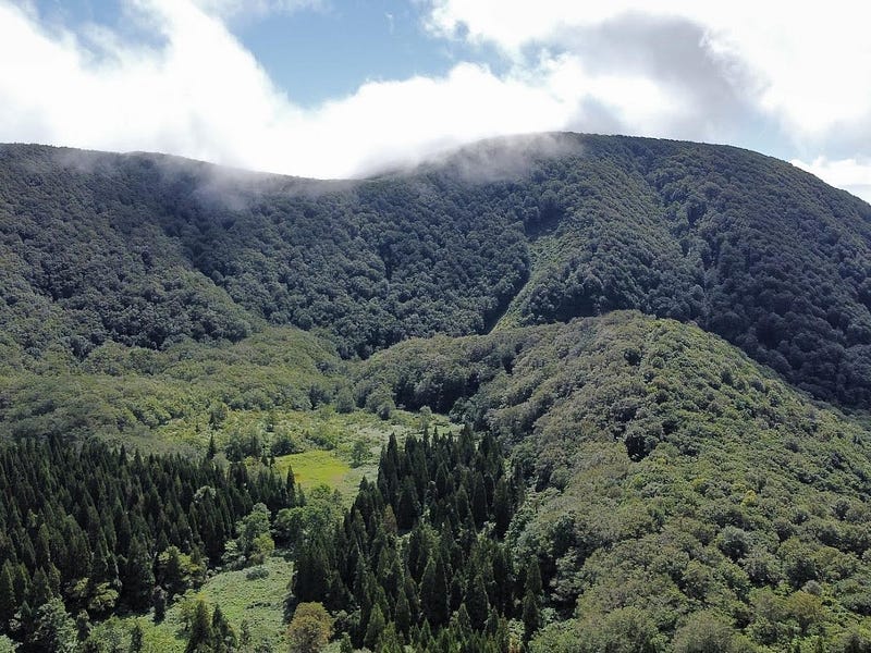
Ohira-yama is a conical-shaped mountain in Obanazawa City. Near the summit of Ohira-yama there are two rocks that were said to be left behind by a high priest. First is the Shishi-iwa rock after the mythical Chinese guardian lion. Second is the Eboshi rock after a form of Heian-era headwear a Shinto priest would wear. There is also a summit marker, and Man’nendo, a group of rocks in the shape of a small hall. Plus, the view from the summit is excellent. From here you can get panoramic views of Koshiki-dake, Gosho-zan, and the Asahi Renpo.
Every year in spring locals from the Hosono area hold a ‘Takai yama unbiraki’ ritual. During the ritual, many people come to pray for the safety of the region. Ohira-yama is also used in the local school song. This shows just how much locals love the mountain.
Ohira-yama Trail (3 hours return)
The start of the Ohira-yama Trail takes you through a forest of thin cedar trees. After a while, you will come across a broad-leafed forest where the climb gets increasingly steeper. There are parts where you need to use the ropes so be warned. You can take a break at the lookout. Then once through the beech forest, there is one last part until you arrive at the summit.
Nearby locations worth visiting
Ginzan Onsen
Okina-san is only a short 20 minute drive from Ginzan Onsen, one of the most well-known parts of Yamagata Prefecture. Famous for its Ryokan along a river that looks like they came straight out of a Ghibli film, Ginzan Onsen is an excellent location to relax after a few hours on the mountains of Yamagata.
Switch on coffee

One day I was passing through Obanazawa on my way home from Sendai and I found this awesome little cafe had only recently opened. They had amazing cheesecakes, and their selection of beans was something special.
Kita-yama

Kita-yama is the perfect spot for a picnic amongst the Sakura. The mountain offers panoramic views over the rice fields and mountains of inland Yamagata Prefecture.
Kamuro-dake
Kamuro-dake is a mountain on the edge of a caldera on the borders of Mogami Town and the Onikobe part of Naruko Onsen, Miyagi Prefecture.
Futatsu-mori
Futatsu-mori is a distinctive twin-peaked mountain in Obanazawa City near the border with Miyagi Prefecture.
Venerable Old Man Mountain — The Mist and Mystery of Okina-san
Lying along The Ou Mountains, Japan’s longest mountain range stretching over 500km across the length of the Tohoku Region, the landscapes and legends of Okina-san make this 1075m (3526 ft.) peak not only a 100 Famous Mountain of Yamagata, but also one of the 100 Famous Mountains of Tohoku.
OHIRA-YAMA
大平山 | おおひらやま
Mt. Ohira, Mt. Ohirayama
Ohira-yama (大平山おおひらやま) is a 814m (2670 ft.) peak in the Murayama region of Yamagata prefecture best hiked from late May to early November. Ohira-yama is a level 1 in terms of physical demand, which means it is easy to hike, has an A technical grade, which means it requires little expertise, and you want to allow at least 3 hours for a climb.
Mountain Range
Gosho-zan Range
Region
Murayama
Elevation
814m (2670 ft.)
Technical Demand
A (doesn't require much expertise)
Physical Demand
1 (easy to hike)
Trails
Ohira-yama Trail (3 hours return)
Best time to climb
Late May to early November
Day trip possible?
Yes
Minimum Time Required
3 hours return
PDF Maps by TheHokkaidoCartographer and JapanWilds.org. See all here.


YAMABUSHI NEWSLETTER
KIWI YAMABUSHI

TIM BUNTING - KIWI YAMABUSHI