The Epitome of Autumn Leaves in North Japan: Taizo-san (Mt. Taizo)
たいぞうさん

胎蔵山
MT. TAIZO
Mount Taizo all but single-handedly confirms why autumn is by far the best season for hiking in Japan.
In all honesty, the corridor of autumn leaves and wide open trails of Taizo-san in Tohoku, North Japan, were a bit too much for me to contain my excitement; for the first time ever I went through my four camera batteries, and spent nearly twice the recommended climbing time going up just to get my autumn fix.
Besides being the ultimate destination to see the autumn leaves in Tohoku, Taizo-san has a very well maintained trail that no doubt made thousands of journeys easier on one of the historically main thoroughfares between Sakata City in The Shonai Region, and Sakegawa Town in the Mogami Region of Yamagata. The cultural significance of Taizo-san doesn’t stop there, however, and its namesake is an interesting one.
The Shugendo History and Namesake of Taizo-san

If I’m not mistaken, Taizo-san takes its name from Taizokai The Womb Mandala, one of two Mandala that form the core of Chinese Tangmi (Chinese Esoteric Buddhism) and Japanese Tendai and Shingon Buddhist rituals. Said to have been opened for spiritual pilgrimages by Kobo Daishi, Kukai, Taizo-san enshrines Yakushi Nyorai, and is a sacred mountain that spiritual followers have gathered on since ancient times.
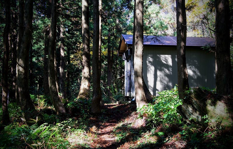
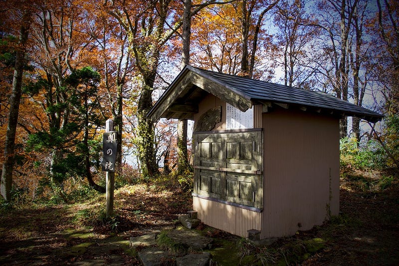
Like many peaks in the Shonai Region of Yamagata, Taizo-san has an extensive history of Shugendo worship, and it’s not hard to see why. From the Naka-no-Miya Shrine in the centre of the mountain, to the Oku-no-in Shrine, and the simply breathtaking Akahage lookout at the summit, the Torii Matsu, pine trees (I assume were at one stage) in the shape of Torii gates, and the natural spring at Koboshimizu, there are tons of spots covering Taizo-san from where it’s only natural the ancient Japanese would have felt a presence.
Taizo-san: The Ancient Route Between the Shonai and Mogami Regions of Yamagata Prefecture
In what was called Taizo Goe ‘Crossing Taizo’, Taizo-san flourished as one of the main routes between The Shonai Region on The Sea of Japan coast, and the Mogami region in inland Yamagata prefecture. This was a huge deal as The Shonai Region was all but unaccessible in the winter once the snow blocked the mountain paths.
Perhaps this explains why the path was rather wide and well looked after, and I wouldn’t be averse to one day hiking the whole trail.
Hiking Taizo-san: Trail Conditions
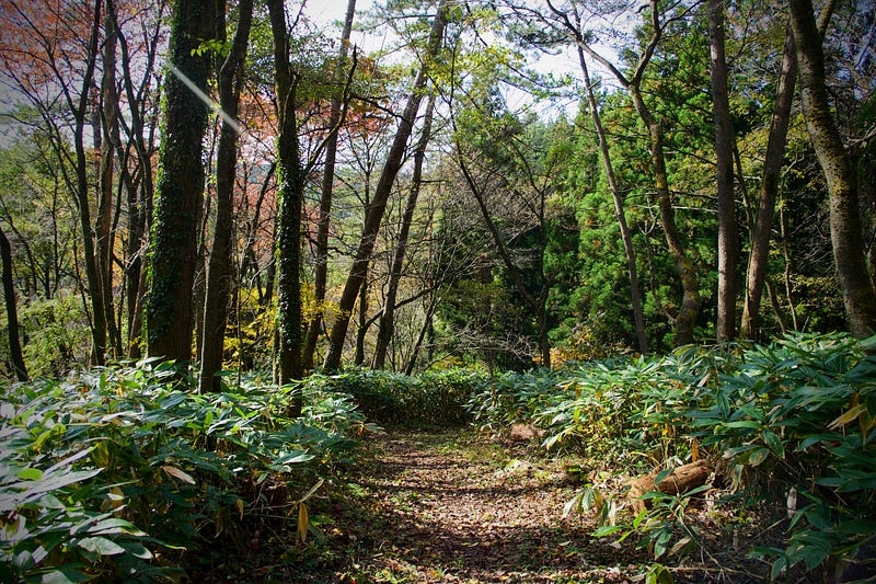
Speaking of the trail, of all the mountains in Shonai, Taizo-san is probably also one of the best for hiking. The paths were for the most part very wide and were natural forest floor, so weren’t too tough on my knees. Plus there was plenty to take in the whole way up through the dense forests.
As you can tell from a distance, Taizo-san is a giant trapezoid with a small tuft of hair at the summit. It’s only logical then that the trails are similar; long stretches of gradual rises, but with the occasional steep part to be aware of. Nothing a bit of effort can’t deal with though.
Hiking Taizo-san During the Autumn Leaves
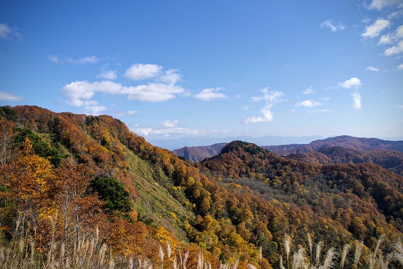
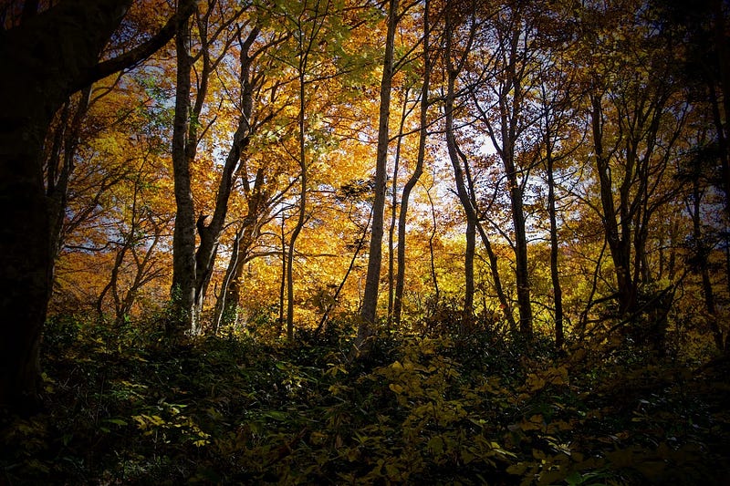
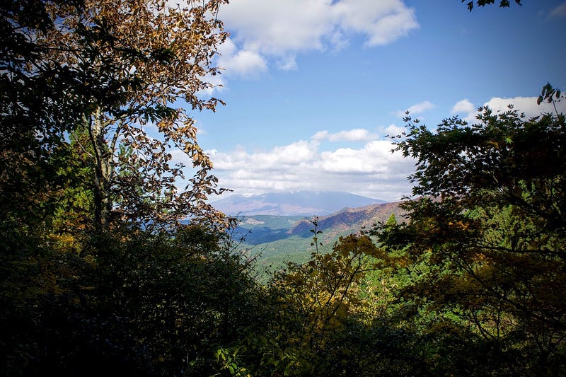
There’s no question that the best season to climb Taizo-san is when the autumn leaves are out, usually mid-October to mid-November; I climbed on October 30, right at peak autumn leaves. This is also when the temperature is mild, and you also get those clear autumn skies to better see Chokai-zan and the other mountains surrounding Taizo-san.
When I was there, I was surrounded by all manner of species. Right at the start of my hike, I could hear the distinctive tapping of a woodpecker. I also swear I heard a bear or something similar growl. Lucky I had my conch on hand to scare it off.
Hiking Taizo-san in Other Seasons
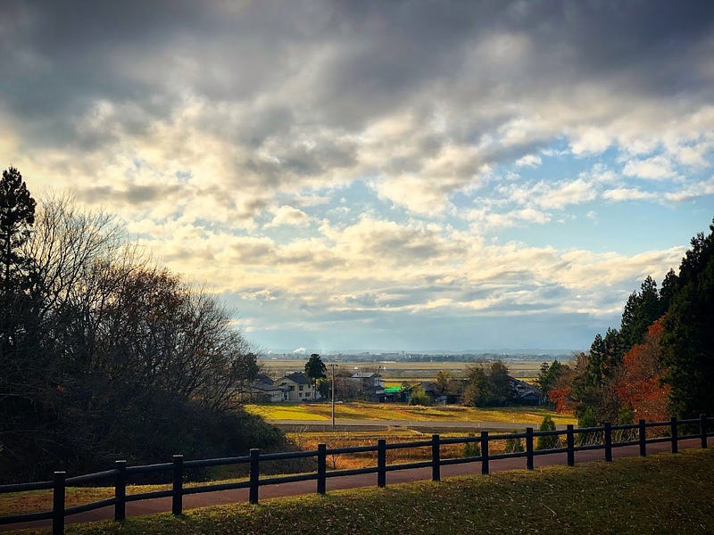
Taizo-san can still be enjoyed with the fresh green of spring and in summer with great views of Chokai-zan and small towns of The Shonai Plains making Taizo-san a popular destination for local elementary school excursions. The fresh green of spring on Taizo-san usually lasts from around April 20 to May 10th.
Each year on May 3 is the Yakushi Nyorai Goshintai (object of worship) Spring Festival at the Oku-no-in Shrine at the summit.
Getting to Taizo-san
Taizo-san features two main trailheads; the Mototazawa Trailhead and Nakazato Trailhead. Both trailheads are located about 25 minutes to the south east of central Sakata city, right near the Ennoji trailhead up Kyogakura-san. It would be possible to take the same bus used for Kyogakura-san to Ennoji, however by far the best way to get to Taizo-san’s trailheads would be by car, especially for the Mototazawa trailhead.
The Mototazawa trailhead is on the other side of a small hill down a long and winding road behind the hills of Ennoji. With its trail beginning behind the Ennoji bus stop, the Nakazato trailhead would be a bit easier to get to.
This would be the path I recommend as it is 40 minutes (one-way) shorter and still keeps the good parts, although I mistakenly didn’t take it. I thought I was heading to the Nakazato Trailhead, as that’s what I plugged into my app, but it took me to the wrong place, the Mototazawa Trailhead I couldn’t find on a map, but followed the signs in the town.
Getting to the Mototazawa Trailhead
Head east from Yakushi Shrine in the Mototazawa hamlet and follow the forest road that goes along the Sagisawa River. Keep heading straight after passing two parts where the Eastern Forest Road and Sagisawa Route 2 Forest road meet (Google Maps has nothing in detail, but I believe it was around here).
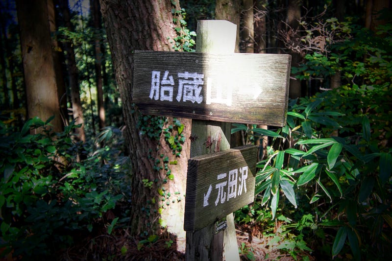
Before long you will come across a sign for the entrance to the trailhead. This part is relatively secluded and there is no designated car park, so you’ll have to park your car on the side of the road. From here, the hike begins in a north-east direction.
Hiking the Mototazawa Trail up Taizo-san (5.5 hours return)
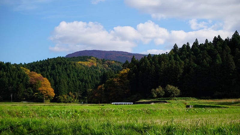
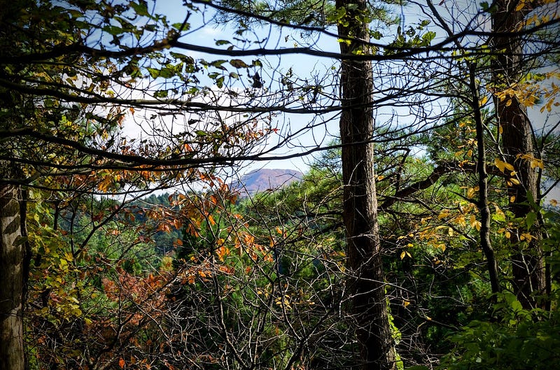
The path from Mototazawa is a gradual incline up a relatively level trail through a mixture of cedar and deciduous forests until you get to the mountain ridge, right where it meets the Nakazato Trail. After meeting the Nakazato route, soon enough you will see the Torii Matsu, The Torii Gate Pines, which is an excellent rest stop as you can see out to the Tateyama hamlet, Chokai no Mori Forest Park, and if you’re lucky, to the mountains further afield.
From here, the path gets steeper again, zig-zagging up the mountain at what turns out to be the steepest part of the whole trail. Thankfully there is an ice-cold spring to check out, the Kobo Shimizu spring, and also the eerie Naka-no-Miya Shrine in the middle of the forest there.
After filling up with water and paying your respects at the Naka-no-Miya Shrine, keep following the path up as the trail levels out, basically until the top. Along the way, keep a look out for Chokai-zan poking its head through the clouds.
The Oku-no-in Shrine and views that take your breath away: The summit of Taizo-san
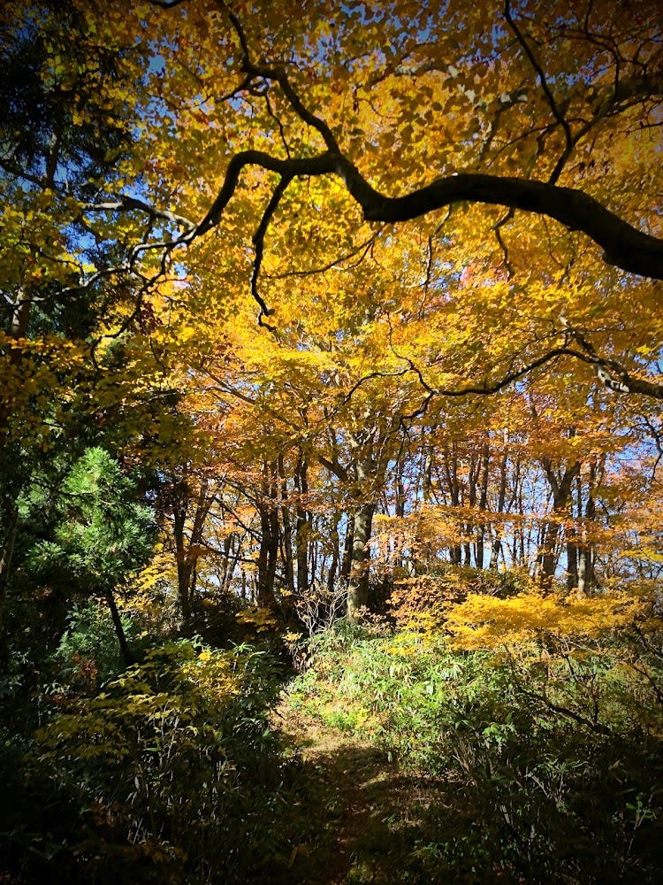
As you can probably tell from the photos, Taizo-san is an eclectic mix of deciduous trees and cedar forests, with the odd spot to lookout and simply take in the glorious autumn views. As you get nearer the top, however, the autumn leaves intensify, and boy was it a sight to behold. It was like walking inside a rainbow, the colours were so sharp! If you don’t have the energy to make it to the summit, it’s at least worth going a little further than the Naka-no-Miya Shrine.
Before long, you will reach a fork in the road, but not before passing through a canopy of some of the most amazing oranges and yellows you have ever seen. A left here will take you to the Oku-no-in Shrine at the summit of Taizo-san. The view from here isn’t exactly amazing, so head back down the trail you came for the view of the century.
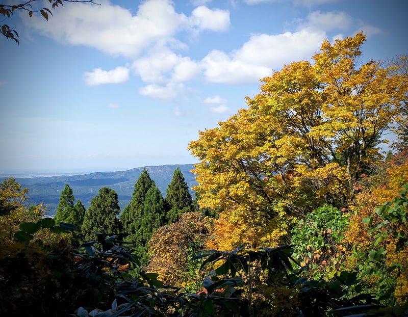
The Best Spot to Take in the Autumn Leaves in Tohoku: Akahage Lookout on Taizo-san
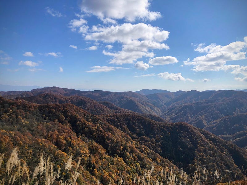
Head back the way you came and take the path that veers to the right at the fork. Soon you will come out at an open area that really puts the autumn leaves of Taizo-san on the map. This is the Akahage lookout, quite possibly the best spot to see the autumn leaves of Taizo-san, let alone Tohoku, in all their glory.
The trail I took up Taizo-san, the Mototazawa Trail, is meant to take 2 hours 40 minutes one way. It took me four hours. Now, you may think I was just wasting my time or walking really slowly. Quite the opposite. It was just such a beautiful spot, I found myself wanting to take photos and video basically the whole way up.
Although I took four hours to climb up, I actually ran the whole way down, and managed to get back in less than an hour, so my average time was about usual. On the way up I had taken so much footage that I knew it would be enough, but I still stopped every once in a while on the way down to get some photos for you, and for some all important rest of course.
Getting to the Nakazato Trail of Taizo-san
The Nakazato Trail up Taizo-san basically cuts out a large part of the Mototazawa Trail and heads straight for the Torii Matsu Pine Gates. It is also easier to get to and takes less time to hike, so would probably be my recommendation.
From the Route 365 Ennoji Sagoshi bus stop, head towards the Nakazato hamlet down a gravel road for a little while. At the intersection where there is a sign to Taizo-san, there isn’t much space for parking your car, so you will have to park on the side of the road. There is a sign here for the Nakazato Trailhead.
Hiking the Nakazato Trail up Taizo-san (4 hours return)
In contrast to the slow incline at the start of The Mototazawa Trail, The Nakazato Trail up Taizo-san has a steep incline and a 10–15 minute section through the cedars. This is where the trail meets the Mototazawa trail, and remainder of the path up Taizo-san is the same.
In Conclusion: Taizo-san

Taizo-san was a stark reminder of why autumn is by far the best time of the year to explore the hiking trails of Tohoku, north Japan. I probably timed my hike perfectly for the autumn leaves, one week later I climbed Hokari-yama, another mountain in the Shonai region with a similar height, yet the top was already balding. Needless to say, you can’t go wrong with a climb up Taizo-san in late October or early November!
Nearby locations worth visiting
Womb Passes and Monkey Crossings: Kyogakura-san

Adjacent to Taizo-san is Kyogakura-san, one of my best finds in the past year. The Monkey Crossing, Womb Pass, and Zazen Rock are just three of the intriguing locations of the unsuspecting Kyogakura-san, an ancient Shugendo peak behind Juninotaki Falls in Sakata City, and one of my new favourite spots to explore in Tohoku, North Japan.
Juninotaki Falls: The Twelve Falls
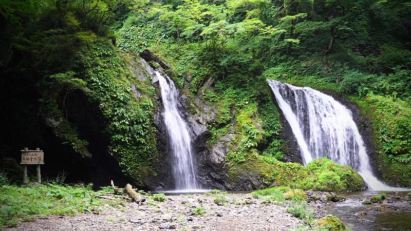
Juninotaki, The Twelve Falls, is one of the most famous spots for the autumn leaves in Sakata, a very popular location for a picnic. Located at one of the trailheads to Kyogakura-san, Juninotaki is only a short drive from the Mototazawa and Nakazato trailheads to Taizo-san.
Aiai Hirata Onsen Hot Springs
People from NZ are used to seeing hills covered in buildings, but for some reason this isn’t very common in the rural parts of Japan. Aiai Hirata Onsen Hot Springs is an exception. Located atop a low mountain that looks over the Shonai Plains out to The Sea of Japan, Aiai Hirata Onsen Hot Springs are probably my favourite public hot springs in Shonai.
Chokai no Mori Mountain Forest Park
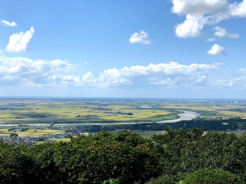
Chokai no Mori is a forest park in the hills behind Matsuyama that has a lookout, a campground, a ski field (one that’s open in summer at that!), and even an observatory. Located at the top of a hill, Chokai no Mori offers great views of Chokai-zan to one side, and the Shonai Plains, Sea of Japan, and Dewa Sanzan to the other. The low-lying mountain is also popular for cycling up and down, the perfect challenge for those on two wheels!
The Former Castle Town of Matsuyama
Matsuyama is a former castle town on the outskirts of Sakata City. Parts of the castle are still very much visible, and the Matsuyama Cultural Heritage Museum is a great place to explore artifacts from the surrounding area.
The Japan Heritage Gardens of Sokoji Temple
Sokoji Temple is located in a forest at the back of Matsuyama just before the road heads up the mountain. Sokoji is famous for its national heritage Zen garden, Horaien, one of the top four gardens in the Shonai area (the others being off the top of my head: Gyokusenji Temple, the Chido Museum, and Seienkaku near Sakata Station).
Somokusha Cafe
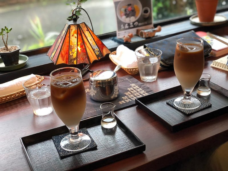
Somokusha Cafe is my go-to cafe for freshly roasted coffee beans, and for someone obsessed with coffee, this is really saying something. Somokusha cafe is run by the very lovely Natsuko-san, and serves all manner of caffeinated beverages with traditional Japanese sweets (think sweet red bean paste). The beans roasted at Somokusha cafe are always fresh, and there is plenty of variety available to keep this coffee nut sane.
The Grandest Waterfall in Yamagata: Tamasudare Falls
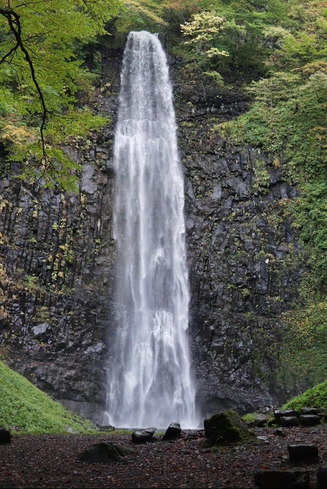
Tamasudare Falls is another popular waterfall in Sakata City. At 64m in height, Tamasudare is the tallest waterfall in Yamagata Prefecture, the prefecture with the most waterfalls in the whole of Japan. Legend has it that Tamasudare was named by Kukai AKA Kobo Daishi, who likened it to Buddhist prayer beads (tama) and Sudare bamboo shades often seen over windows during summer. Tamasudare is also a popular destination for cyclists and picnickers alike.
Omatsuya Restaurant
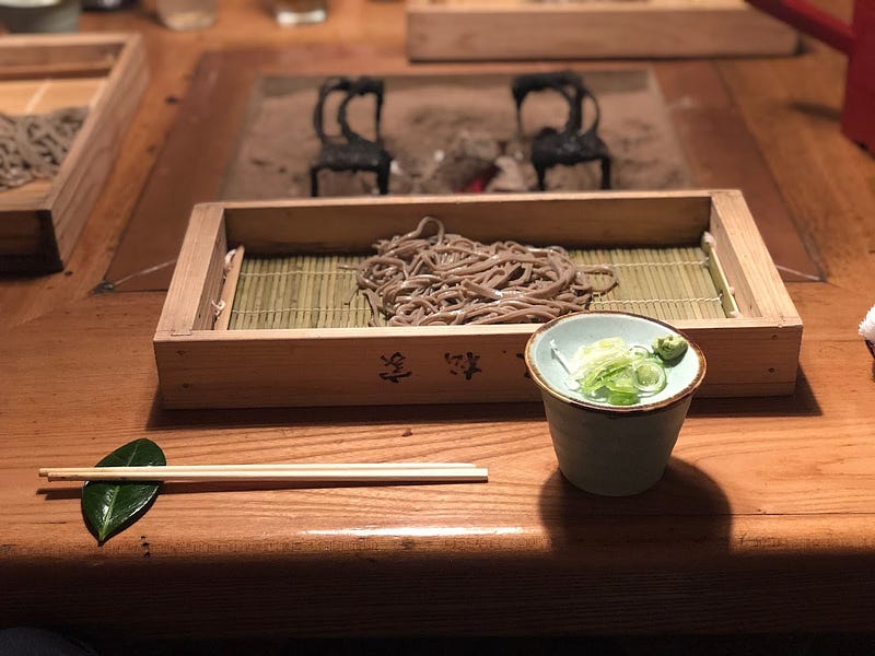
Omatsuya is a restaurant serving local delicacies from recipes of old in a Kominka traditional farm house. Omatsuya is a great spot to chill in an authentic Japanese environment surrounded by rice fields and mountains.
MT. TAIZO
胎蔵山 | たいぞうさん
Mt. Taizo, Taizosan, Mt. Taizosan
Mount Taizo (胎蔵山たいぞうさん) is a 729m (2391 ft.) peak in the Shonai region of Yamagata prefecture. Mount Taizo is open from April to November. Mount Taizo is a level 2 in terms of physical demand, which means it is relatively easy to hike, has a B technical grade, which means it doesn't require too much expertise, and you want to allow at least 4 hours for a climb.
Mountain Range
Mt. Taizo
Region
Shonai, Mogami
Elevation
729m (2391 ft.)
Technical Demand
B (requires some technical expertise)
Physical Demand
2 (relatively easy to hike)
Trails
Two: 1) Mototazawa Trail (5.5 hours return), 2) Nakazato Trail (4 hours return)
Best time to climb
April to November
Day trip possible?
Yes
Minimum Time Required
4 hours
PDF Maps by TheHokkaidoCartographer and JapanWilds.org. See all here.


YAMABUSHI NEWSLETTER
KIWI YAMABUSHI

TIM BUNTING - KIWI YAMABUSHI