The best Fuji alternative: Chokai-san
ちょうかいざん

鳥海山
CHOKAI-ZAN
Dewa Fuji, The Fuji of The North, Chokai-san, Mt. Chokai: Tallest peak entirely in Tohoku often said to resemble Mt. Fuji, leading to the name Dewa Fuji (after the former province of Dewa).
Jump to the Chokai-san Hiking Guide Section
Fuji-san is a looker, rather than a climber. So they say. If that’s true then Chokai-san is a both.
Chokai-san (Mt. Chokai, or Chokai-zan, depending on dialect) is not only an incredible peak to gaze upon, it is also an incredible peak to climb upon. Don’t take my word for it, though! Chokai-san isn’t one of the 100 Famous Mountains of Japan for nothing.
Besides its status as one of the most important Kami (deities) in Japan, the 2236 m (7335 ft) Chokai-san is the tallest peak entirely in the Tohoku, and as such the tallest mountain on The 100 Famous Mountains of Yamagata list.
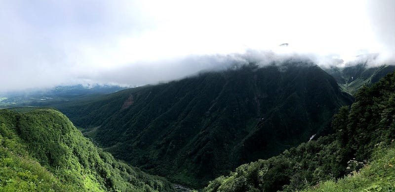
The towering peak offers the sort of unbelievable backstory, awe-inspiring views, a plethora of trails, and distinct flora and fauna expected of the highest peak in Tohoku, northern Japan. Plus there’s also the sheer number of remarkable waterfalls on Chokai-san, and the creepy legend about how Chokai-san got its unique shape too!
Wait!? Chokai-san wasn’t a mountain?
Chokai-san has been revered for centuries, and not simply because of its stature. In fact, Chokai-san wasn’t originally called Chokai-san. More than 1,000 years ago, Chokai-san wasn’t even known as a mountain.
According to the 9th century Shoku Nihon Koki (the fourth volume in the Six National Histories), Chokai-san was known as 飽海郡鎮座の大物忌大神 Akumigun-Chinza-no-Omonoimi-no-Okami. For the uninitiated, this means ‘Omonoimi-no-Okami (Kami, deity) enshrined in Akumi Province’.
You see, until around the Nara Period (710 to 794), the area around Chokai-san wasn’t actually a part of Yamato Japan (see my article on Nihon-koku for more on this). Rather, the area had many settlements of native Japanese Emishi or Ezo tribes. The presence of these tribes, and the fact that Chokai-san was an active volcano puffing with smoke, meant the mountain was to be feared and treated with caution.
Chokai-san, The Great Pacifier?
To quell the attacks of the Emishi tribes, and to suppress the might of the volcano, Chokai-san was enshrined as Omonoimi-no-kami (Japanese wikipedia link), the great pacifier, or great purifier. Omonoimi-no-kami was since regarded as a guardian Kami of the country, known to cleanse Kegare (impurities).
Locals considered any eruption of Chokai-san the anger of Omonoimi-no-kami, and to appease the powerful deity, each eruption the Kami moved up a Shinkai (Kami rank). Chokai-san last erupted in the 1970s, so by now it has well and truly reached the upper echelons of Kami in Japan.
Chokai-san’s Shugendo and Mountain Worship History
What followed was centuries of Mountain Worship, for example by followers of Shugendo, AKA Yamabushi. As such, Chokai-san is a Reizan, a sacred or holy peak (for more on traditional Japanese mountain classifications, see my article on Murayama Hayama). At one point, Chokai-san was even one of the Dewa Sanzan, the three sacred mountains of the former Dewa Province (currently Haguro-san, Gassan, and Yudono-san).
Along its base, Chokai-san had four main settlements used by worshippers: In Yamagata Prefecture there were settlements in Warabioka and Fukura in current-day Yuza Machi. Then in Akita Prefecture, there were settlements in Yashima in current-day Yurihonjo City, and Kotaki in current-day Kisakata, Nikaho City.
Unfortunately, these worshippers didn’t always see eye to eye, and there were countless disputes over the centuries. The numerous sects and traditions mean that there are many different claims as to the history of the mountain.
’Bird Ocean’: Chokai-san’s Namesake
Chokai (鳥海) means ‘bird ocean’. According to Warabioka-kuchi-no-miya (Warabioka Trailhead Shrine), when the founder of Shugendo En-no-Gyoja (En the Ascetic), first climbed Chokai-san, he saw an ocean of birds. I’m not entirely certain what this means, but it was probably a huge flock of birds, which led to the mountain’s current name.
En-no-Gyoja is also said to be the one who defeated Tenaga-Ashinaga and established the first trails up the mountain.
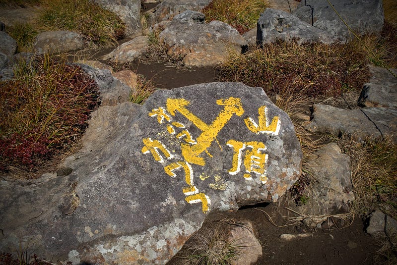
Remnants of this history are spread all over the mountain. Omonoimi Jinja near the summit of Shin-zan is an obvious example. However, places such as Fushiogami-dake (lit. peak where you bow down), Gyoja-dake (lit. ascetics’ peak), and Sai-no-kawara (the river in front of the Sanzu River, the Buddhist equivalent of the River Styx) give us more to go from.
The Gazing Part: The Thirty-Six Views of Chokai
Fuji-san is renowned for its thirty-six views, Ukiyoe paintings featuring Japan’s most famous peak. Well, unlike Fuji-san, Chokai-san offers breathtaking views not only of the mountain, but also from the mountain.
For example, have you ever heard of The Chokai Shadow?
The Chokai Shadow
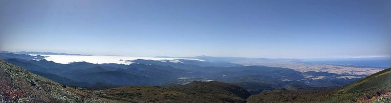
The Chokai Shadow is the shadow of Chokai-san in The Sea of Japan, seen from the mountain. Due to the positioning of the sun, this phenomenon only ever occurs at sunrise, and only ever on clear days.
In other words, if you stay on or near the summit of Chokai-san, and if you time it right, you can wake up to witness The Chokai Shadow for yourself.
I am yet to see it, although I have heard of people purposely spending multiple nights on the mountain just to see the phenomenon for themselves.
Just be warned, though. Since Chokai-san is a national park (or maybe because it’s a Geopark?) pitching a tent isn’t allowed. You’re going to have to either rough it in a sleeping bag, or stay in the cabin near the summit. The other option, of course, would be night hiking.
Chokai-san Hiking Guide: Hiking Season
Chokai-san opens for climbing once the snow melts in July, and the climbing season finishes when the first snow falls, usually in the middle of October.
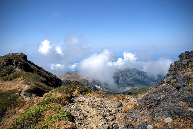
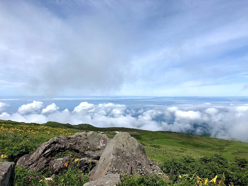
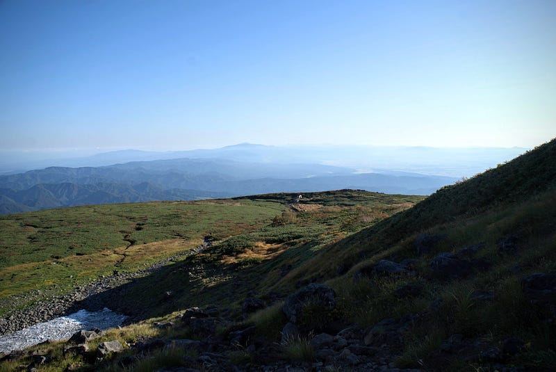
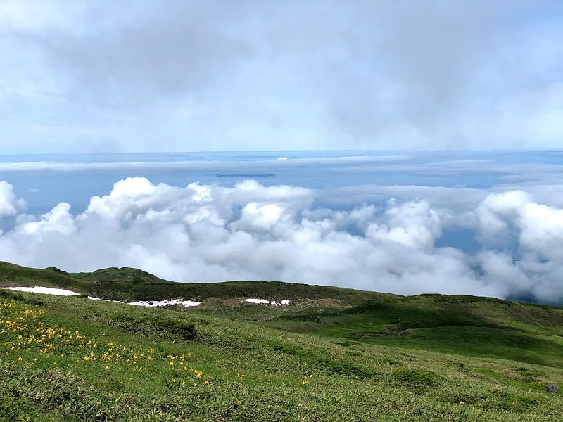
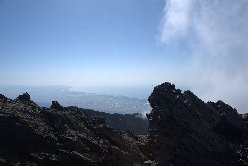
If you catch the right day, the views from Chokai-san are nothing short of a miracle. Since Chokai-san lies on the edge of The Sea of Japan coast, views of the ocean are all but guaranteed. On clear days it’s easy to spot Tobishima Island, Yamagata Prefecture’s only inhabited island that together with Chokai-san forms the Chokai-Tobishima Geopark.
Also visible are the Shonai Plains and inland Yamagata Prefecture to the south, and Yurihonjo and Nikaho Cities of Akita Prefecture to the north. If you’re lucky, you can even see out to the Oga peninsula.
And what would a mountain view be without a mountain view? To the south, it’s easy to recognise Gassan and the Dewa Sanzan mountains, as well as The Shonai Alps and the Kinbo Shugen line of mountains. Look inland, and you’ll spot the Kamuro Renpo along the border of Akita and Yamagata Prefectures.
But, let me tell you, Chokai-san is much more than just amazing views.
Hiking Chokai-san: Come for the views, stay for the climb.
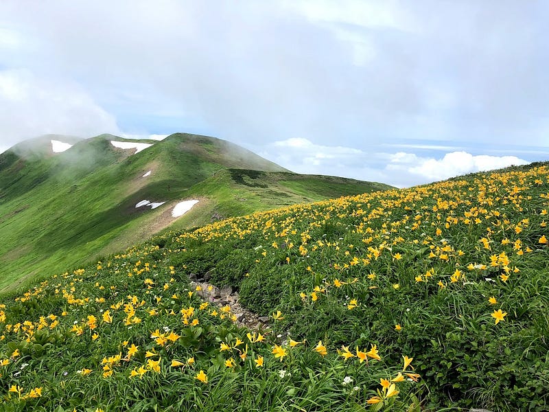
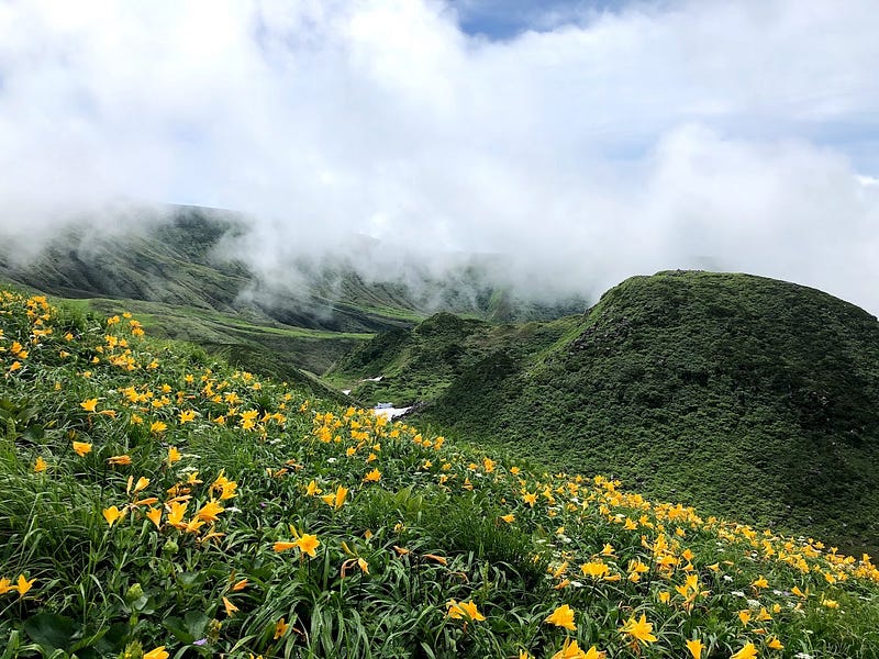
The abundant rain and snow of Chokai-san provides the perfect environment for its rare flora and fauna. In all, Chokai-san boasts over 200 species of alpine vegetation. For example, the distinct orangey-yellow Dawn Lily is but one of the many flowers to grow there.
Also popular is the cutely named chinguruma (Geum pentapetalum). And how could I forget, during your hike, try to spot Chokai Azami, the Chokai Thistle, an indigenous species to Chokai-san.
Don’t Look Up. Or do. Who am I to tell you what to do?
When hiking Chokai-san, don’t forget to look up as well. The mountain boasts extensive habitats for birds of prey that the mountain hawk eagle (Kumataka) or golden eagle (Inuwashi) use as breeding grounds.
Active Volcano
Take note, Chokai-san is an active volcano, currently at eruption level 1. This simply means you need to be aware it is an active volcano (as of December 2022, more details can be found here in Japanese).
Getting there: Trailheads to Chokai-san
Most people opt to climb Chokai-san from The Chokai Blue Line on the Hokodate or Odaira Trailheads. This is what I would recommend. The Hokodate trail is the easiest of these two, with the Odaira trail a close second.
If you want to hit up the fields of dawn lilies of Shoga-dake on the way, the Odaira Trail is the better option. However, it isn’t too much of a detour to visit Shoga-dake from the Hokodate trail. Going to the crater lake and then hooking back around to the Hokodate trail is also a fun adventure.
Chokai Blue Line
The Chokai Blue Line is a road from the base of the mountain in Fukura, Yuza Machi, on the Yamagata Prefecture side. The road loops up to The Hokodate Trailhead at the fifth station, passing The Odaira Trailhead along the way. Then, the Chokai Blue Line goes down to Kisakata in Nikaho City, Akita Prefecture. This is a pretty fun drive in and of itself.
There are carparks and huts at both the Odaira and the Hokodate Trailheads. There is also on-road parking nearby, although you’ll probably have to walk if you arrive later on busy days (arrive by 7am, and you’ll be fine).
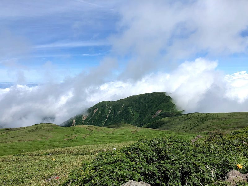
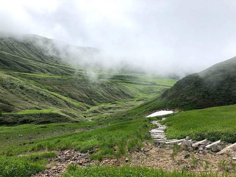
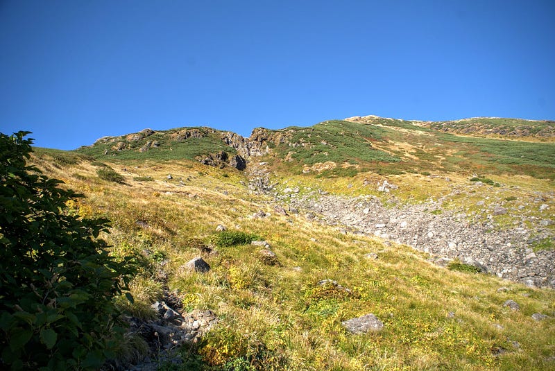
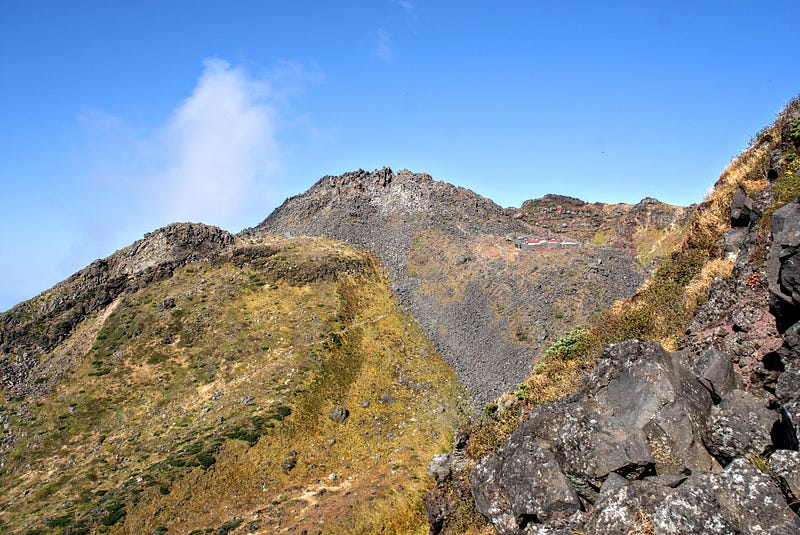
Hokodate Trailhead (5–6 hours one way)
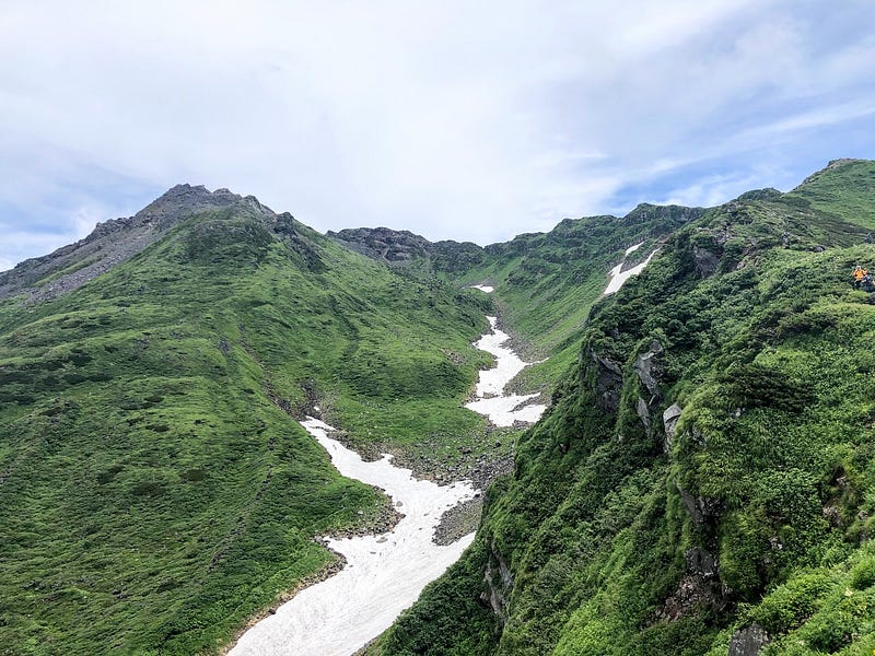
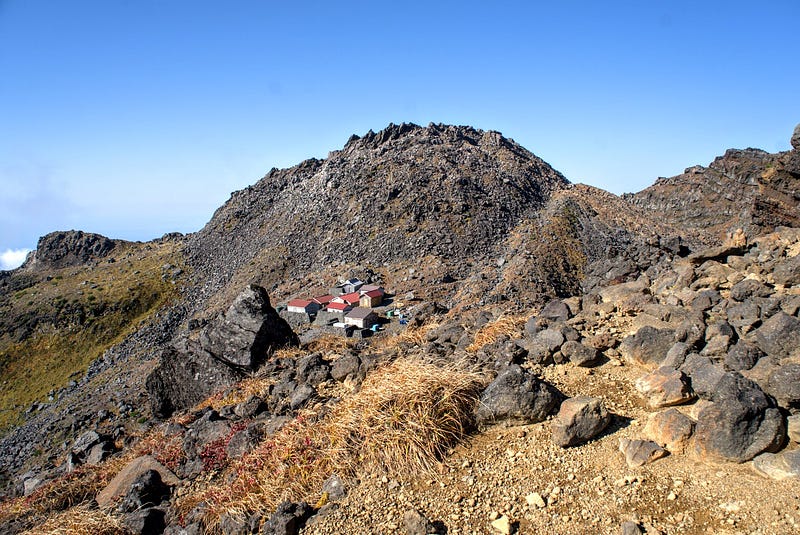
This is the most popular of the trails up Chokai-san, and for good reason. The Hokodate Trail is serviced by the Hokodate Hut, where you can fill up on all manner of foods and drinks before your hike. The Hokodate Trail is also flatter overall, and is an easy way to split your hike, as Chokai-ko, Chokai-san’s crater lake, lies at about the halfway mark.
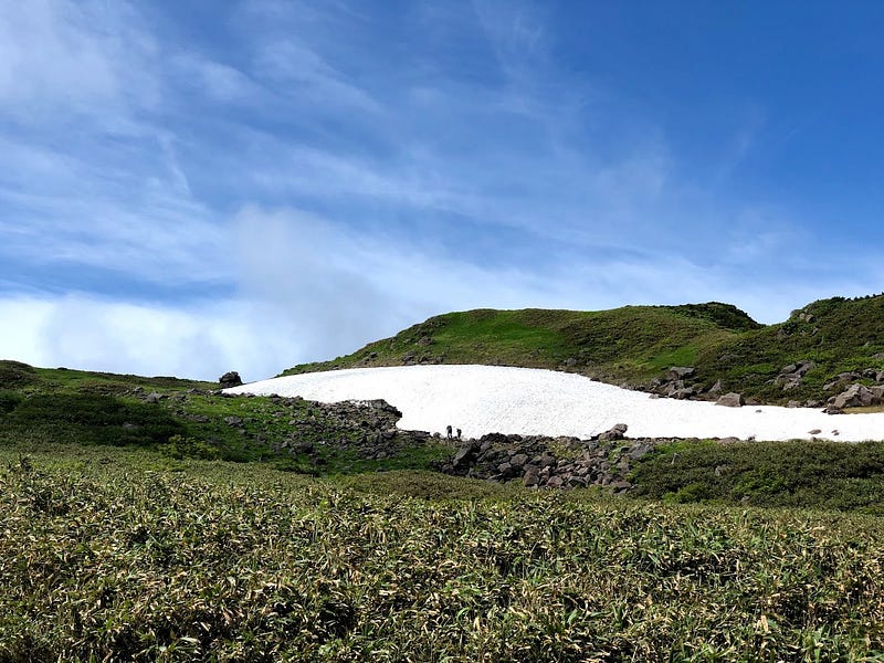
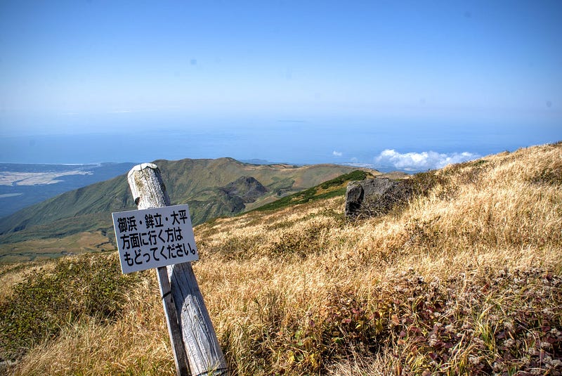
There are several lookouts along the first part of the trail. Then, partway up, you will come across a sort of junction called Sai-no-kawara 賽の河原. What you’ll see here is either a giant snowbank, or a dry river. This is the river said to come before the Sanzu River, the Buddhist equivalent of the River Styx.
If you’re up for it, climbing here will take you to the fields of dawn lilies on Shoga-dake. There are also a few alpine lakes up there to check out as well (like Midagahara on Gassan). This is a viable option for those calling it a day at the crater lake.
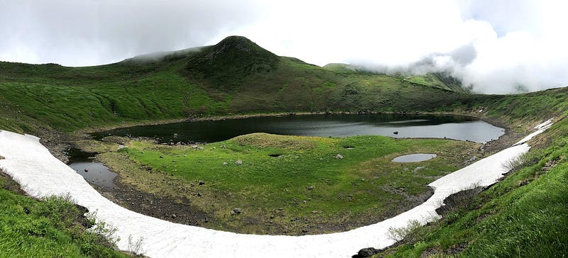
Chokai-Ko: Mt. Chokai’s Crater Lake
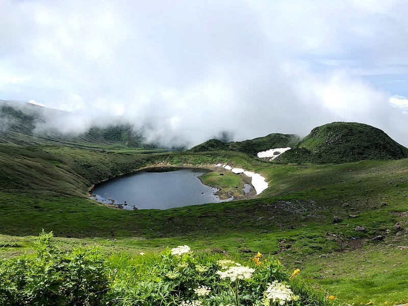
To get to the summit of Chokai-san (called Shin-zan), just keep following the normal trail. Soon, you will come out at the crater lake. This is an excellent spot for a break, as the views on the right day are truly stunning.
It’s possible to walk around the crater lake, and if you do so anti-clockwise, you will link up with the main trail to the summit. This adds a bit of time, however, so keep this in mind.
The Valley of 1,000 Serpents
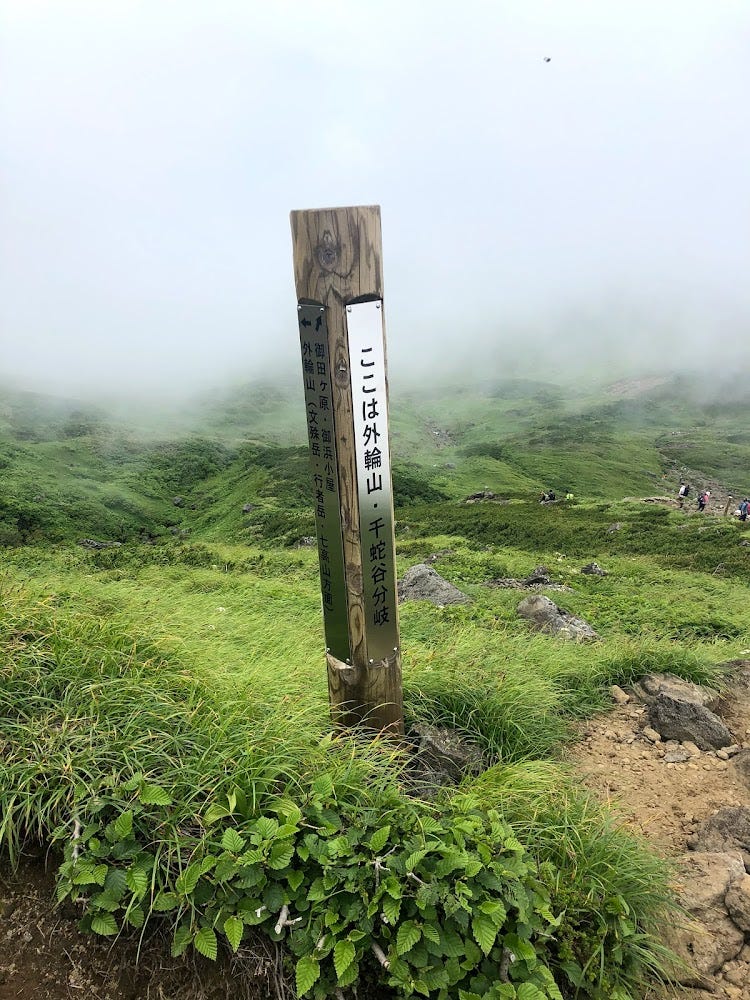
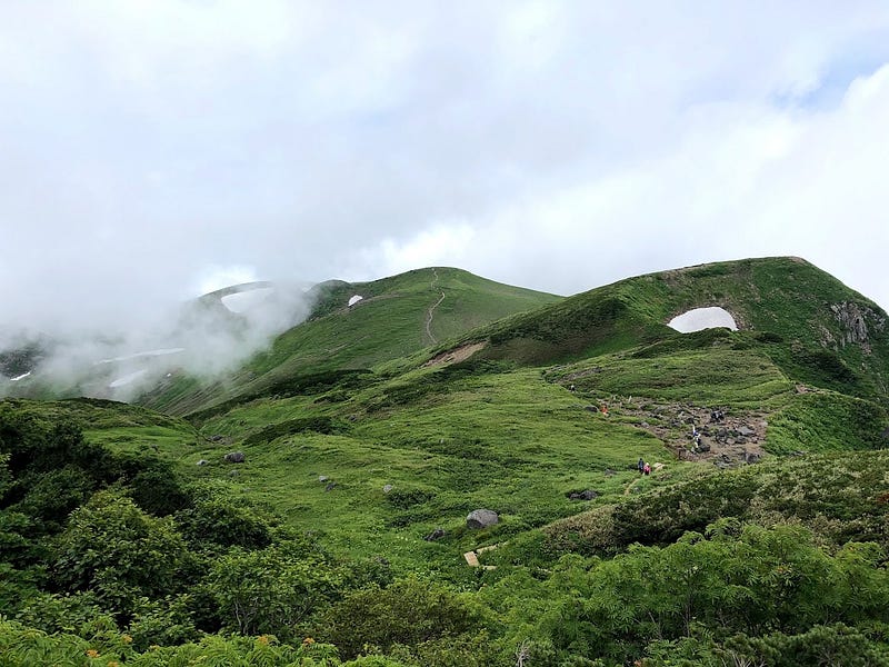
A little past the crater lake, the trail splits in two. A left turn will take you down Senjadani, lit. The Valley of 1,000 Serpents (it’s just a name, I swear), to a snowbank that you walk across to then climb to Omonoimi Jinja (shrine).
Omonoimi Jinja is near the summit (Shin-zan), but you aren’t quite there yet. Behind the shrine, there is a literal mountain of boulders to navigate before reaching the summit. Just keep following the white arrows, but be warned it can be quite physically challenging.
The Outer Rim of Chokai-san
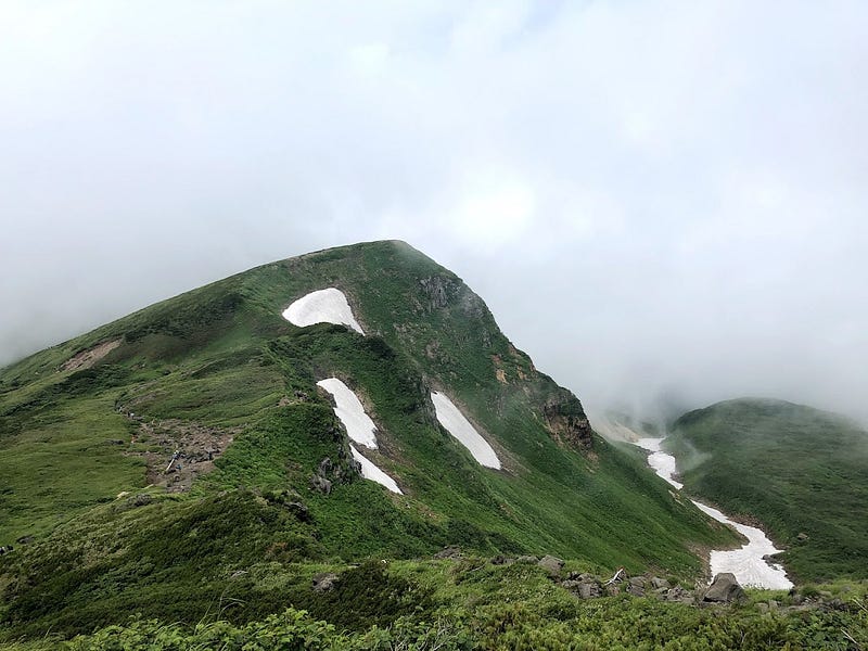
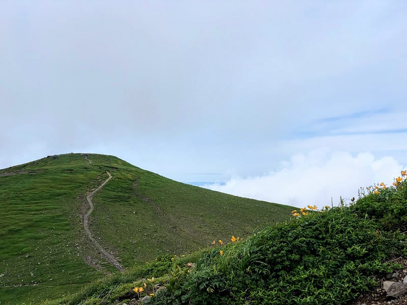
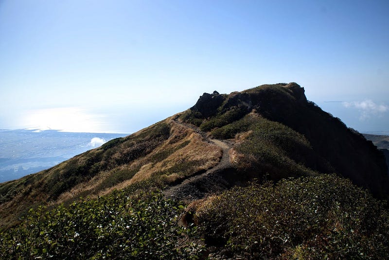
If you take a right at the split after the crater lake, you will head around the outer rim of Chokai-san. The views from here are spectacular, but getting to the summit is a bit of a mission, to say the least.
First, you have to keep following the ridge past Fushiogami-dake and past Gyoja-dake. If you’d like to, you can go all the way around to Shichiko-san (2229 m). However, before that, there is a very steep section to first climb down, and then climb back up to the pile of boulders that takes you to Shin-zan. It’s possible to then return via the shrine, which is arguably the easier route down.
The Yunodai Trail (4 to 5 hours one-way)
The Yunodai Trail is more for experienced hikers. I took this trail in September 2022, and it was much more difficult than The Hokodate Trail (read on for more), but still a lot of fun.
Hiking The Yunodai Trail
The Yunodai Trail starts at the Yunodai Rest Spot in the former Yawata Town part of Sakata City. The trailhead is on the left as you come up the road, just in front of the carpark. The distance to the summit isn’t that far, but you are climbing a dry river bed for much of the hike, and it gets very steep indeed.
The first part of The Yunodai Trail is through low-lying trees. The trail takes you over a few mountain streams and past a huge red mountain cabin called Taki-no-koya. Then the trees slowly grow lower as you ascend. This means that the views get that much grander, too.
Kawara-Juku and the 7th Station
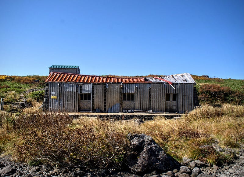
Keep following the trail. Eventually, you’ll make your way to a place called Kawara-juku where the 7th station is. The 7th Station is a dilapidated building that looks really cool, but I would definitely not want to have to go inside.
You can see the ridge around the summit from Kawara-juku, and the trail that heads up even more dry river beds, this time complete with snowbanks.
Mind the Markers
Here you need to be extra careful to follow the trail markers, which are essentially painted rocks, signs, and ropes. One easy way not to get lost going up is to stick to the right-hand side of the river (which I didn’t do).
The trail leads you back through some low-lying bush, again with amazing lookouts. Soon you will reach Fushiogami-dake, the first peak along the rim of Chokai-san. This rim is the same as that found on the Hokodate Trail by taking a right at the fork.
Follow the rim around to the east, go over Gyoja-dake, and soon enough you’ll get to Shichiko-san. Or, before getting that far, there is a left turn that takes you down a bit, and then up to Shin-zan (see the Hokodate Trail for more).
Warnings for Taking the Yunodai Trail
For The Yunodai Trail, I would definitely recommend leaving as early as possible, before 8am at the latest. This is always true for a mountain of Chokai-san’s calibre, but is especially true for this trail.
Or, at least, just don’t do what I did and spend half your time taking videos. The view was insane, I just couldn’t help myself!
Thanks (or not) to filming, I was pressed for time once I made it to the summit, and had to hurry back down the mountain before sunset.
This meant I didn’t film many areas of the hike that I would have liked to, such as those closer to the summit. My legs were shot by then, which is most likely how I got blisters on the soles of my feet. To make matters worse, the sun was sneakily going down (see the above photo with Kawara-juku), and my phone was rapidly running out of battery.
Get lost (or don’t)
I actually got lost after Kawara-juku, which is why I’m giving this advice. All that it meant was that I had to backtrack quite a bit just to get back to the main trail, but it was an easily avoided mistake. Thankfully it wasn’t that hard to find, as all you’re doing is clambering over massive boulders, although that in itself is a bit of a challenge (blisters, ouch!).
There are large sections of snow that remain until early autumn. This snow actually saved me. Even though I had 2.5l of water on me, it wasn’t enough on the day I went. There was just enough sun and heat that I ran out of water on the way down. Thankfully, these snow banks were here for me to fill up, and I’d recommend it even if you weren’t out of water.
How Yamabushi get through the tough parts
During yamabushi training, when things get tough like this, we sing. There’s a song that goes ‘Rokkon Shojo (Rokkon Shojo), Zange, Zange, (Zange, Zange)’, which is basically ‘purify us for our six Āyatana (sense bases), repent, repent’. (Legend has it that this is where the saying ‘dokkoisho’ comes from in Japanese). This and a combination of reciting The Heart Sutra helped me get back in time.
I got back to my car while the sun was very low in the sky, and my phone battery at 1%. But I still made it!
I have prepared for moments such as these, though. Besides having a mobile battery charger, I also always carry a headlight with spare batteries (as per Quinlan’s advice).
Chokai-san, Dewa Fuji
Chokai-san is as good as a hike-able mountain as it is a viewable one. The 2236 m behemoth really stands out, and for good reason too. If you’re in the area, I definitely recommend trying to climb Chokai-san, although only try The Yunodai Trail if you’re experienced.
Nearby Locations Worth Checking Out
The Waterfalls of Chokai-san

Chokai-san has the most waterfalls of any mountain in Japan. So many, I wrote a whole article about them that you can read here!
Shoga-dake (Mt. Shogadake)
To the west of Chokai-san’s crater lake is another mountain on the 100 Famous Mountains of Yamagata list, Shoga-dake.
It would certainly be possible to climb to the summit of both Chokai-san and Shoga-dake in the same day. The easiest way to do so would be to climb from the Odaira trailhead and hit up Shoga-dake, then continue your way up the mountain.
Climbing from Hokodate would mean a bit of backtracking, as the path from the crater to Shoga-dake takes at least one hour one-way. However, if you were to take the turnoff at Sai-no-Kawara, it wouldn’t be so bad.
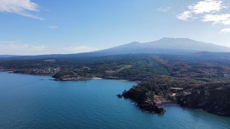
Tobishima Island and Kashiwagi-yama
Along with Chokai-san, Tobishima Island forms the Chokai Tobishima Geopark. I will introduce many of the features of the Chokai Tobishima Geopark below, but what you should know is that the place is covered in a massive variety of natural spots to explore.
For example, Tobishima Island is home to a natural habitat for nurse sharks, meaning it is a great spot for diving, as well as Kashiwagi-yama, the lowest of the mountains on the 100 Famous Mountains of Yamagata list. The island is also very popular among birdwatchers, as many migratory birds that don’t reach the mainland congregate here.
Warabioka Hamlet
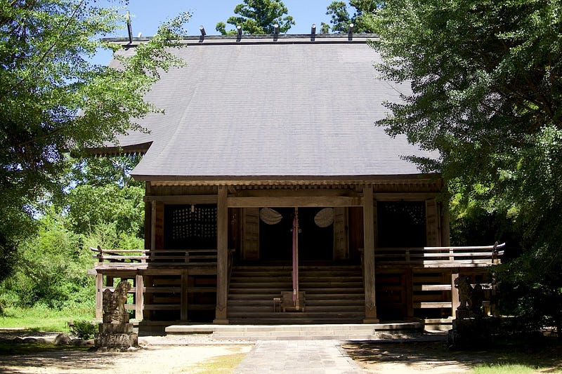
In Yuza Town along the Sakata border there is a tiny hamlet called Warabioka. This is one of my favourite spots to visit, and not just because of the fantastic shrine (Google Maps) Omonoimi-Jinja Warabioka-Kuchi-no-Miya over 1400 years old.
Warabioka also has some Shukubo pilgrim’s lodges that those on spiritual journeys to the sacred peak would have used for centuries. These Shukubo were undoubtedly in use when Chokai-san was a popular destination for spiritual pilgrimages, or perhaps even during Chokai-san’s time as a Dewa Sanzan peak.
Juroku-Rakan-Iwa The 16 Arhats
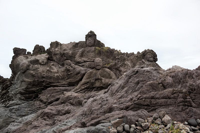
Along the Yuza Machi coast lies Juroku-Rakan-Iwa, ‘The 16 Arhat Rocks’ or ‘Sixteen Rakan’. Arhats are Buddha’s disciples, and in 1864, the high priest of Fukura commissioned stoneworkers to carve the statues to pray for the souls of those lost in The Sea of Japan, and for general safety at sea.
It took 5 years to complete the 16 statues, but they didn’t actually stop there! By 1892, the statues numbered an incredible 22. See if you can find them all!
Kamaiso-no-Yusui Spring
Kamaiso-no-Yusui is a naturally occurring spring that comes out on the beach in Yuza Town. Be careful, though, it’s freezing! Unless of course if you’re visiting in the middle of summer. That’s when it can be quite pleasant.
Maruike-sama Pond
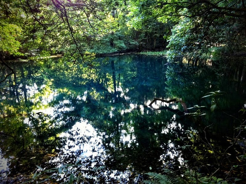
The cerulean blue pond Maruike-sama is so sacred it has the honourific ’sama’ attached. Like Kamaiso-no-Yusui, Maruike-sama formed from a natural spring deep under Chokai-san. Maruike-sama’s water is so fresh it appears as a bright blue, and is extremely transparent.
Ushiwatari-gawa River
Right next to Maruike-sama is the Ushiwatari-gawa River, another source of water known for its freshness. Due to the freshness, the Ushiwatari-gawa River is a popular spawning location for salmon, who return here annually after spending time in the ocean.
Nakayama Kasen Park
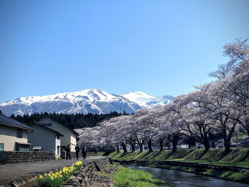
Nakayama Kasen Park lies in Yuza Machi at the foothills of Chokai-san. The park is extremely popular during cherry blossom season as you can see the cherry blossoms, Koinobori (carp streamers) of children’s festival, and Chokai-san all at the same time.
Yashima Ski Field
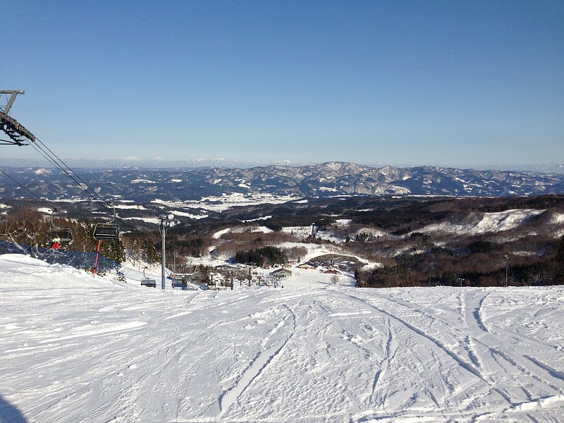
Yashima Ski Field is my usual go-to for snowboarding. It’s not too far from where I live, probably one hour to 90 minutes away, and its compact size, but fast lift, mean there are plenty of chances to hit the slopes. Definitely check it out if you’re in the area during winter.
Espresso Aube in Nikaho

If you have time for coffee, and let’s face it, you always have time for coffee, there’s no better spot in the surrounding area to get your fix than at Espresso Aube in Nikaho City. As the name suggests, this tiny café specialises in espresso-based drinks, but also has a variety of amazing cakes and slices to choose from, and freshly roasted beans to boot. This place is so good that at least once a month I purposely make the two-hour return trip there just to get a Café Nico, an espresso topped with fluffy milk, orange zest, and cinnamon! My top recommendation for café in the region!
Bakery and Bistro Crust
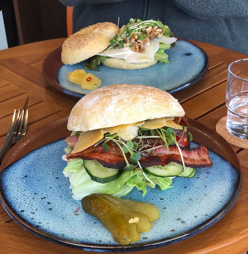
Bakery and Bistro Crust is a newly built bakery and bistro in Nikaho City featuring bread, cakes, coffee, and sandwiches lovingly prepared by some Dutch dudes. One idea for a great day out is to go to Crust for lunch, and then return via Espresso Aube. But be warned. The food and drink is so good, you’ll be tempted to buy a lot! Don’t say I didn’t warn you!
Chokai-san in Sakata City | 鳥海山 | ちょうかいさん (Mt. Chokai, Chokai-zan)
Chokai-san is known for:
- Tallest mountain entirely in the Tohoku Region
- On the 100 Famous Mountains of Japan list
- Tallest mountain on the 100 Famous Mountains of Yamagata list
- Former Dewa Sanzan Peak with extensive history of Shugendo
- Active volcano
- Expansive views abound
- Comparison with Fuji-san
- Core part of the Chokai Tobishima Geopark
- Home to Shoga-dake and many rare alpine flowers such as the Dawn Lilies or Chokai Thistle
Resources:
Yamagatayama page (Japanese)
Omonoimi-no-Kami Wikipedia Page (Japanese)
Shrineheritager.com (machine-translated English, or Japanese)
CHOKAI-ZAN
鳥海山 | ちょうかいざん
Mt. Chokai, Chokai-san, Mt. Chokai-san, Mt. Chokai-zan, Chokaizan, Chokaisan, Dewa Fuji, Fuji of the North
Chokai-zan (鳥海山ちょうかいざん) is a 2236m (7335 ft.) peak in the Shonai region of Yamagata prefecture best climbed from July to October. Chokai-zan is a level 5 in terms of physical demand, which means it is hard to hike, has a C technical grade, which means it requires a moderate level of expertise, and you want to allow at least 8 hours for a climb.
Mountain Range
Chokai-zan
Region
Shonai
Elevation
2236m (7335 ft.)
Technical Demand
C (requires some expertise)
Physical Demand
5 (Difficult to climb)
Trails
Three. 1) Odaira (10 hours return), 2) Hokodate (10 hours return), 3) Yunodai (8 hours return)
Best time to climb
July to October
Day trip possible?
Yes
Minimum Time Required
8 hours
PDF Maps by TheHokkaidoCartographer and JapanWilds.org. See all here.
100 Famous Mountains of Japan, 100 Famous Mountains of Tohoku, 100 Mountains of Yamagata, Akita Prefecture, Autumn Leaves, Birds of prey, Favourites, Full Day Hikes, Hard to reach, Historical Hikes, Hyakumeizan 100 Famous Mountains of Japan, Mountain Flowers, Mountains above 2000m, Myths and Legends, Sakata City, Shonai Region, Shugendo Mountains, Waterfalls, yamabushi, Yamagata City


YAMABUSHI NEWSLETTER
KIWI YAMABUSHI

TIM BUNTING - KIWI YAMABUSHI