Homer Simpson’s Heaven in North Japan: The Donut-shaped Yonetaihei-san (Mt. Yonetaihei)
よねたいへいざん
米太平山
YONETAIHEI-ZAN
Tiny donut-shaped peak in Sakegawa Village of the Mogami region worthy of a snowshoe hike.
Jump to My Guide to Hiking Yonetaihei-zan
Yonetaihei-zan is a donut lover’s dreamland. The whole peak is shaped like a donut. Well, a donut that has had a big chunk bitten out if it, that is. If this doesn’t pique Homer Simpson’s interest I don’t know what would.
I climbed the giant donut that is Yonetaihei-zan. Only I didn’t. I feel like a cheat, an impostor. Can you really say you climbed a mountain if you didn’t reach the summit? I mean, elevation-wise I was only ten metres off. At the tim,e I was probably only a few hundred metres away from the summit. It felt like the summit. But it wasn’t the summit.
Thinking this way could get you killed. Never underestimate the mountains. Never let your ego get the best of you when it comes to nature. If it’s too much, it’s too much. When out in nature always be able to retrace your steps, both mentally and physically. But you already knew that. And I’m OK with not reaching the summit, I still got to explore this giant donut!
Yonetaihei-zan’s Namesake

The locals have their own name for Yonetaihei-zan, Tanekatsuzawa. Yonetaihei-zan is the official name and comes after Taihei-zan in Akita Prefecture. The ‘Yone’ part is the name of this tiny hamlet in Sakegawa Village in the northern Mogami Region of Yamagata Prefecture. So you may be wondering, what’s the connection?
Well, legend has it that the demon kami (deity) of Taihei-zan, a 1,170m peak 150-odd km to the north in Akita prefecture, escaped to the 206m-high (676 ft.) mountain of this tiny little town. The kami of Taihei-zan is said to have been the lord of the Taihei area of Akita Prefecture.
However, I’m not exactly sure why he would A) want to escape, Akita is beautiful, and B) come to this mountain in particular (any guesses?). Perhaps the kami just liked donuts as much as Homer Simpson.
Evidence of the legend of Taihei-zan

At one of the lookouts on Yonetaihei-zan there is a monument that says ‘三吉大権現’ Miyoshi Daigongen, supposedly the name of the Gongen avatar of the mountain (see my explainer of gongen video here). There is also a Miyoshi Shrine in Taihei, Akita City (check out their old school website!), so there is most likely some connection, although I have nothing to back this up. Either way, Yonetaihei-zan has been both a place of recreation and a place of worship for the people of the nearby Yone hamlet for centuries.
My Guide to Hiking Yonetaihei-zan: Getting There
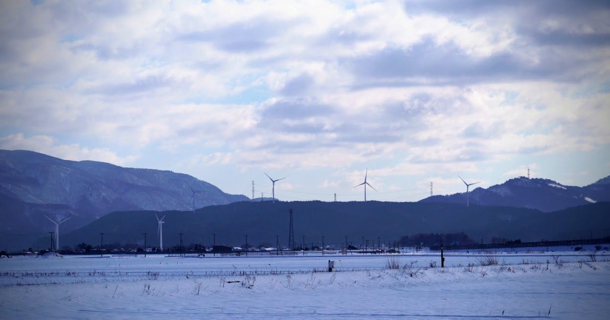
Yonetaihei-zan is located to the south of central Sakegawa Village in the Yone hamlet. The only way realistically to get there is by car, or you could potentially walk for an hour from central Sakegawa, but you would have to be pretty desperate. There is one main car park on Yonetaihei-zan at the Yone Marsh that has room for plenty of cars.
Climbing Yonetaihei-zan
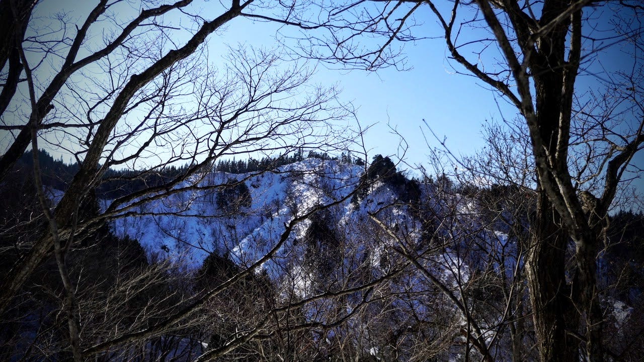
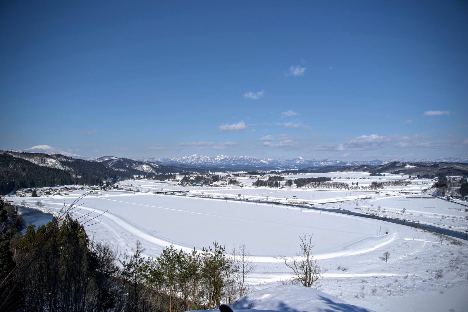
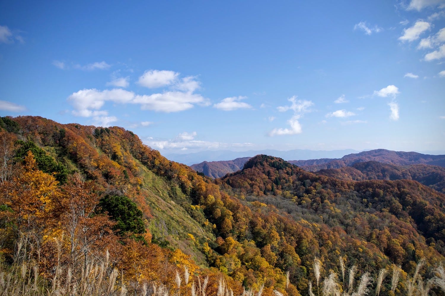
Yonetaihei-zan probably has the coolest shape of a low-lying mountain I’ve ever seen. The huge ring that is Yonetaihei-zan is reminiscent of a lagoon, and I wouldn’t be surprised if it was indeed a lagoon in a past life. Perhaps more apt of a description though, is a giant donut Homer Simpson took a bite out of.
Where the bite was taken out is a small marsh called the Yone marsh where many native animals gather. This is also where the car park is. From here you have the option of taking the short route that goes anti-clockwise and is about an hour return, or doing the whole donut, which takes about 3 hours at an average pace.
The Short Summit Trail up Yonetaihei-zan (1 hour return)
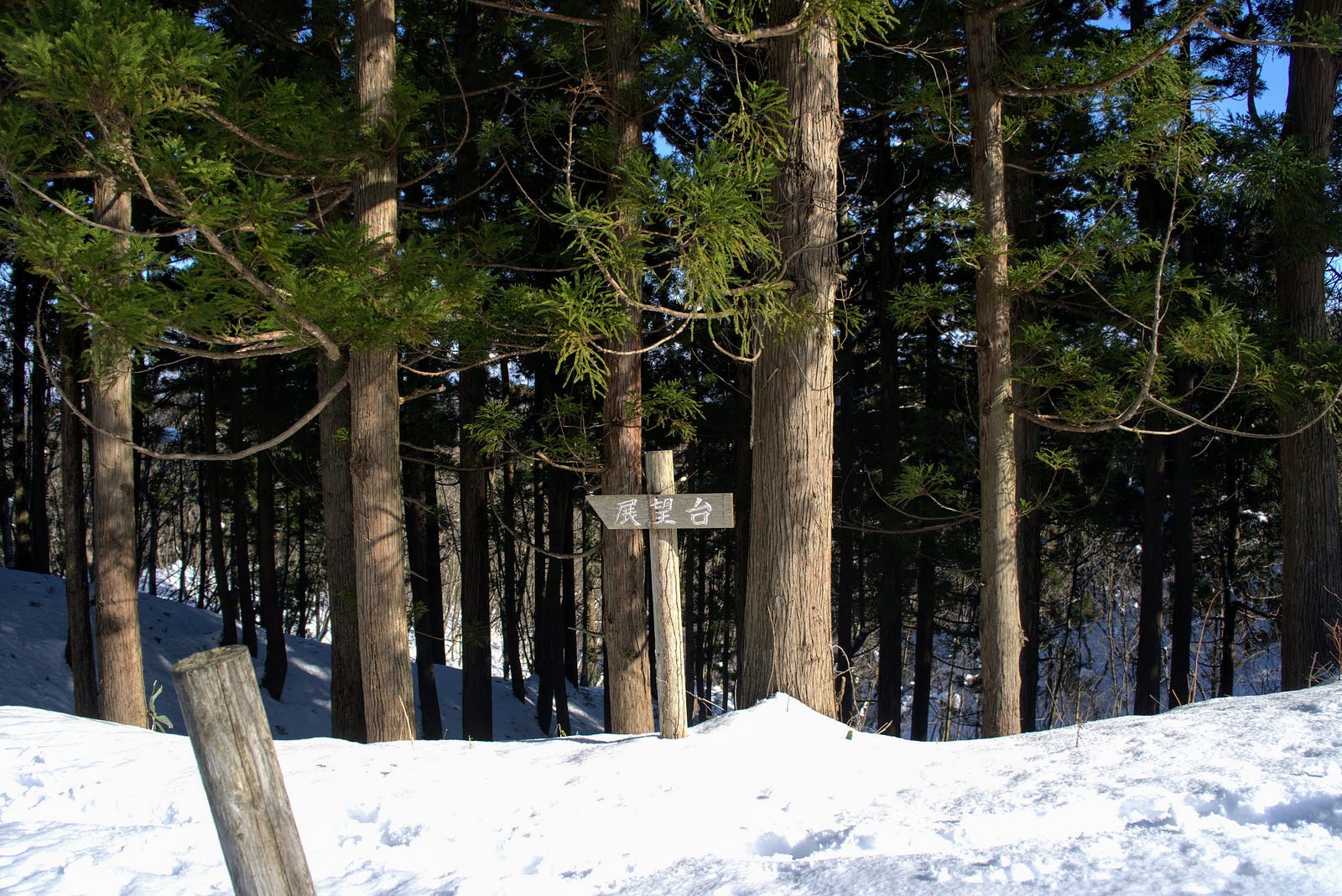
Head anti-clockwise around the donut from the car park by first going back down the mountain a little. You will see a path leading to a small embankment that runs across the marsh and heads into a forested hill. This hill is where you will find the summit of Yonetaihei-zan.
As you can probably tell just by looking at the mountain, this part of the climb is rather steep. There are three short but steep parts here, and it’s recommended to stop to catch your breath at the top of each as it can be quite tough. Once at the top though, there is a lookout from where you can see a monument with ‘三吉大権現’ Miyoshi Daigongen, supposedly the name of the Gongen avatar of the mountain (see my explainer video here).
The First Lookout on Yonetaihei-zan
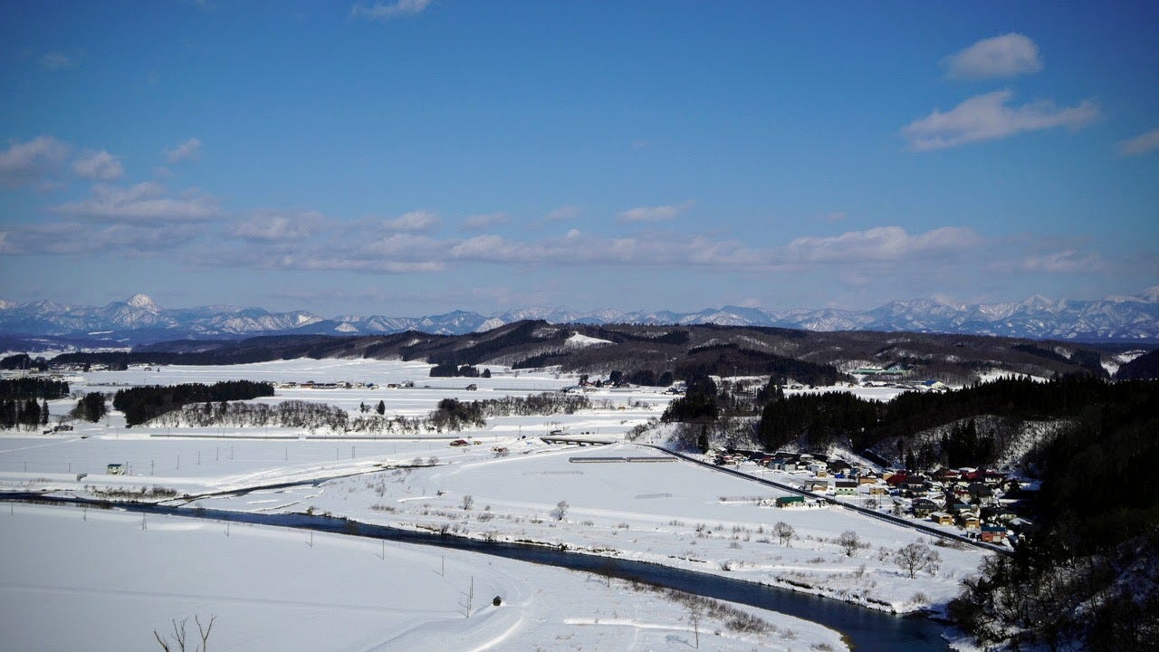
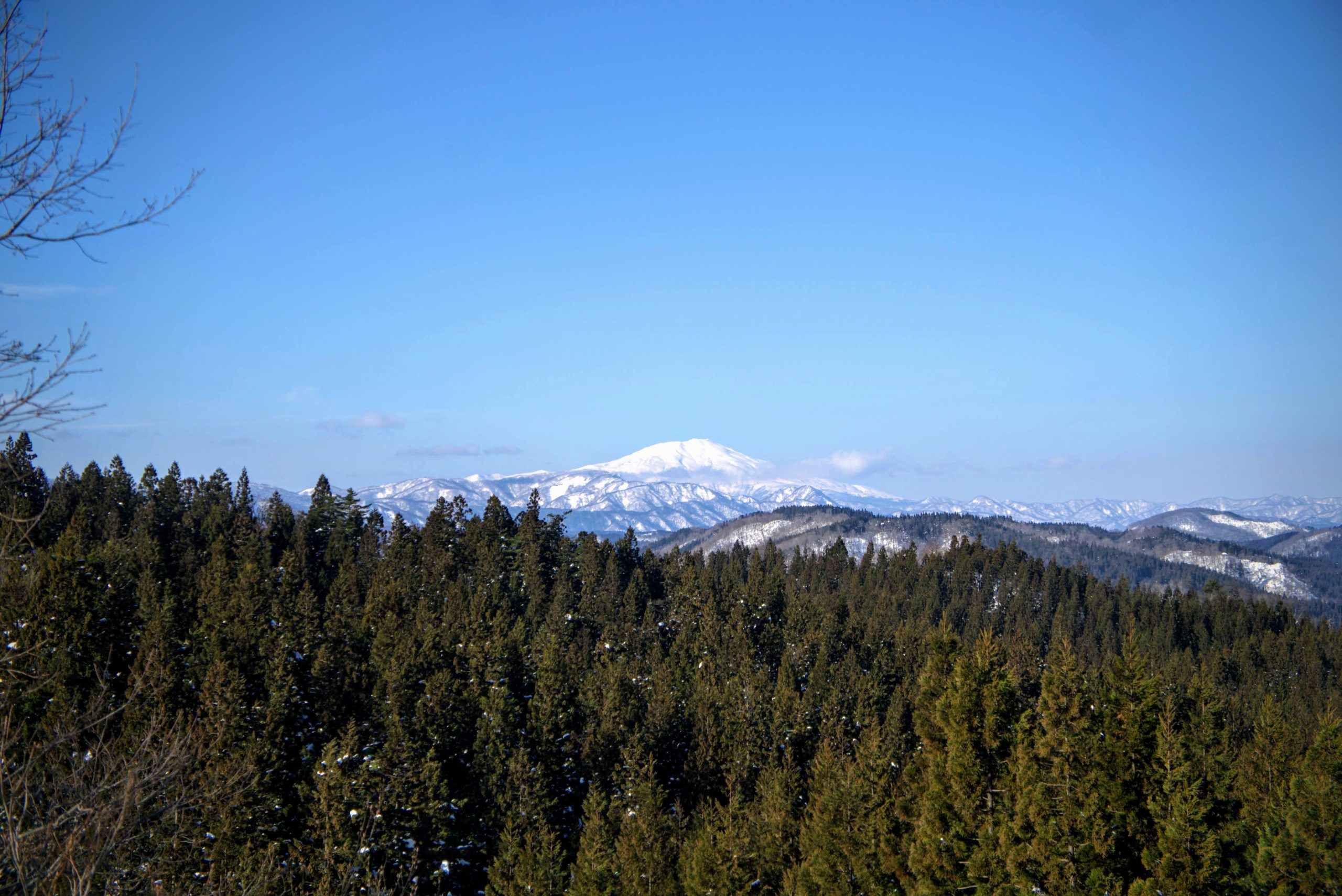
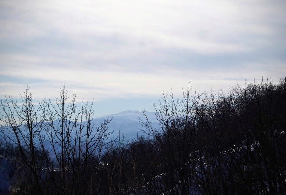
To the west of the lookout lies the Matsuzaka and Kanjin areas of Tozawa Village and to the north the rice fields of Sakegawa Village, and Chokai-zan on fine days. The sheer beauty visible from this lookout led to the locals calling this the actual summit of Yonetaihei-zan, but the real summit is still a little bit up the mountain.
Heading east from the lookout the turning point can be a little hard to spot, so be careful here. From this point you just follow the ridge so it should be a relatively easy climb, if the grass is cut that is. After a while you will arrive at the summit, however there is no lookout up there. Just in front of the real summit is another lookout, which is a better spot to grab a bite to eat. Then to get back all you need to do is retrace your steps. If you want more, do the Yonetaihei Donut Trail (my name for it).
This is the route I should have taken, ‘always take the easy option’, both my waterpolo coach and dad used to say. I should have listened. However, this means that if you wanted to you could always take the long way down, and in fact this is the recommended route instead of going clockwise like I did.
Do the Donut Trail on Yonetaihei-zan (2 hour loop)
The Yonetaihei Donut Trail uses the same path as the short summit. Then, once at the summit, follow the ridge down that heads to the east. You will come across a forest road, with an access road for cars. Keep walking along and eventually you will come across a sign pointing to the second lookout. From here you can see Chokai-zan and the Kamuro alps to the north, as well as Sakegawa Village and the rice fields in the foreground. Once well rested, the walk back to the car park and the Yone marshlands isn’t too far.
My experience climbing Yonetaihei-zan
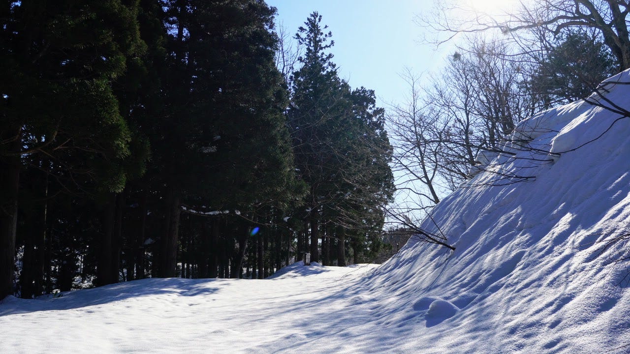
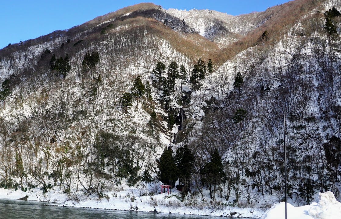
The official Yamagatayama guide said Yonetaihei-zan was a relatively easy snowshoe hike, the main reason why I chose it besides proximity. I only wonder what guidebook they were reading, though. I was trying out my snowshoes for the first time, on a trail that had at least a metre of snow on it, with zero tracks to follow. Needless to say, by no means was I sure I was headed the right way.
The way I did head felt like the right way, and it turns out it was. Well, except for one important part of the trail through a forest buried in snow that I had no way of knowing, that is. Bear in mind that if you’re climbing when there’s no snow, you shouldn’t have this problem.
Arriving at Yonetaihei-zan
I parked my car where the road leading up to the car park ends (the road was blocked with snow), put my snowshoes on, and followed what felt like the natural trail up the mountain. There was one point along this path that veered off to the right. I found out once I reached the car park that this was the path straight to the summit I should have taken. However, I decided against turning back here as I was already a little tired, and that would mean retracing my steps. I also thought it would be a case of simply doing the donut in reverse. How wrong I was.
The beginning of the trail up Yonetaihei-zan
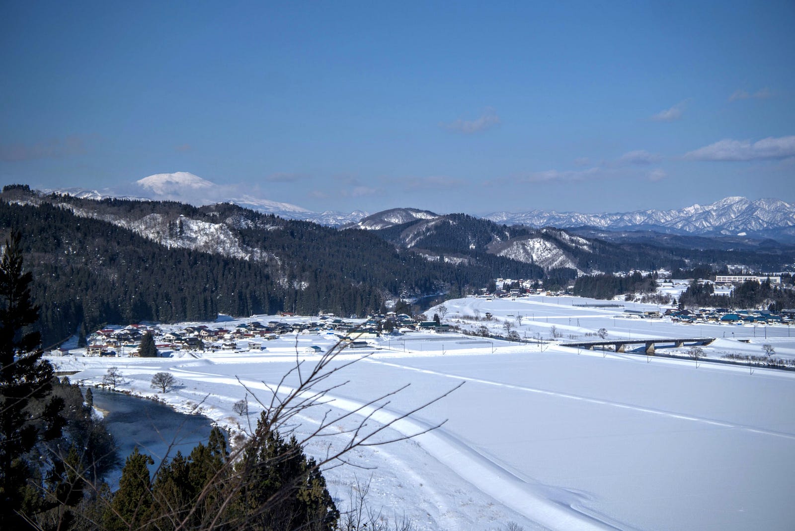
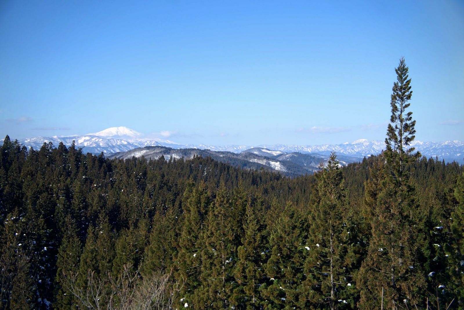
This beginning part of the trail was by no means uneventful. First, it was extremely calming, just myself out in nature surrounded by forest and snow-capped peaks, with small birds and critters to keep me company. I kept following the access road up and before long there was a sign for a lookout to the left. I took this trail, and it turned out to be the perfect lunch spot. More than 180 degree views of the Sakegawa river, Sakegawa village, and the pièce de résistance, Mt Chokai. In summer I imagine this also being an excellent spot for a picnic.
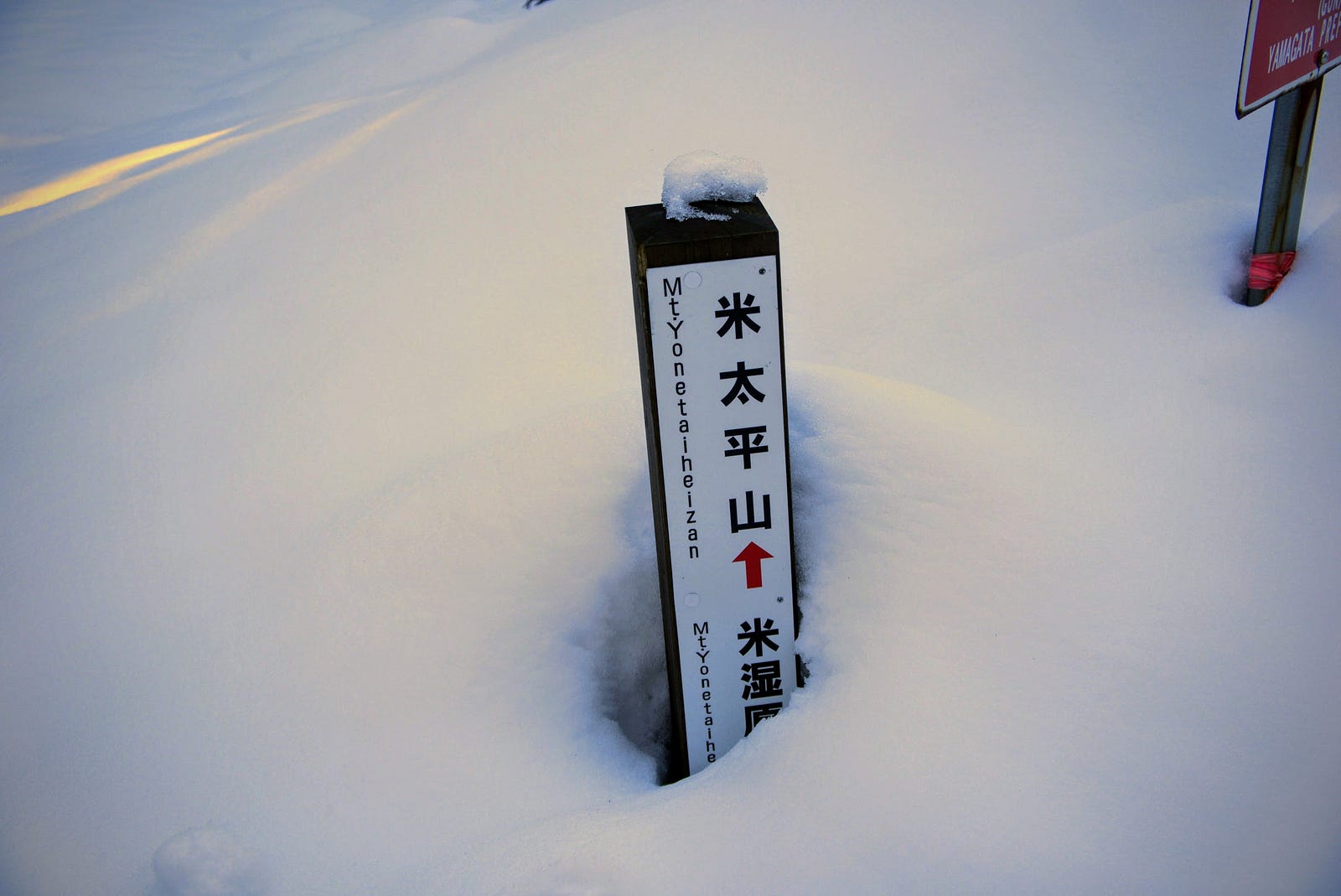
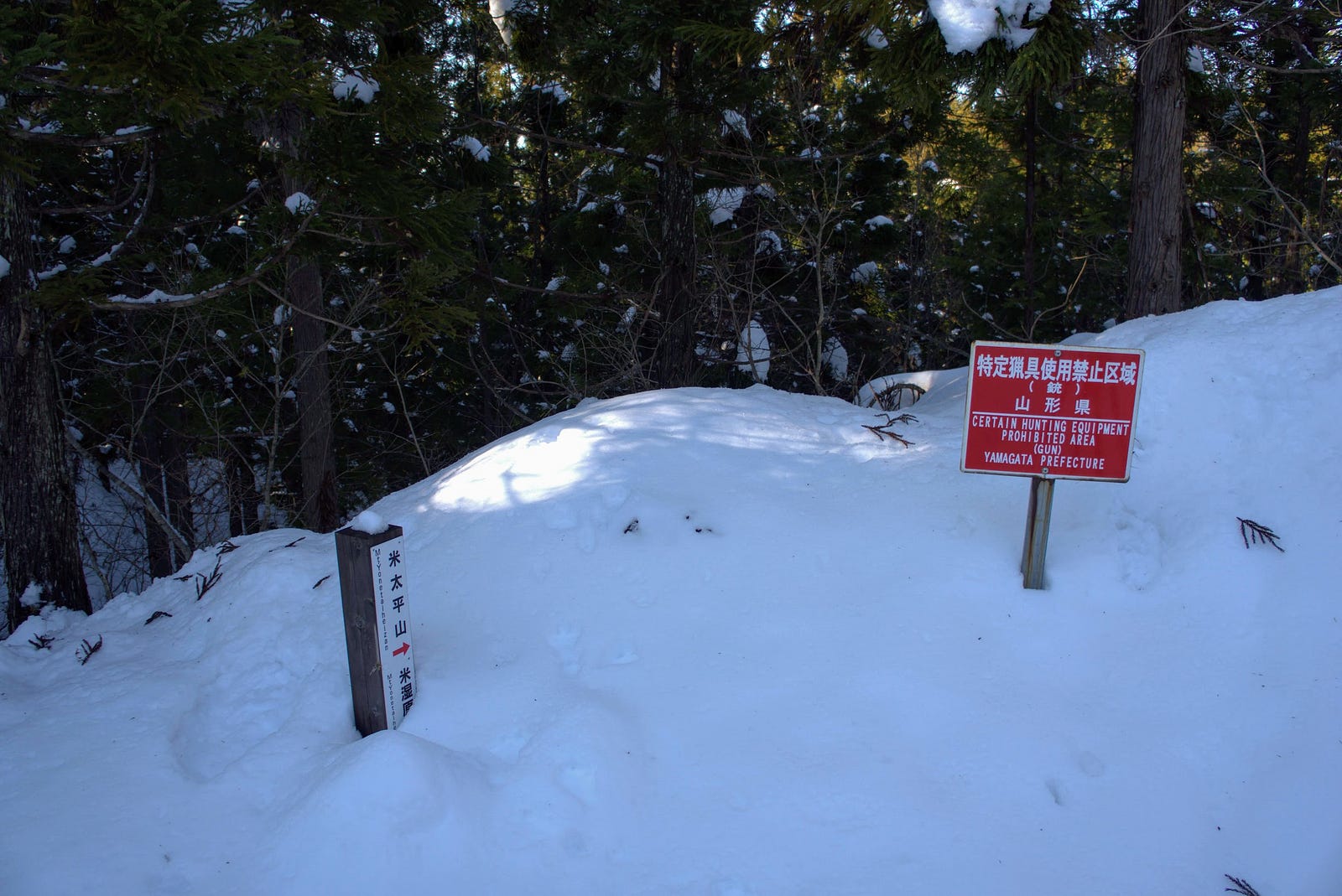
Then I retraced my steps a bit by heading back around the donut, and come across the most glorious view of Yonetaihei-zan. The mountain drops down sharply into a small valley, then rises steeply right up until the summit. A true sight to behold. From there the trail does a huge loop around the mountain edge where it meets other trails from the township below. Then as you come around one corner, there is a sign pointing to the summit leading into a forest. This is where I went wrong.
Doing the Yonetaihei-zan Donut the Wrong Way in Snow
If you’re doing the donut clockwise like I was, what you’re supposed to do at the sign that says ‘summit this way’ is to go in that direction, even if the forest floor is covered in snow and you can’t see the trail. Head downhill in the direction of the summit and before long you will reach the edge of the forest.
Go along the edge of the forest and back up a hill that leads you to the summit and you‘ve made it. Then all you need to do is complete the donut by climbing down the hill to the marsh, and linking back up with the car park. Simple in theory, hard to know in practice.
Figuring out where I went wrong
I found out much later by corroborating multiple maps, but this was indeed the correct way to go. It’s just by the time I was there the trail had completely disappeared. For the life of me I couldn’t find a clear path through the forest and not wanting to risk it, I did the next best thing and kept following the trail I was originally on.
The path I took wasn’t so bad though. Before long I made it to a giant power pylon from where the view of Gassan and I assume Zao-san and Hayama-san was exquisite. However, after about 30 or so minutes walking the trail I realised that I had indeed been going the wrong way. At least by then I was at 196m of elevation, but I was unfortunately nowhere near the summit. So, turn around and go back home I did.
All up, I spent about 4 hours hiking Yonetaihei-zan, including stopping for lunch and going back and forth to catch video. If you’re snowshoeing in the winter, I would expect to be able to do the loop in about 3 hours.
Yonetaihei-zan In Conclusion
Yonetaihei-zan is a great little mountain full of places to explore. The donut shape means there’s no backtracking, and it means you get to take in quite a lot in a short amount of time.
Since I only got to see Yonetaihei-zan in the winter, since it is famous for its marshlands, and since it’s only a short hike to the summit, I will most likely come back here in the summer. There are a few other peaks around, such as Yozo-san or the Kamuro Alps, and I should be able to stop by and climb to the summit the proper way on the way to or from another mountain.
In the meantime, I hope you too can enjoy what was a great experience on this donut-shaped peak in the middle of Yamagata prefecture.
Locations Near Yonetaihei-zan Worth Checking Out
Yamuki-yama
Mountains in Japan have been revered for millennia, but often it is the taller peaks that garner all the attention. It’s not hard to see why, I mean, the taller peaks stick out like a sore thumb. In the case of Yamagata Prefecture, this honour belongs to the likes of Chokai, Gassan, Ide-san, and Zao-san. However, some of the low-lying peaks truly deserve a lot more attention than they get. Take the once medieval castle on the precarious cliff-face along the Mogami River that is Yamuki-yama, for example.
Shinjo City

Sakegawa Village is located adjacent to Shinjo City, and is a short 15 minute drive to the station. Shinjo City is famous for its three-day festival in August, featuring huge floats and large dances that are free to watch. It is also home to one of my absolute favourite bakeries, Geta Pan (Facebook), that I intentionally go to sometimes even though it is an hour drive away.
The Totoro Trees
With places like Ginzan Onsen and Genso-no-Mori, the forest of illusions, Yamagata Prefecture is covered in places similar to those depicted in Ghibli films, or in this case, two trees that resemble the famous character Totoro. The Totoro Trees aren’t too far from Yonetaihei-zan, about 20 minutes by car.
River Cruise on the Mogami
The nearby Mogami River that runs the length of Yamagata is the longest contiguous river in one prefecture and was featured prominently in Matsuo Basho’s The Narrow Road to the Deep North. Matsuo Basho and his trusty partner Kawai Sore stayed three days in Oishida, and once they had good weather, they travelled to the Dewa Sanzan. This river voyage inspired the following haiku:
Gathering the rains
Of summer, how swift she is
Mogami River
Matsuo Basho
This cruise is now offered by multiple companies along the Mogami, including during the cold winter months when you can sit under a heated Kotatsu and sip Amazake, a sweetened sake lees drink (the extract from making sake that is non-alcoholic).
Yozo-san and the Yozo marsh
One other famous marsh near Yonetaihei-zan is the Yozo marsh found on Yozo-san on the borders of Sakata City and Sakegawa Village. Yozo-san is famous for five ancient Katsura trees, and a group of waterfalls called Maboroshi-no-Taki-gun the group of phantom falls.
The Forest of Illusions: Genso no Mori in Tozawa Village
Genso no Mori, the forest of illusions, is a naturally occurring cedar forest that is covered in trees that have morphed due to the snowfall in the region. However, Genso no Mori forest is a bit tough to get to. You have to take a sharp turn into the mountains from Route 47 along the Mogami River, and then drive up a gravel road for a while, but once you’re there it really is like being in another world (it felt like Murakami’s atmosphere for me).
Taizo-san: The Epitome of Autumn Leaves in north Japan
Taizo-san is one of the historic routes linking The Shonai and Mogami Regions of Yamagata Prefecture, and is by far one of the best spots in Tohoku, North Japan, to take in the autumn leaves.
YONETAIHEI-ZAN
米太平山 | よねたいへいざん
Mt. Yonetaihei
Yonetaihei-zan (米太平山 よねたいへいざん) is a 206m (676. ft.) peak in the Mogami region of Yamagata prefecture. Yonetaihei-zan is open year-round. Yonetaihei-zan is a level 1 in terms of physical demand, which means it is easy to hike, has a B technical grade, which means it is relatively easy to hike, and you want to allow at least 30 minutes one-way for a hike.
Mountain Range
Yonetaihei-zan
Region
Mogami
Elevation
206m (676 ft.)
Technical Demand
B (relatively easy to hike)
Physical Demand
1 (easy to hike)
Trails
Two: 1) Short Summit Trail (30 minute one-way in summer), 2) The Yonetaihei-zan Donut (2 hour loop in summer)
Best time to climb
Year-round
Day trip possible?
Yes
Minimum Time Required
30 minutes one-way on the Short Summit Trail
PDF Maps by TheHokkaidoCartographer and JapanWilds.org. See all here.


YAMABUSHI NEWSLETTER
KIWI YAMABUSHI

TIM BUNTING - KIWI YAMABUSHI